100 Florida Trails®
Top FL Multi-use Bike Trails
Map Links & Photos Galore
Coast-to-Coast Updates
You are here > Home > Trails > West Florida
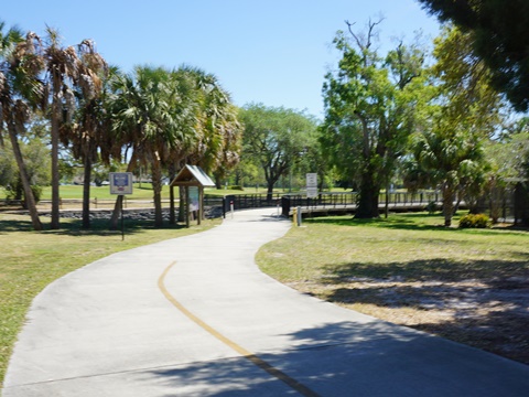
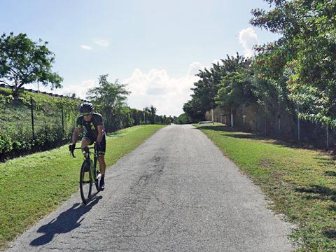
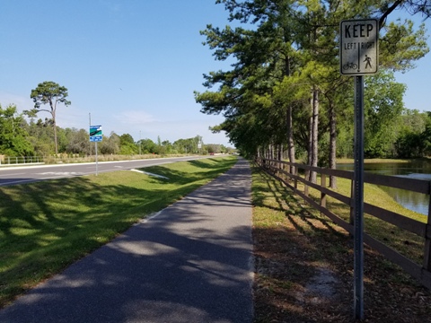
Bike Trails... West Florida Region
34 Trails, E-Z Maps, Photos Galore (scroll down or click on links below)
Paved Multi-Use Bike Trails
Bayshore Trail
Bayshore Linear Greenway (see:
Safety Harbor Bike
Trail)
Bayshore Linear Park Trail
Coastal Anclote Trail
Courtney Campbell Trail
Crystal River Biking
Druid Road Trail*
Duke Energy Trail*
Elfers Spur Trail
Fort DeSoto Park
Good Neighbor Trail
Good Neighbor Connector
Memorial Causeway Trail
North Bay Trail*
Old Fort King Trail
Oldsmar Trail
Pinellas Trail Loop (Regional Trail System)*
Ream Wilson Clearwater Trail
Safety Harbor Bike Trail
Skyway Trail (St. Pete)
Skyway Park Trail (Tampa)
Starkey Blvd. Trail
Starkey Gap Trail
Starkey Wilderness Trail
Suncoast Trail
Tampa Riverwalk
Town-n-Country Greenway
Tri-County Trail
Upper Tampa Bay Trail
In Our Top 10
Pinellas Trail*
Withlacoochee State Trail
Eco-biking (paved and unpaved on public lands)
Alderman's Ford Park Trail
Chassahowitzka Wildlife Management Area
Crystal River Archaeological State Park
Crystal River Preserve State Park
Myakka River State
Park
* = Included in Pinellas Trail Loop Regional System
Trails Overview Map... West Florida Region
West Florida Bike Trails... All First-hand Reports
Here are summaries and links to 34 trails in West Florida (2 in our Top 10 Trails), each with Google map and photos.
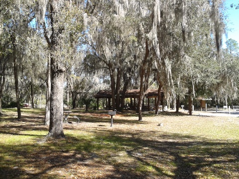 Alderman's Ford Park Trails - both paved and unpaved eco-biking at Alderman's
Ford Conservation Park (Lithia, FL). The moss-draped, 2-mile paved trail through the woods was a pleasant find while checking
out kayak launches on the Alafia River.
Alderman's Ford Park Trails - both paved and unpaved eco-biking at Alderman's
Ford Conservation Park (Lithia, FL). The moss-draped, 2-mile paved trail through the woods was a pleasant find while checking
out kayak launches on the Alafia River.
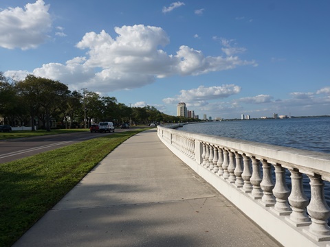 Bayshore Linear Park Trail - Tampa -
A scenic 4.5 mile trail following Bayshore Blvd. along Hillsborough
Bay.
Bayshore Linear Park Trail - Tampa -
A scenic 4.5 mile trail following Bayshore Blvd. along Hillsborough
Bay.
 Bayshore Trail - Clearwater - a 9/10 mile trail
connecting Ream Wilson Clearwater Trail and Courtney Campbell
Trail. Roadside with a wide median and no road or driveway
crossings.
Bayshore Trail - Clearwater - a 9/10 mile trail
connecting Ream Wilson Clearwater Trail and Courtney Campbell
Trail. Roadside with a wide median and no road or driveway
crossings.
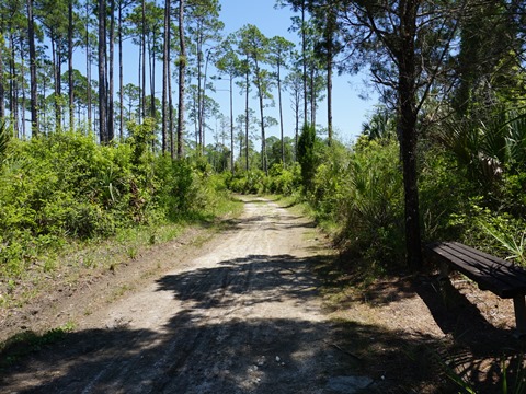
 Chassahowitzka Wildlife Management Area - unpaved eco-biking
destination. Located on Florida's Gulf Coast, 15 miles south of
Crystal River. Avoid hunts and it's quiet and remote. Miles of
biking on limestone roads and logging tram roads Two hiking trails,
two cave diving sites.
Chassahowitzka Wildlife Management Area - unpaved eco-biking
destination. Located on Florida's Gulf Coast, 15 miles south of
Crystal River. Avoid hunts and it's quiet and remote. Miles of
biking on limestone roads and logging tram roads Two hiking trails,
two cave diving sites.
 Coastal Anclote Trail - 4.5 miles, connecting 3
parks, schools and neighborhoods in Pasco County. Ends at Pinellas
County Line, link to Pinellas Trail via the Elfers Spur Trail.
Coastal Anclote Trail - 4.5 miles, connecting 3
parks, schools and neighborhoods in Pasco County. Ends at Pinellas
County Line, link to Pinellas Trail via the Elfers Spur Trail.
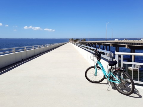 Courtney Campbell Trail - A Florida "must-do," this
scenic ride runs 9.5 miles across the Courtney Campbell Causeway
connecting Clearwater and Tampa, totally separate from the roadway.
Courtney Campbell Trail - A Florida "must-do," this
scenic ride runs 9.5 miles across the Courtney Campbell Causeway
connecting Clearwater and Tampa, totally separate from the roadway.
 Crystal River Biking - Crosstown Trail,
Kings Bay Riverwalk... a growing network of bike trails and paths
linking parks, springs, and historic areas.
Crystal River Biking - Crosstown Trail,
Kings Bay Riverwalk... a growing network of bike trails and paths
linking parks, springs, and historic areas.
 Crystal River Archaeological State Park - Paved
eco-biking destination along the Crystal River. A short path winds
through this archaeological site (a National Historic
Landmark) featuring Pre-Columbian Native American mounds.
River views, birdwatching, picnicking and fishing.
Crystal River Archaeological State Park - Paved
eco-biking destination along the Crystal River. A short path winds
through this archaeological site (a National Historic
Landmark) featuring Pre-Columbian Native American mounds.
River views, birdwatching, picnicking and fishing.
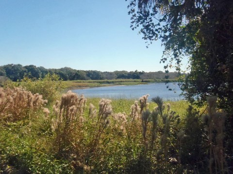
 Crystal River Preserve State Park - unpaved eco-biking
destination. 27,000 acres along the Gulf Coast for about 20 miles
from Yankeetown to Homosassa, and including the mouth of the Crystal
River. 7-Mile Loop Trail is the eco-biking
highlight. Hiking trails, paddling, picnicking, fishing, more.
Crystal River Preserve State Park - unpaved eco-biking
destination. 27,000 acres along the Gulf Coast for about 20 miles
from Yankeetown to Homosassa, and including the mouth of the Crystal
River. 7-Mile Loop Trail is the eco-biking
highlight. Hiking trails, paddling, picnicking, fishing, more.
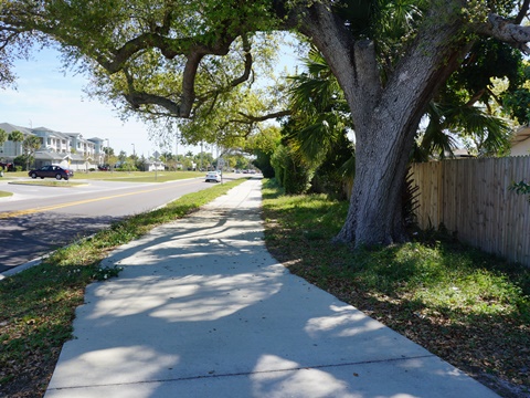 Druid Road Trail - An east-west Clearwater trail
linking Pinellas Trail to Duke Energy Trail. It completes a link
from Gulf (Clearwater Beach) to Bay (Tampa).
Druid Road Trail - An east-west Clearwater trail
linking Pinellas Trail to Duke Energy Trail. It completes a link
from Gulf (Clearwater Beach) to Bay (Tampa).
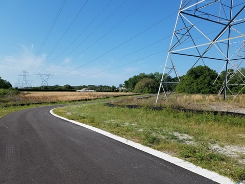
 Duke Energy Trail -
The trail is being developed as part of the Pinellas Trail
Loop, mostly following the Duke Energy power line corridor.
About 13 miles to date, 22.5 when done.
Duke Energy Trail -
The trail is being developed as part of the Pinellas Trail
Loop, mostly following the Duke Energy power line corridor.
About 13 miles to date, 22.5 when done.
 Elfers Spur Trail - A 1.8 mile connector trail between
the Pinellas Trail and Coastal Anclote Trail near Tarpon Springs. A side
trail runs to the North Anclote River Nature Park.
Elfers Spur Trail - A 1.8 mile connector trail between
the Pinellas Trail and Coastal Anclote Trail near Tarpon Springs. A side
trail runs to the North Anclote River Nature Park.
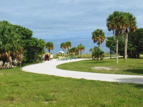 Fort DeSoto Park - Fort DeSoto Park, a 1,000 acre Pinellas County park on 5 keys south of St. Petersburg at the mouth of Tampa Bay. The paved 7-mile multi-use
trail runs from the boat ramp near the entrance, connecting
campgrounds and the east and north beaches.
Fort DeSoto Park - Fort DeSoto Park, a 1,000 acre Pinellas County park on 5 keys south of St. Petersburg at the mouth of Tampa Bay. The paved 7-mile multi-use
trail runs from the boat ramp near the entrance, connecting
campgrounds and the east and north beaches.
 Good Neighbor Trail -
The trail runs 13 miles east from Brooksville along a former narrow
gauge railway line. Part of the Florida Coast-to-Coast Trail,
it links to the east with the Withlacoochee State Trail and to the west
to the Suncoast Trail.
Good Neighbor Trail -
The trail runs 13 miles east from Brooksville along a former narrow
gauge railway line. Part of the Florida Coast-to-Coast Trail,
it links to the east with the Withlacoochee State Trail and to the west
to the Suncoast Trail.
 Good Neighbor Connector - A connector
along the Florida Coast-to-Coast Trail, this 4.5
mile trail runs off-street next to SR 50 (Cortez Blvd.) from the
Suncoast Trail near Spring Hill to Cobb Road in
Brooksville where it links to
the Good Neighbor Trail.
Good Neighbor Connector - A connector
along the Florida Coast-to-Coast Trail, this 4.5
mile trail runs off-street next to SR 50 (Cortez Blvd.) from the
Suncoast Trail near Spring Hill to Cobb Road in
Brooksville where it links to
the Good Neighbor Trail.
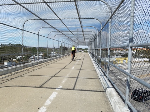
 Memorial Causeway Trail - 2.5 mile multi-use
bike trail connecting the Pinellas Trail to Clearwater Beach,
completing Clearwater's Bay-to-Beach connection from Clearwater
Beach to Tampa.
Memorial Causeway Trail - 2.5 mile multi-use
bike trail connecting the Pinellas Trail to Clearwater Beach,
completing Clearwater's Bay-to-Beach connection from Clearwater
Beach to Tampa.
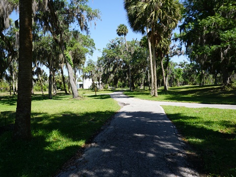
Myakka River State Park - A Florida
eco-biking and hiking destination. 7 miles of biking on the
paved park road, plus unpaved options and hiking trails. A highlight
is the Canopy Walk, a suspended walkway 25 feet above
ground through the hammock to a 74-foot viewing tower.
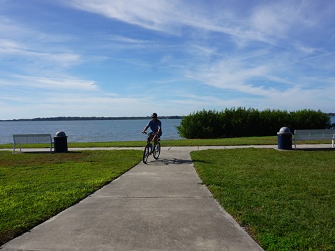
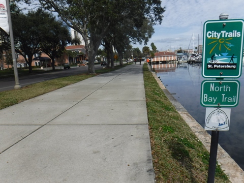 North Bay Trail - We were wowed by the southernmost portion
of this St. Petersburg trail. The best section runs from Demens Landing
to Coffee Pot Park, about 3 miles with water views. Part of the
Pinellas Trail Loop.
North Bay Trail - We were wowed by the southernmost portion
of this St. Petersburg trail. The best section runs from Demens Landing
to Coffee Pot Park, about 3 miles with water views. Part of the
Pinellas Trail Loop.
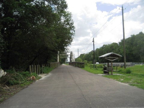 Old Fort King Trail - Multi-use trail (biking,
walking/hiking, horseback riding). First 2.4 miles from Sargeant
Park is paved, with a portion sharing the roadway with autos. The
remainder is unpaved at Lower Hillsborough Wilderness Preserve and
Hillsborough River State Park.
Old Fort King Trail - Multi-use trail (biking,
walking/hiking, horseback riding). First 2.4 miles from Sargeant
Park is paved, with a portion sharing the roadway with autos. The
remainder is unpaved at Lower Hillsborough Wilderness Preserve and
Hillsborough River State Park.
 Oldsmar Trail - Located along the northern end of
Tampa Bay, the Oldsmar Trail connects 11 city parks with much
variety from water to nature to sports. Best thought of as a trail
network vs. point-to-point trail.
Oldsmar Trail - Located along the northern end of
Tampa Bay, the Oldsmar Trail connects 11 city parks with much
variety from water to nature to sports. Best thought of as a trail
network vs. point-to-point trail.
 Pinellas Trail - a Top 10
Florida multi-use trail. An urban rail-trail from St. Petersburg
to Tarpon Springs. The well-marked trail - popular with bikers,
walkers, joggers, and skateboarders - links Pinellas County cities,
parks, scenic coastal areas, and residential neighborhoods.
Currently about 46 miles, it's part of the 75-mile Pinellas Trail Loop. Westernmost
section of the Florida Coast-to-Coast Trail.
Pinellas Trail - a Top 10
Florida multi-use trail. An urban rail-trail from St. Petersburg
to Tarpon Springs. The well-marked trail - popular with bikers,
walkers, joggers, and skateboarders - links Pinellas County cities,
parks, scenic coastal areas, and residential neighborhoods.
Currently about 46 miles, it's part of the 75-mile Pinellas Trail Loop. Westernmost
section of the Florida Coast-to-Coast Trail.
 Pinellas Trail Loop - This regional trail network
will eventually total 75 miles. The loop incorporates the Fred
Marquis Pinellas Trail (St. Petersburg to Tarpon
Springs) on its western leg (46 miles), and on its eastern leg
the Duke Energy Trail (13 miles, 22.5 miles when
complete) and the North Bay Trail (6.5 miles).
Pinellas Trail Loop - This regional trail network
will eventually total 75 miles. The loop incorporates the Fred
Marquis Pinellas Trail (St. Petersburg to Tarpon
Springs) on its western leg (46 miles), and on its eastern leg
the Duke Energy Trail (13 miles, 22.5 miles when
complete) and the North Bay Trail (6.5 miles).
 Ream Wilson Clearwater Trail - This trail runs
west to east in Pinellas County, about 4.75 miles from Coachman's
Ridge Park (Clearwater) to Safety Harbor. It passes multiple parks
and sporting facilities, and connects to the Duke Energy Trail
(Pinellas Loop Trail).
Ream Wilson Clearwater Trail - This trail runs
west to east in Pinellas County, about 4.75 miles from Coachman's
Ridge Park (Clearwater) to Safety Harbor. It passes multiple parks
and sporting facilities, and connects to the Duke Energy Trail
(Pinellas Loop Trail).
 Safety Harbor Bike Trail - 2 mile trail along Upper
Tampa Bay from Ream Wilson Clearwater Trail to Philippe Park. An
easy ride linking parks, downtown restaurants, and residential
areas.
Safety Harbor Bike Trail - 2 mile trail along Upper
Tampa Bay from Ream Wilson Clearwater Trail to Philippe Park. An
easy ride linking parks, downtown restaurants, and residential
areas.
 Skyway Trail - Connecting the Pinellas Trail in St.
Petersburg to the Sunshine Skyway. A nice community asset linking
parks, schools, residential and business areas.
Skyway Trail - Connecting the Pinellas Trail in St.
Petersburg to the Sunshine Skyway. A nice community asset linking
parks, schools, residential and business areas.
 Skyway Park Trail - At the eastern end of Courtney
Campbell Causeway, link to free parking at Skyway Park and Cypress
Point Park.
Skyway Park Trail - At the eastern end of Courtney
Campbell Causeway, link to free parking at Skyway Park and Cypress
Point Park.
 Starkey Blvd. Trail -
The trail runs along Starkey Blvd. from Longleaf (New Port
Richey, north of SR 54 - where it meets the Starkey Gap Trail),
to Starkey Wilderness Park (4.5 miles). Part of the
Florida Coast-to-Coast Trail.
Starkey Blvd. Trail -
The trail runs along Starkey Blvd. from Longleaf (New Port
Richey, north of SR 54 - where it meets the Starkey Gap Trail),
to Starkey Wilderness Park (4.5 miles). Part of the
Florida Coast-to-Coast Trail.
 Starkey Gap Trail -
The 2 mile trail connects the Tri-County Trail in Pinellas County to the Starkey
Blvd. Trail in Pasco County. Part of the Florida Coast-to-Coast Trail.
Starkey Gap Trail -
The 2 mile trail connects the Tri-County Trail in Pinellas County to the Starkey
Blvd. Trail in Pasco County. Part of the Florida Coast-to-Coast Trail.
 Starkey Wilderness Trail - This trail runs 7.5
miles through
the Jay B. Starkey Wilderness Park and is part of the Florida
Coast-to-Coast Trail with links to the Suncoast Trail
and Pinellas Trail (via Starkey Blvd. and Starkey Gap Trails).
Starkey Wilderness Trail - This trail runs 7.5
miles through
the Jay B. Starkey Wilderness Park and is part of the Florida
Coast-to-Coast Trail with links to the Suncoast Trail
and Pinellas Trail (via Starkey Blvd. and Starkey Gap Trails).
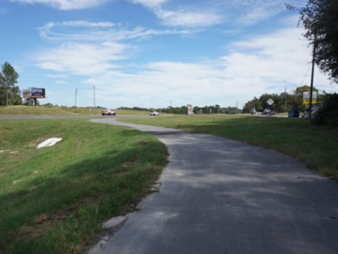
 Suncoast Trail - This 41-mile trail parallels
the Suncoast Parkway in Hillsborough, Pasco and Hernando Counties.
Links to Starkey Wilderness Trail (as part of the Florida
Coast-to-Coast Trail) and Upper Tampa Bay Trail.
Suncoast Trail - This 41-mile trail parallels
the Suncoast Parkway in Hillsborough, Pasco and Hernando Counties.
Links to Starkey Wilderness Trail (as part of the Florida
Coast-to-Coast Trail) and Upper Tampa Bay Trail.
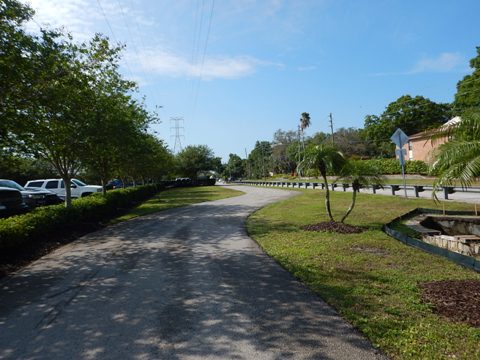
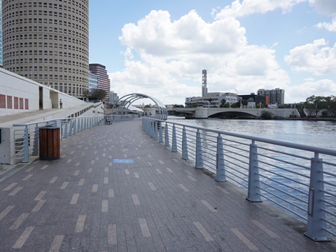 Tampa Riverwalk - 2.6 miles path along the
Hillsborough River, passing museums, restaurants, historical sites,
sports facilities and more. More biking via connecting trails and
protected bike lanes.
Tampa Riverwalk - 2.6 miles path along the
Hillsborough River, passing museums, restaurants, historical sites,
sports facilities and more. More biking via connecting trails and
protected bike lanes.
 Town-n-Country Greenway - Tampa suburbs. 2-mile
neighborhood trail along a canal. Future links to Upper Tampa Bay
Trail, Courtney Campbell Causeway Trail, City of Tampa.
Town-n-Country Greenway - Tampa suburbs. 2-mile
neighborhood trail along a canal. Future links to Upper Tampa Bay
Trail, Courtney Campbell Causeway Trail, City of Tampa.
 Tri-County Trail - Part of the Florida Coast-To-Coast Trail -
connects the Pinellas Trail at East Lake Road to the Starkey
Gap Trail in Pasco County, 5 miles.
Tri-County Trail - Part of the Florida Coast-To-Coast Trail -
connects the Pinellas Trail at East Lake Road to the Starkey
Gap Trail in Pasco County, 5 miles.
 Upper Tampa Bay Trail - Popular multi-use trail for
bikers, runners, walkers, and skaters. There are two sections (8
miles and 4.5 miles), eventually they will be connected. At the
north, links to the Suncoast Trail.
Upper Tampa Bay Trail - Popular multi-use trail for
bikers, runners, walkers, and skaters. There are two sections (8
miles and 4.5 miles), eventually they will be connected. At the
north, links to the Suncoast Trail.
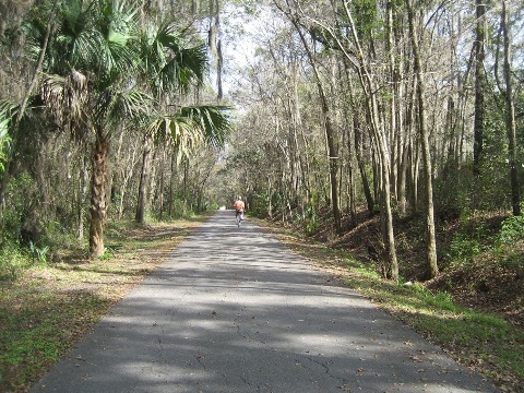
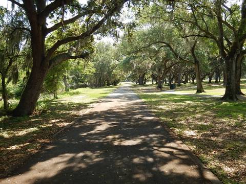
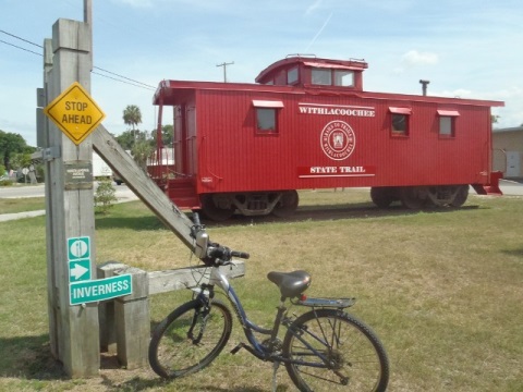 Withlacoochee State Trail - a Top 10
Florida bike Trail. This 46-mile paved rail-trail goes through small
towns, the Withlacoochee State Forest and other natural areas. A linear
state park, the trail offers many recreational opportunities with parks,
river, and lake views. Now connects to the Dunnellon Trail.
Withlacoochee State Trail - a Top 10
Florida bike Trail. This 46-mile paved rail-trail goes through small
towns, the Withlacoochee State Forest and other natural areas. A linear
state park, the trail offers many recreational opportunities with parks,
river, and lake views. Now connects to the Dunnellon Trail.
Also visit us on water: Paddling in West Florida at PaddleFlorida.net
Find Trails by FL Region or Listed A - Z

100FloridaTrails.com... 100+ Florida Multi-use Bike Trails, Best for Safe, Fun Recreation and Fitness
Other Websites:
BikeOrlando.net
PaddleFlorida.net
BikeTripper.net
Copyright © 100FloridaTrails.com. All Rights Reserved.