100 Florida Trails®
Top FL Multi-use Bike Trails
Map Links & Photos Galore
Coast-to-Coast Updates
You are here >
Home >
Top Ten >
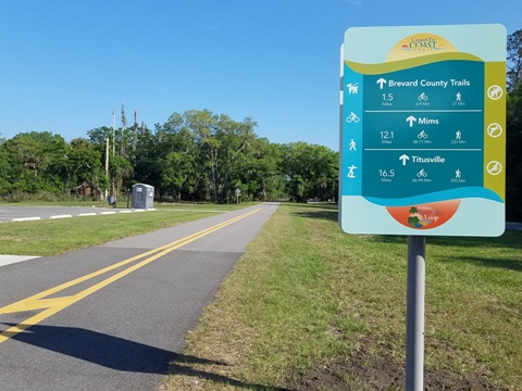
East Central Regional Rail Trail
Latest update: December 2025
East Central Regional Rail Trail... Florida
Top 10 FL Bike Trail... E-Z Google Map, 130+ Photos
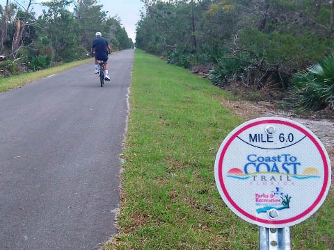
At 52 miles, the East Central Regional Rail Trail ("ECRRT") is a major component of both the 250-mile Florida Coast-to-Coast Trail and 260-mile St. Johns River-to-Sea Loop. It traverses southern Volusia County (with some shade) and northern Brevard County (virtually no shade). Trailheads and parks along the way provide some amenities. Used by recreational bikers, hikers and joggers, the miles of open, rural straightaways are especially popular with road bikers. At its western terminus, the trail links to the Spring-to-Spring Trail, and on its eastern side to the East Coast Greenway. (Map link and photos below.)
Location: Volusia and Brevard Counties
End Points: Green Springs Park in Deltona to
Maytown; from Maytown north to Edgewater; from Maytown south to
Titusville
Mileage: 52 miles
Surface: Asphalt, 12'
Trailheads/Parking: Volusia County: Thornby Park,
Green Springs Park (Deltona); SR 415 bridge, Gobblers Lodge Road (Osteen);
Maytown Spur Road (Maytown); SR 442 bridge, Rotary Park (Edgewater).
Brevard County: I-95 underpass at Mims; Chain of Lakes
Park, Titusville Visitor Center, Veterans Memorial Park, Parrish
Park (Titusville)
(See map)
Nearby points of interest: DeBary Hall, Gemini Springs Park,
American Space Museum. Kennedy Space Center, Merritt Island Wildlife Refuge,
Cape Canaveral National Seashore
Bike Shops/Rentals/Tours:
Ten Speed Drive Bicycle Center (Titusville; sales, service)
Deland Cyclery (Deland; sales, service)
JC's Bike Shop (Deland; sales, service)
Bubba’s Pampered Pedalers (Group Tours, Coast-to-Coast Tour includes ECRRT)
Page Summary:
- Biking the East Central Regional Rail Trail
- Trail Section 1... Green Springs Park to Maytown (18 miles)
- Green Springs Park Trailhead, Osteen Trailhead, Gobblers Lodge Trailhead, Maytown Spur Rd. Trailhead - Trail Section 2... Maytown Intersection to Titusville (18 miles)
- I-95 Trailhead, Chain of Lakes Park, Draa Park Trailhead, Sand Point Park, Parrish Park - Trail Section 3... Maytown Intersection to Edgewater (15.5 miles)
- Cow Creek Road Trailhead, SR 442 Bridge, Rotary Park - More Information and Resources
Biking the East Central Regional Rail Trail... Comments and Photos
The rail-trail corridor ranges from 35 to 200 feet wide and totals 668 acres. State and private managed areas within a 6 to 7 mile radius of Maytown (a Florida ghost town) provide a natural experience. Areas of the trail are extremely remote; bring sunscreen and extra water. Cooler months are best. We describe the ECRRT in 3 Sections, from west to east (*mileage is approximate):
Trail Section 1... Green Springs Park to Maytown (west to east, 18 miles)
This section of trail serves as part of both the FL Coast-to-Coast Trail and St. Johns River-to-Sea Loop.
Green Springs Park Trailhead (Some History)
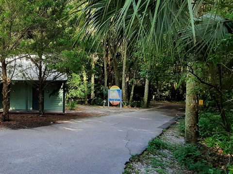
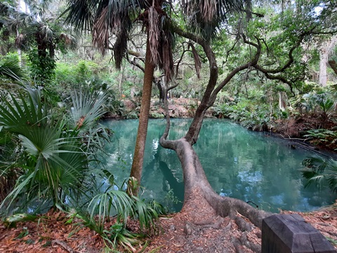
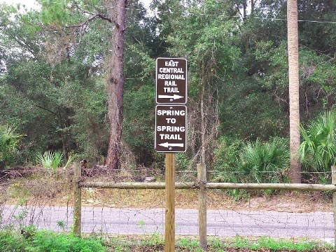
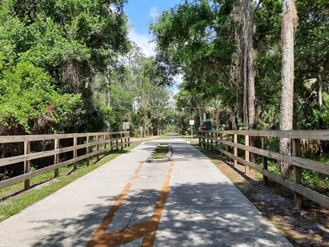
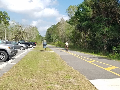
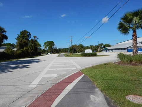
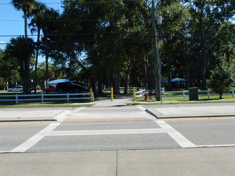
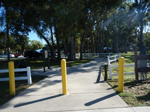
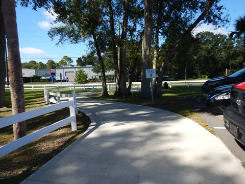
Green Springs Park is as a trailhead and connector to the Spring-to-Spring Trail. One of a few green sulphur springs remaining, Green Springs was once popular as a health spa and is now a county park, with parking, water, picnic, playground. Enter the park from Lakeshore Drive, then to access the ECRRT follow the path around the parking lot and past the restrooms (follow the sign pointing toward the Spring Overlook). The path meets the trail (about 2/10 mile) at the point where the Spring-to-Spring Trail ends, and ECRRT begins.
Green Spring Park East to Osteen Trailhead - 5.5 Miles
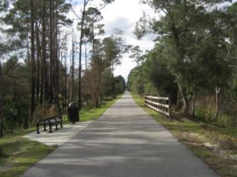
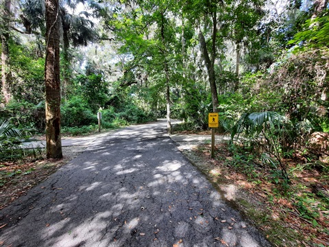
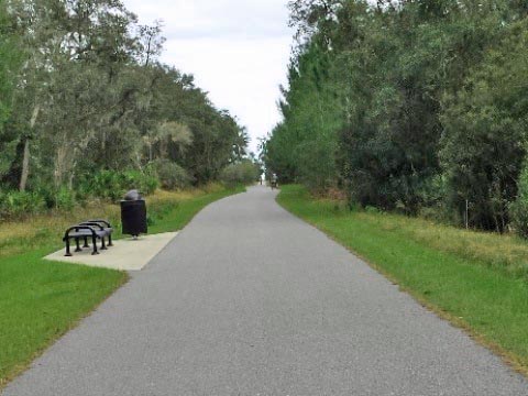
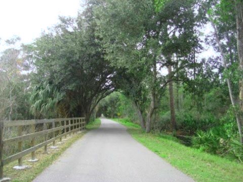
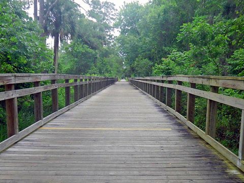
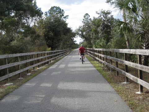
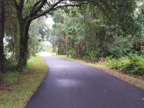
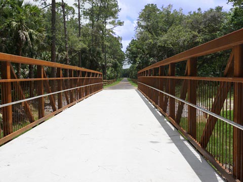
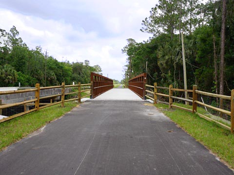
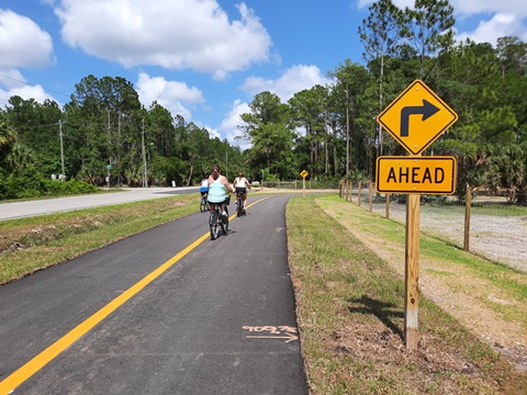
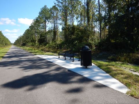
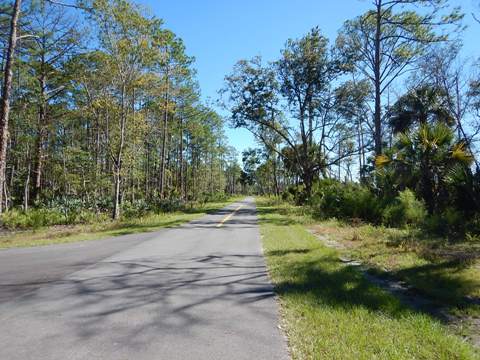
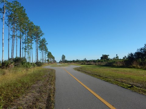
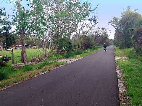
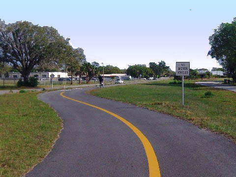
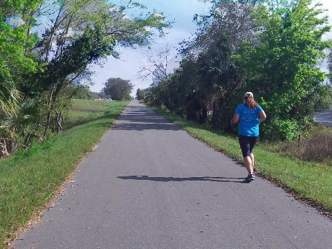
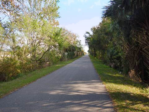
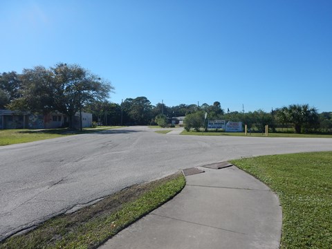
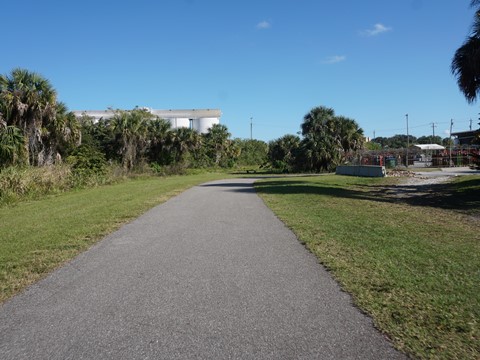
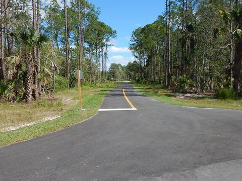
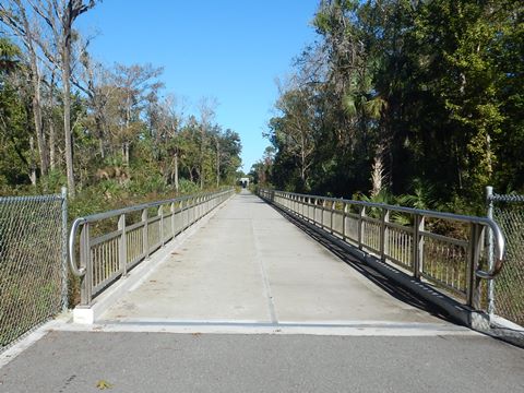
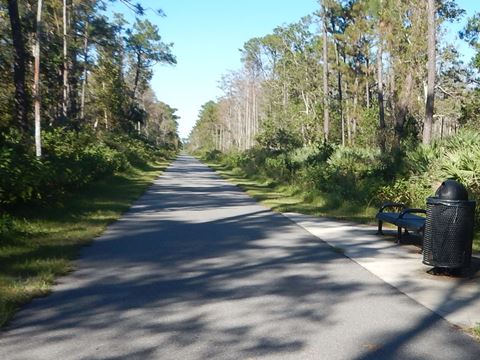
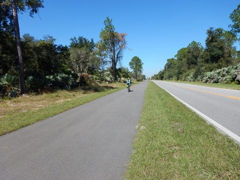
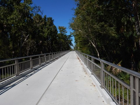
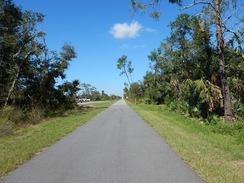
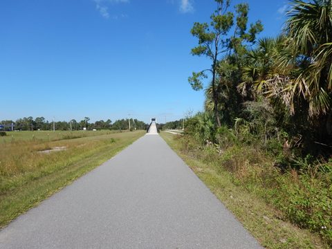
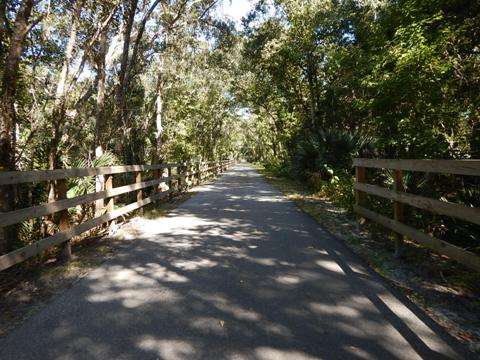
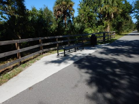
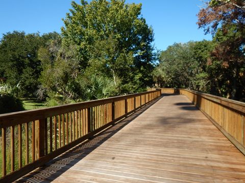
From the Green Springs trailhead, the East Central Regional Rail Trail runs mostly away from roads, with shaded sections and boardwalks over wetlands. Benches are spaced regularly. There are some crossroads (some can be busy) and driveways (where traffic is light if any). Do be careful as at the crossroads cars have the right-of-way, while at the driveways trail riders are given the right-of-way. The area still retains a rural feel. Being close to the I-4 corridor, this is the most popular section of the ECRRT for families and recreational bikers.
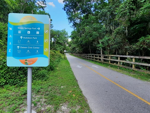
Osteen Trailhead to Guise Road - 2.7 Miles
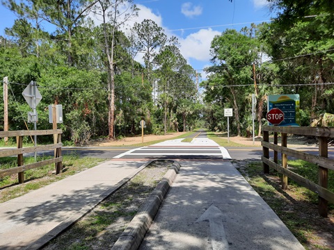
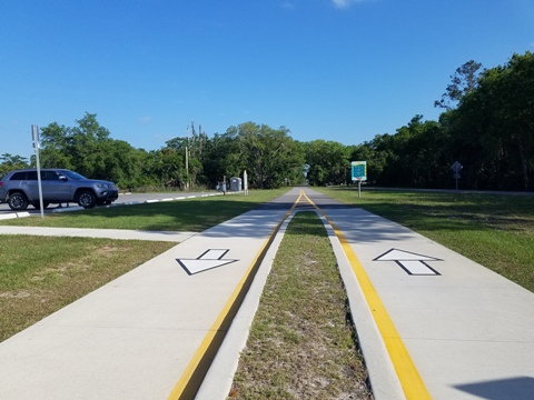
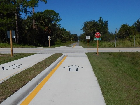
There are trailhead parking and facilities (building by Community Center) under the east side of the SR 415 bridge. After crossing over SR 415, the ECRRT runs mostly parallel to Maytown Road for 2.7 miles to Guise Road.
Note: another 5-mile bike trail begins at this same trailhead (SR 415 Trail / Beck Ranch Pathway) and goes south parallel to SR 415, crossing a bridge over the St. Johns River (traffic barrier, nice view) into Seminole County. This trail will eventually link to the Sanford Riverwalk as part of a future Lake Monroe Loop.
Guise Rd. to Gobblers Lodge Trailhead - 3.5 Miles
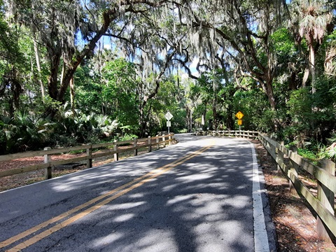
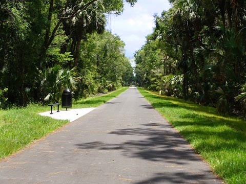
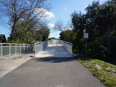
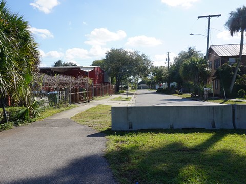
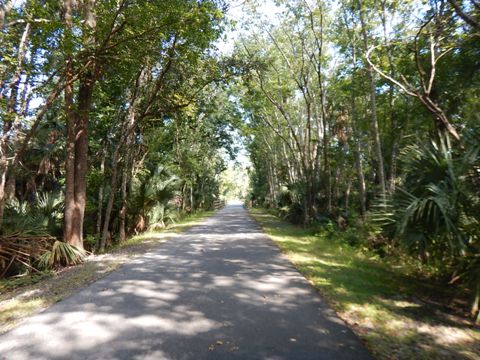
This is the final section of the ECRRT to be completed (ribbon-cutting May, 2021). For the first 1.25 miles, the trail continues behind homes along Maytown Road, with intermittent sun and shade. Here, the most scenic spot is a tree-lined area where the trail crosses over the Deep Creek diversion canal. The trail bends and runs roadside for the next 1.75 miles, but with a comfortable 50' buffer. Here, the trail crosses over the original Deep Creek, then again makes a quick bend away from the road and continues straight through a tree-line for about 0.5 mile to Gobblers Lodge Trailhead.
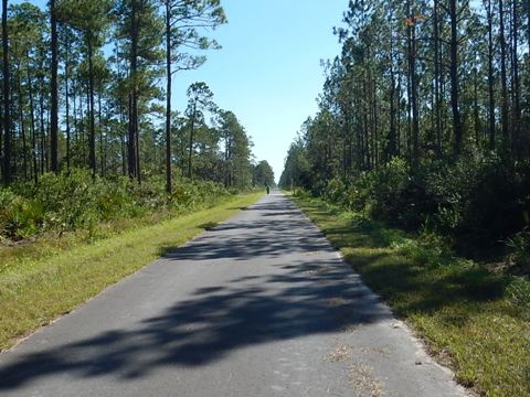
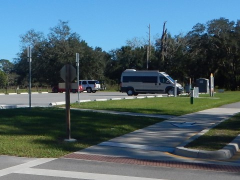
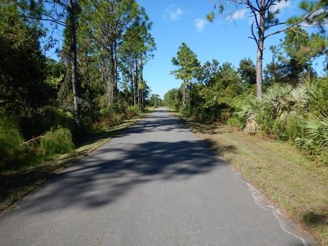
Gobblers Lodge Trailhead to Maytown Intersection - 6.5 Miles
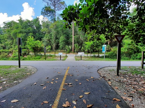
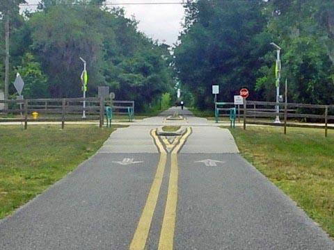
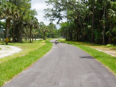
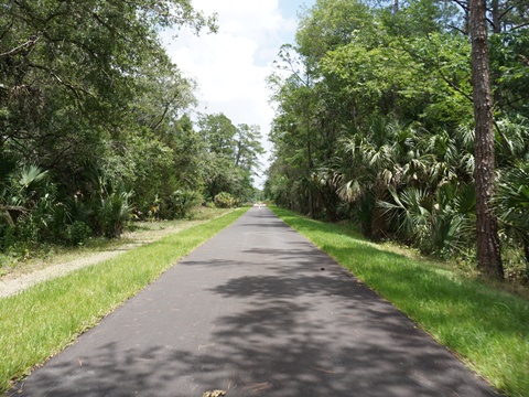
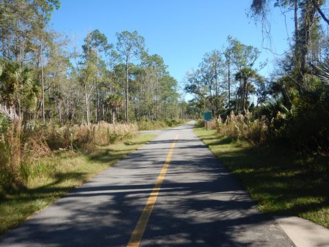
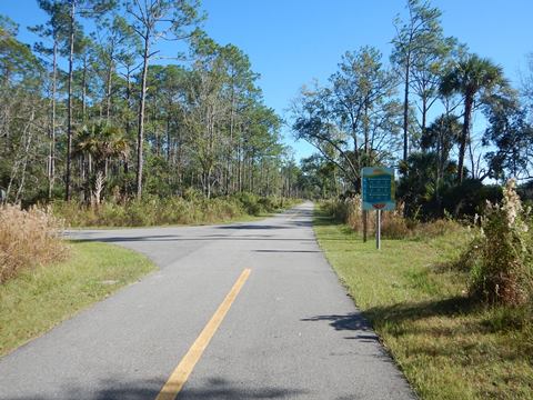
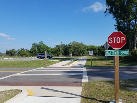
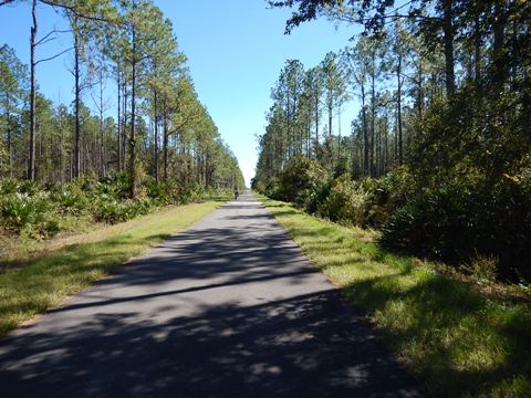
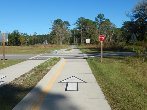
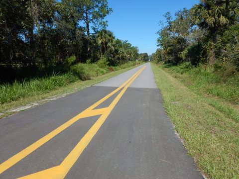
From the trailhead off Gobblers Lodge Road (parking, portalet), the trail quickly turns more to the south and runs 6.5 miles to the trail intersection at Maytown. This section is mostly tree lined and totally rural (within the Farmton Tree Farm). Bikers pass no public driveways and only one public road crossing (Lake Harney Rd.) before reaching Maytown. Just before Maytown Spur Road, the ECRRT branches - one branch (to the left) runs east and north to Edgewater as part of the St. Johns River-to-Sea Loop. The other branch (straight) leads to Titusville (Brevard County) as part of the Florida Coast-to-Coast Trail.
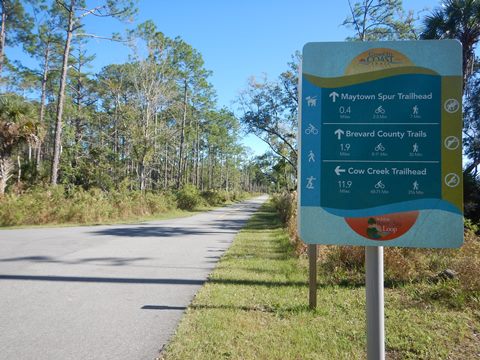
Maytown Spur Road Trailhead
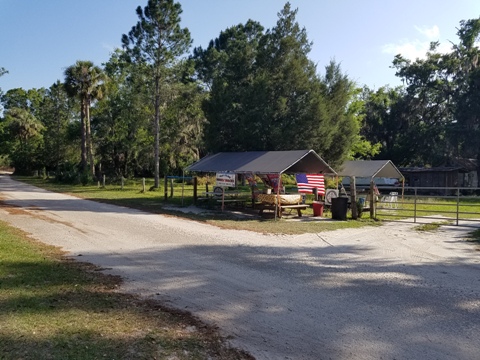
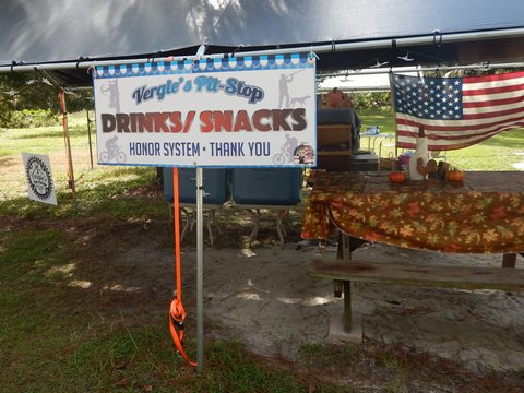
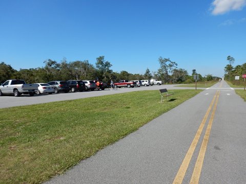
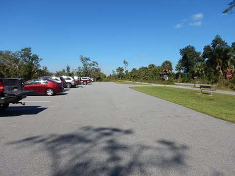
From the trail intersection, continue straight for about 0.4 mile to the Maytown Trailhead, (parking, portalet). Just past the parking lot, look to the right for Vergie's Pit Stop - an "honor system" stand along the trail offering beverages and snacks. Quaint and useful, this is the only "store" for many miles in all directions.
Trail Section 2... Maytown Intersection to Titusville (southeast, 18 miles)
This ECRRT section serves as part of the FL Coast-to-Coast Trail. Titusville is a designated Florida Trail Town, situated along the FL Coast-to-Coast Trail and East Coast Greenway.
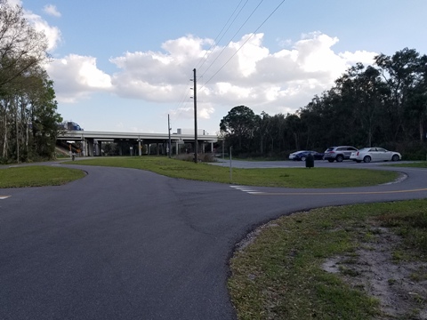
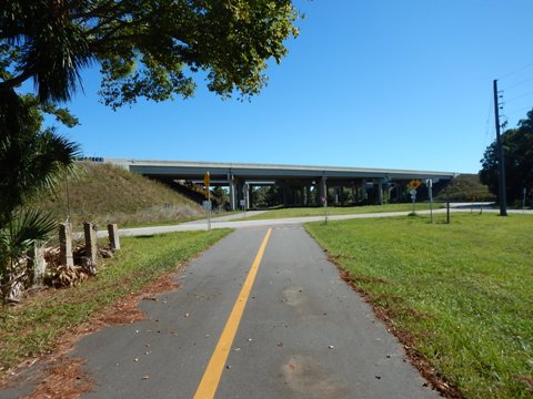
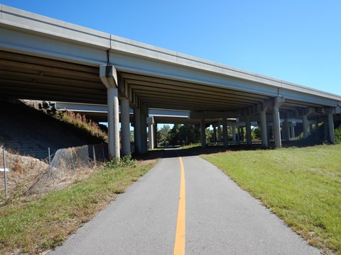
Maytown Intersection to I-95 Trailhead - 7 Miles
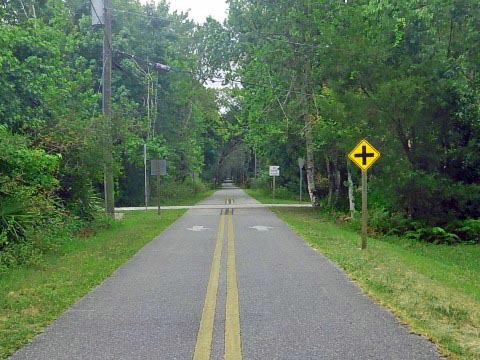
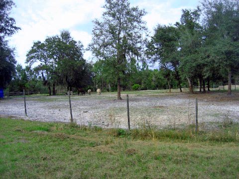
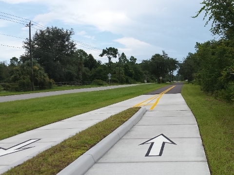
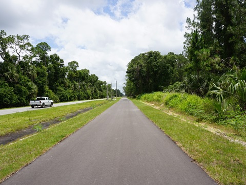
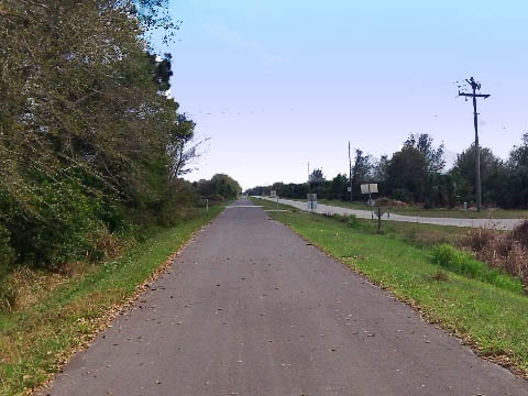
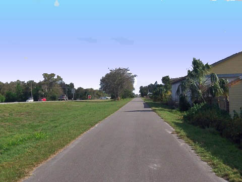
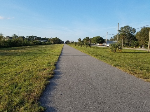
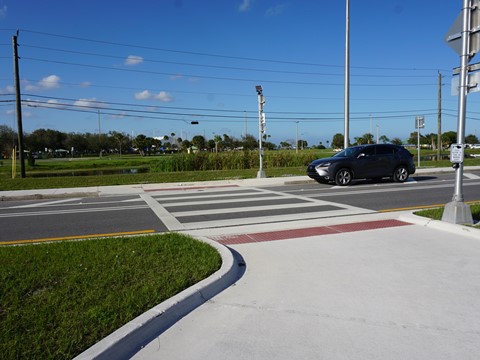
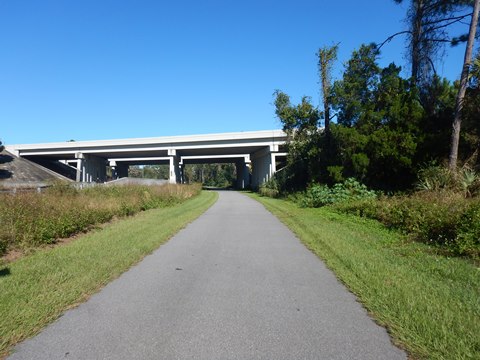
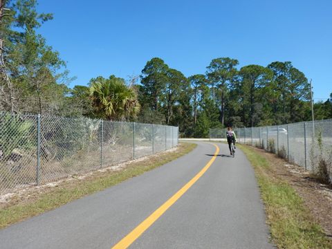
This ECRRT section runs from Maytown, past the trailhead at I-95 in Mims, and continues to Titusville. Leaving the Maytown Trailhead (Volusia County) is a pleasant, partially shaded 1.5 mile section to the Brevard County line. From here the Trail becomes mostly a straight line, with open vistas but virtually no shade until .5 mile before the I-95 trailhead at Aurantia Road (parking only). This is a remote area, no road crossings. An equestrian trail parallels the bike path. No covered benches or other amenities yet. There are several roundabouts in the Brevard County section, not sure of future use - perhaps rest stops?

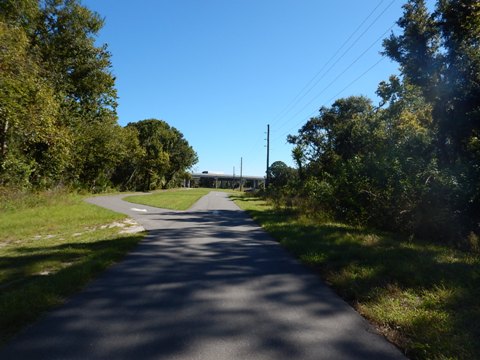
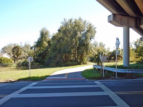
I-95 Trailhead to US Hwy 1 - 5.5 Miles
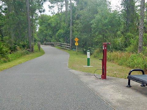
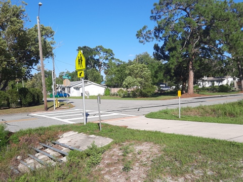
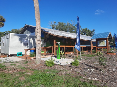
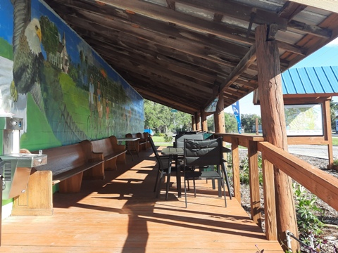
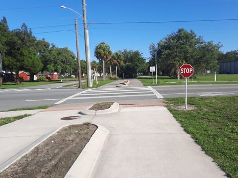
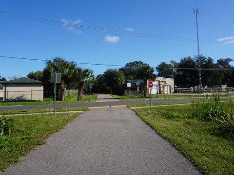
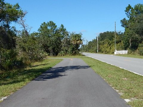
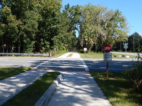
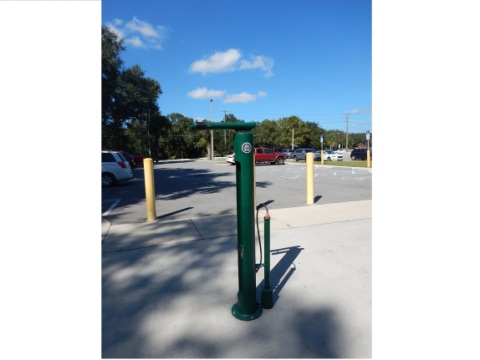
Past I-95 the trails turns more to the south, partial shade possible depending on time of day. Homes can be seen through the trees. The trail passes Indian River Preserve Golf Club before emerging roadside along Folson Rd., Broadway Rd. and Railroad Rd. This section serves neighborhood homes and schools; be careful at cross streets. Just before crossing SR 46 the Chain of Faith Bike Stop and trailhead at Mims United Methodist Church has parking, water refill station, bike fix-it station, picnic tables, covered porch, bike-pack camping, and porta-pottie - plus refreshments on the deck on Saturdays. Restrooms and shower are coming soon. The trail continues parallel with the road until merging with US Hwy 1 at the Mims/Titusville line at Parker Street.
US 1 to Draa Park Trailhead - 3 Miles
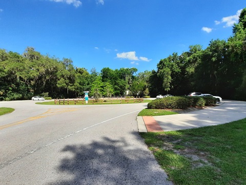
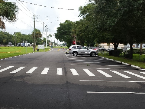
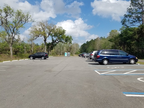
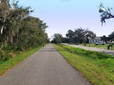
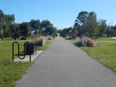
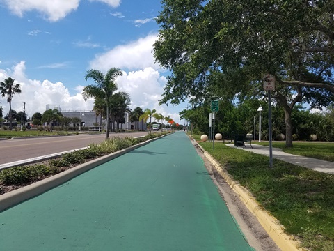
The trail parallels US Hwy 1 with a wide buffer for about 3 miles, past businesses and homes. At Dairy Rd. cross US1 to Chain of Lakes Park, which serves as a trailhead with parking, restrooms, playing fields and a 3-mile multi-use trail. Continuing on US1, the trail branches off at Malinda Lane and follows Norwood Avenue. Approaching the Garden Street / SR 406 Bridge, there's a new trailhead at Draa Road - turn right and go to the 2nd driveway on the right. Draa Park is a stormwater treatment project, it now provides parking and restroom, plus a 1/2 mile paved trail around the pond.
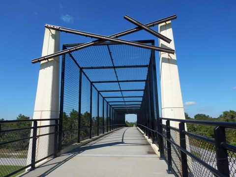
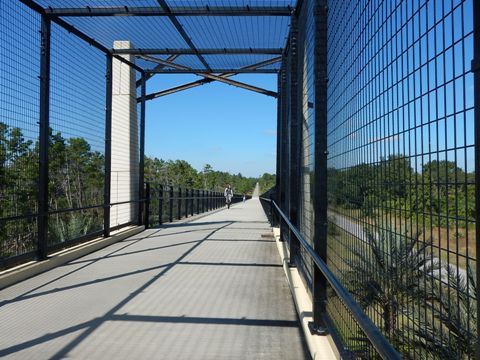
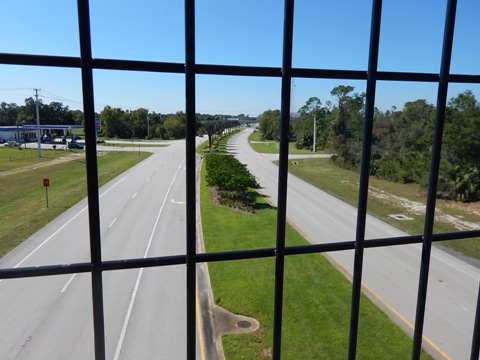
Garden St. Bridge to Indian River Road - 1 Mile
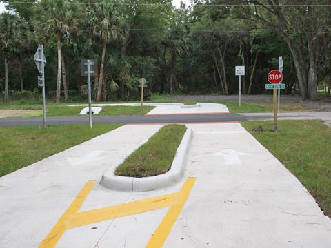
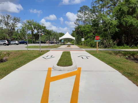
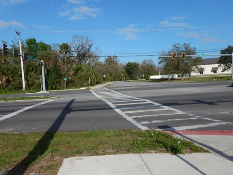
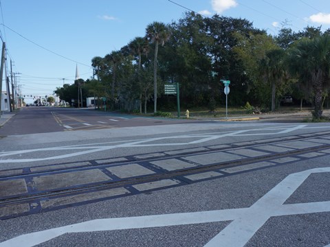
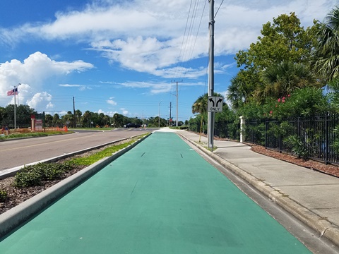
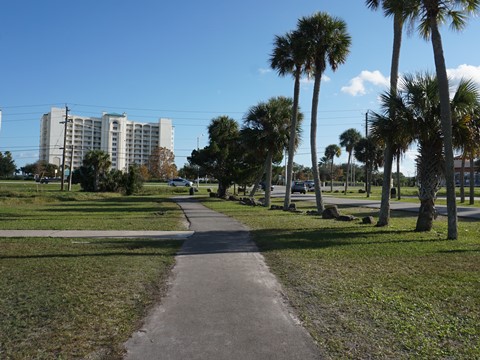
Across Draa Road is the approach to the Garden St. bridge. Across the bridge, the trail runs through an industrial corridor to Canaveral Ave. where it continues as a street route one block to Main Street. Along Main Street the street route continues 1/10 mile to a railroad track, then a 12-foot, striped bike lane runs through the downtown area and ends at Indian River Road. Located along both the Florida Coast-to-Coast Trail and East Coast Greenway, Titusville is serious about becoming a biking hub and is a recognized Florida Trail Town. Off Main St., access to shops and restaurants is being made easier.
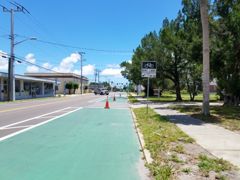
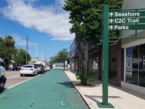
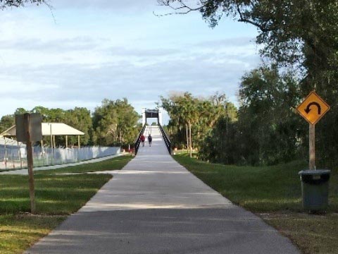
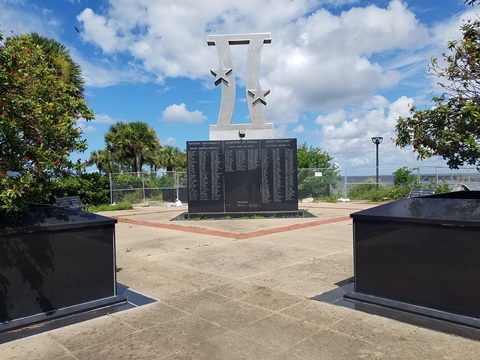
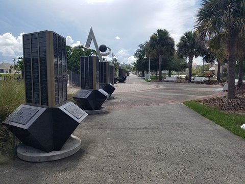
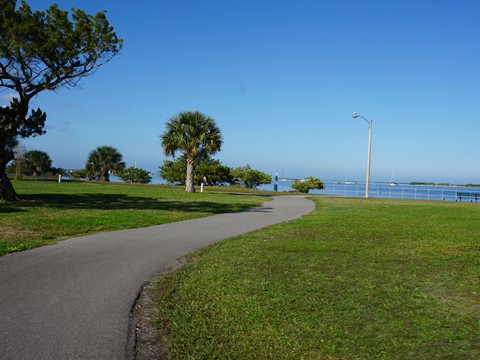
Indian River Avenue to Max Brewer Bridge - 0.2 Mile
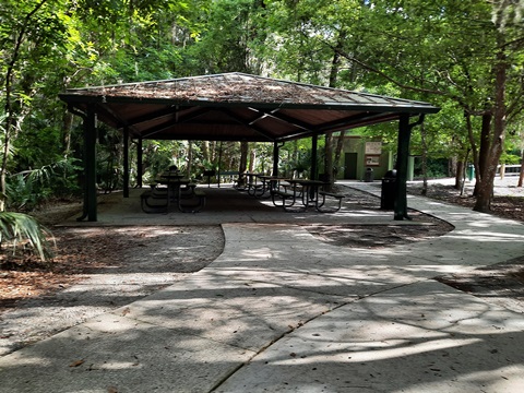
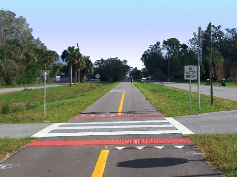
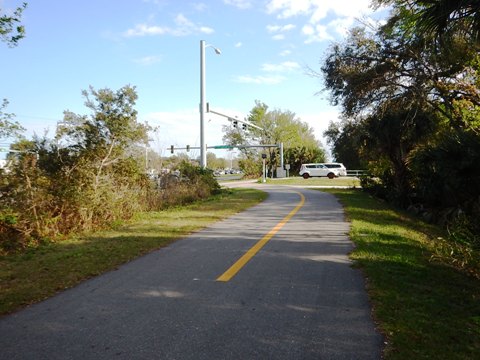
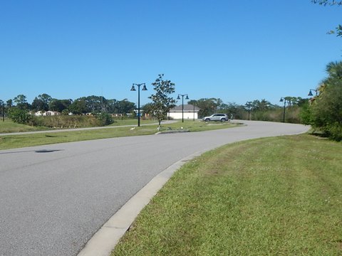
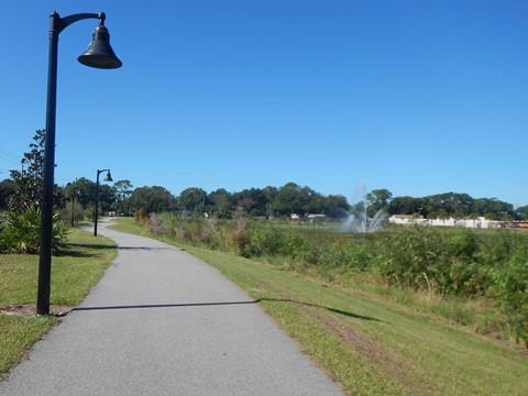
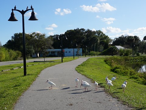
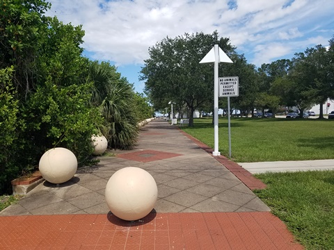
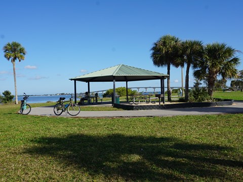
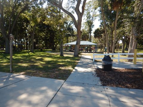
The striped bike lane continues along Indian River Avenue, marking the route to Max Brewer Memorial Pkwy. The city also celebrates its space and astronaut heritage with several interesting exhibits and stops at Space View Park along Indian River Avenue. From the end of Indian River Ave., the trail then runs along Max Brewer Memorial Pkwy. Continue straight to the bridge, or at about halfway use the crosswalk to popular Sand Point Park (parking, restrooms, picnic, playground, splash park, bikeable walking/fitness This is a pleasant stop with nice river views, and includes a paved trail). 0.7 mile bikeable walk/fitness trail. Also from the park, an access road leads to Pier 220 Seafood Grill for refreshments.
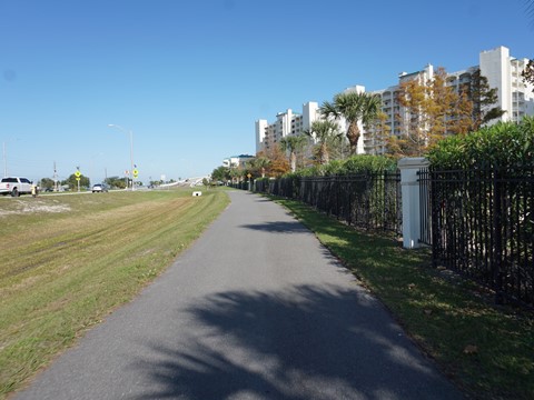
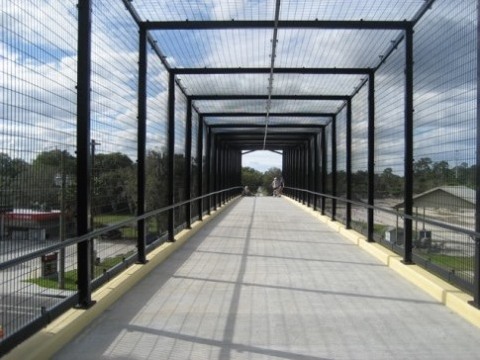
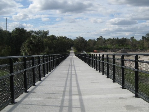
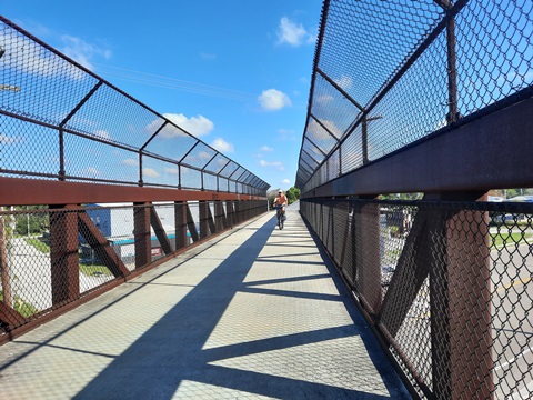
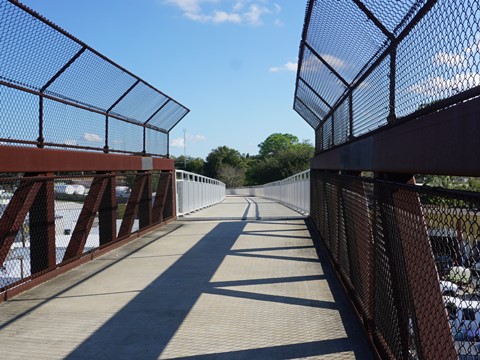
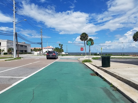
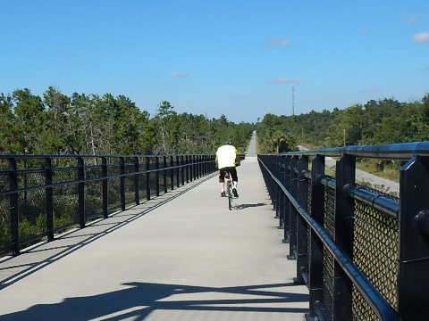
Max Brewer Bridge to Merritt Island National Wildlife Refuge - 1 Mile
- The Max Brewer Bridge has a bike lane roadside (although we've seen some use the separated pedestrian path). Over the bridge, cross A. Max Brewer Memorial Pkwy. at the crosswalk to Parrish Park.
- Parrish Park is a popular recreational spot, stretching along the Indian River for about 1/2 mile. There are two sections: 1) to the west are paved parking, restrooms, picnic shelters, boardwalk, fishing pier, and boat ramps; and 2) to the east is the Parrish Park Trailhead, part of the Coast-to-Coast Trail. This section has paved parking, ramp to beach, and river access for non-motorized water sports (kiteboarding is especially popular here).
- Past the trailhead, the trail continues alongside the A. Max Brewer Memorial Pkwy., ending at the boundary of the Merritt Island National Wildlife Refuge (NWR).
Max Brewer Bridge to Parrish Park


Trail Section 3... Maytown Intersection to Edgewater (northeast, 15.5 miles)
This section serves as part of the St. Johns River-to-Sea Loop.
Maytown Intersection to Cow Creek Road - 8.5 Miles
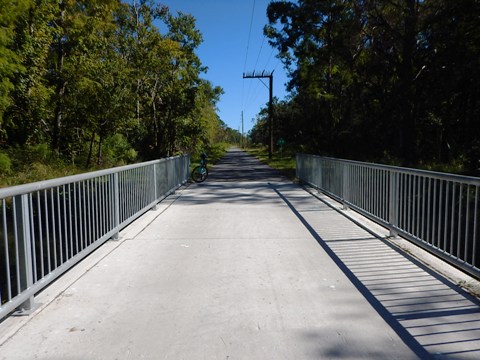
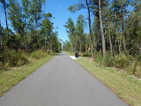
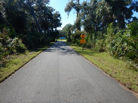
From the split at Maytown, the trail to Edgewater runs to Maytown Road and shortly passes Maytown Spur Road (road route to the trailhead). With a 50' to 60' tree-lined buffer, this section has some shade as well as bridges over wetlands and Cow Creek. It's about 3.5 miles to the I-95 underpass. Past the underpass, a few homes and ranchettes appear along with an airfield for small planes. Slightly over 2 miles past I-95, Maytown Road turns to the right, while the trail continues straight. To the right (east) is the Turnbull Hammock Conservation Area. Just before reaching Cow Creek Road, the trail passes through an old sand mine operation.


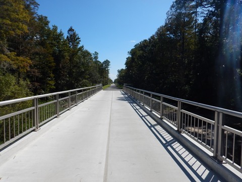
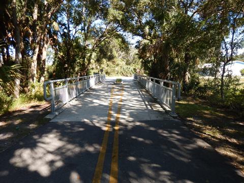
Cow Creek Road to Trailhead and SR 442 Bridge - 3.5 Miles
After emerging from the conservation area and passing a sand mine, the trail runs closely parallel to Cow Creek Road for about 1.5 miles. The trail then swings further away from the road and enters a pleasantly diverse, forested area. Although passing between I-95 and Cow Creek Road, there's a wide natural buffer, so it's typically a quiet ride, except for some I-95 traffic noise from the west, depending on the direction of the wind.
Cow Creek Road Trailhead and SR 442 Bridge
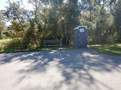
The trailhead is along Cow Creek Road, 0.4 mile south of the SR 442 bridge (parking, benches, and portalet).
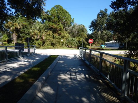
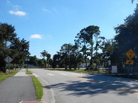
SR 442 Bridge to Dale Street - 3.5 Miles (ECRRT Ends)
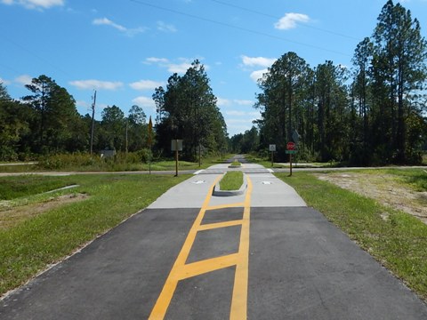
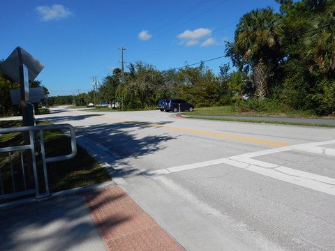
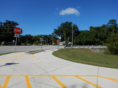
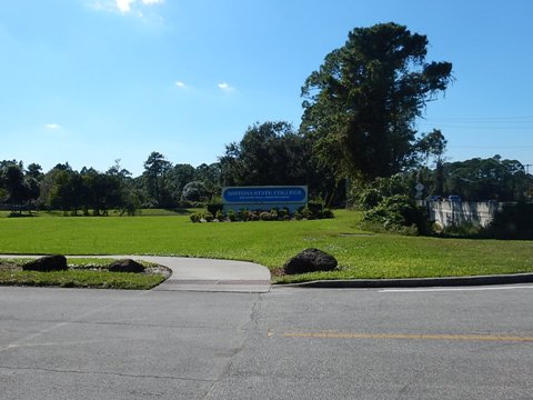
The bridge spans SR 442, then the trail continues to Dale St. through a nicely shaded section. There are some road crossings, the busiest at Old Mission Road. (Take care here, perhaps the most difficult road crossing along the entire trail.) Otherwise, thanks to some tree canopy, this stretch is a pleasant ride and popular with locals. From Dale St., a path along W. Park Ave. leads to a trailhead at Rotary Park, or continue on a short connector trail to the north, ending at 10th Street and Daytona State College.
Dale Street to 10th St. (1.2 Miles)
The ECRRT ends at Dale St. in Edgewater. However, a short but surprisingly pleasant trail connector (part of the St. Johns River-to-Sea Loop and the multi-state East Coast Greenway) now extends north (left) to 10th St. and Daytona State College. After running about two blocks parallel to Dale Street, the trail enters a natural preserve with 3 boardwalks.
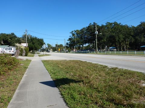
Rotary Park
From the point where the ECRRT ends at Dale St., go right (south) a half-block to N. Park Ave., then left along the sidewalk to the Rotary Park crosswalk (less than 1/4 mile from trail end). Rotary Park has parking, restrooms, playground, basketball court, picnic tables, and walking trail.
More Information and Resources
Nearby Biking:
Spring-to-Spring Trail
SR 415 Trail /
Beck Ranch Pathway
Chain of Lakes Park
Merritt Island National Wildlife Refuge (eco-biking)
Regional Overviews:
Florida Coast-to-Coast Trail - see the entire trail network, west to
east
St. Johns
River-to-Sea Loop - see the trails and gaps
Central FL Region - see
Overview Map for nearby trails
East FL Region - see Overview Map for
nearby trails
Related Resources:
Volusia County - Trails
Edgewater Trails
Titusville Cycling/Pedestrian Trails
Find Trails by FL Region or Listed A - Z

100FloridaTrails.com... 100+ Florida Multi-use Bike Trails, Best for Safe, Fun Recreation and Fitness
Other Websites:
BikeOrlando.net
PaddleFlorida.net
BikeTripper.net
Copyright © 100FloridaTrails.com. All Rights Reserved.