100 Florida Trails®
Top FL Multi-use Bike Trails
Map Links & Photos Galore
Coast-to-Coast Updates
You are here >
Home >
FL Eco-biking >
Lake Kissimmee State Park
Reported: October 2021
Lake Kissimmee State Park... Florida
Ecotourism by Bike ("Eco-biking") and Hike in a Less Crowded FL State Park
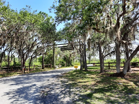
Established in 1977, Lake Kissimmee State Park consists of 5,930 acres of a former cattle ranch. Nestled between 3 lakes (Kissimmee, Rosalie, Tiger), there is only one way in and out by car. Being far from major metro areas, this remains one of the more remote areas of Central Florida, and the Park is rarely crowded. While we don't rank this as a top "eco-biking" destination, as with so many Florida State Parks, bicycles are a great way to explore and enjoy the most interesting parts in a single day-trip. (Map link and photos below.)
Location: Polk County, east of Lake Wales
Mileage: Varies, 3.2 miles paved road, intersected by marked trails
Surface: Paved Park road, unpaved multi-use trails (much is sandy)
Nearby points of interest: Legoland, Catfish Creek Preserve
Support and Advocacy:
Florida State Parks
Foundation
Page Summary:
- Eco-biking and Hiking at Lake Kissimmee State Park
- Biking the Main Park Road
- Marina, Concession, Picnic, Playground - Unpaved Multi-use Trails
- Lake Kissimmee State Park - More to Do and See
- More Information and Resources
Eco-biking and Hiking at Lake Kissimmee State Park... Comments and Photos
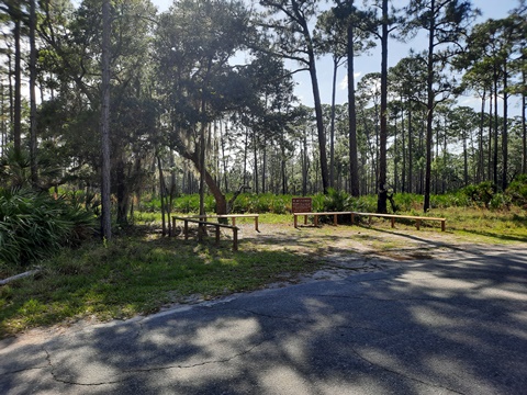
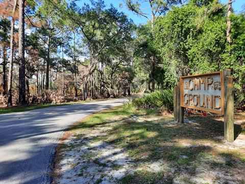
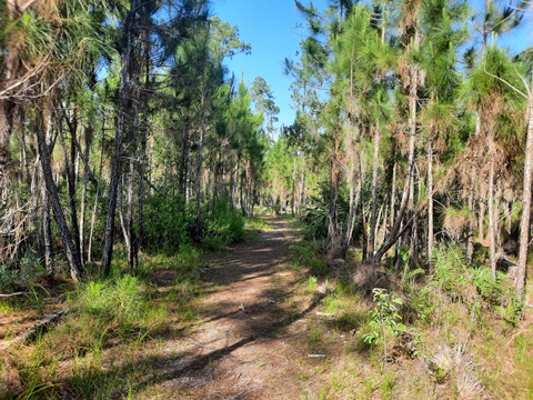
For easy recreational biking, the paved Park Road is best. Multi-use trails offer many miles of additional wide-tire biking and hiking options. The Park lands are mostly floodplain marsh, pine flatwood, and scrub, with some hammock. Nature and wildlife take center stage. We enjoyed the serenity the Park offers; the location is remote, no swimming areas (for people), and hunting is prohibited (as in all Florida State Parks). Activities include camping (campground, primitive, equestrian), mountain biking, eco-biking, hiking, fishing, boating, canoeing, kayaking, horseback riding, and birdwatching (the Park said to host over 200 bird species). On clear nights, stargazing is also popular, as there is little light pollution in this remote location.
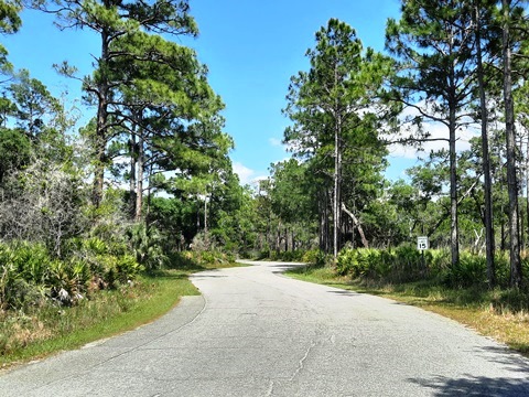
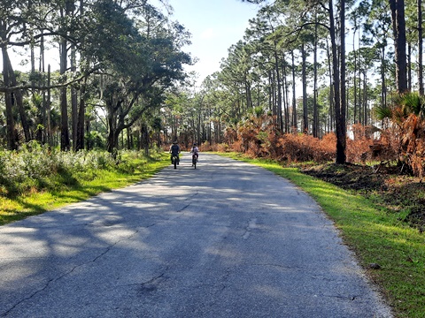
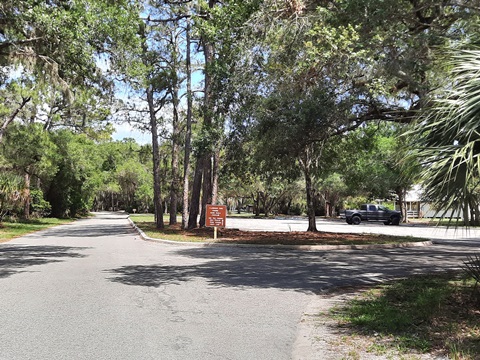
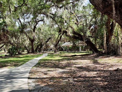
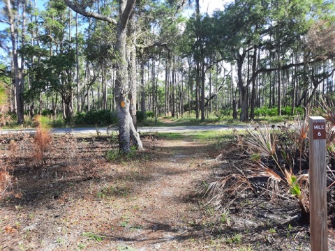
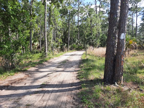
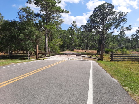
Biking the Main Park Road... About 6.4 Miles Roundtrip
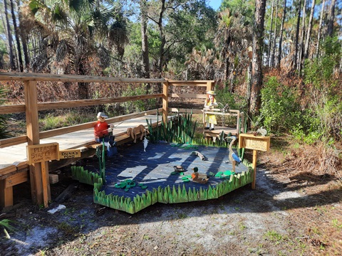
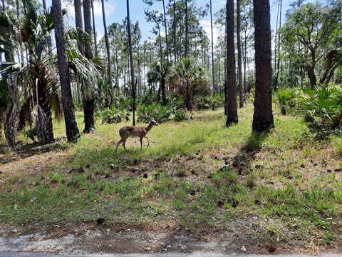
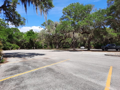
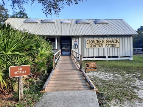
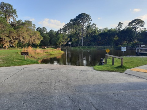
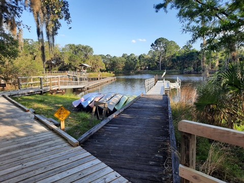
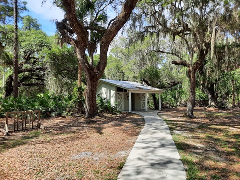
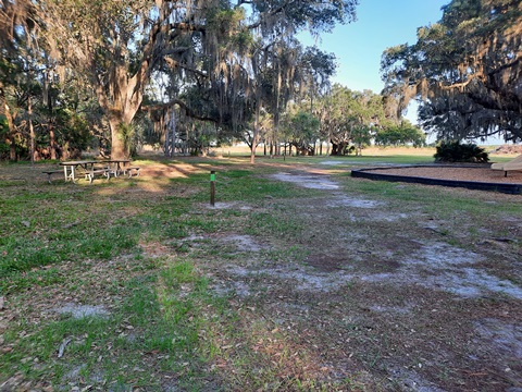
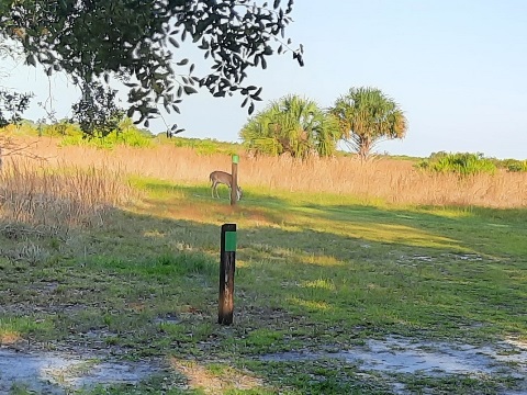
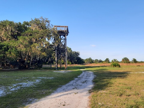
We rode on a weekday and there were few cars. The paved Park Road winds its way from the Park entrance for about 3.2 miles. Watch for the numbered intersection markers at trail crossings. Past the entrance to the main campground, the paved road splits. To the right... the road goes over the Zipprer Canal, where the pavement ends and a sandy road continues, left to the Cow Camp or straight to the equestrian staging area and the Buster Island Loop Trail (see below). Continuing straight... the paved road goes a short distance past the camp store, boat ramp, picnic area, and main parking area, before the pavement ends just before the Youth Camp. Here Park visitors will find restrooms, playground, concession/camp store, marina with boat ramp and fishing deck, and an observation tower (via Gobbler Ridge Trail, see below). The shady picnic area overlooks an expansive floodplain with a wide field of view. Deer are often seen in the distance.
Biking On the Park Road
Unpaved Multi-use Trails
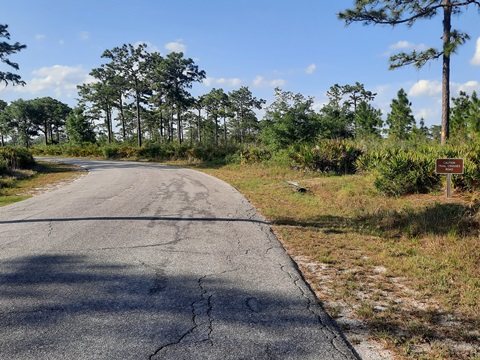
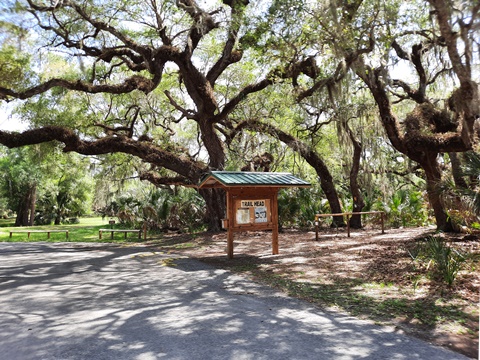
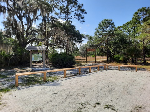
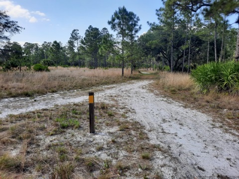
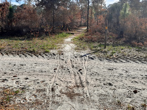
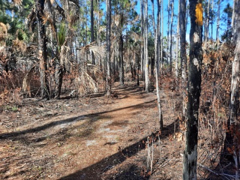
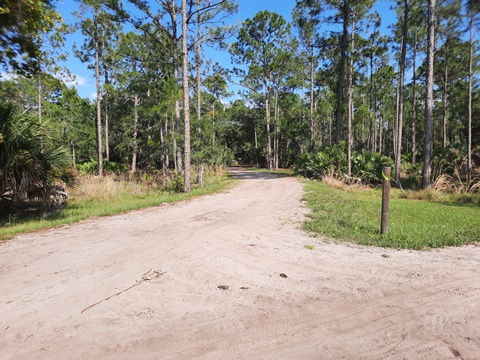
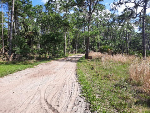
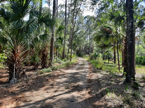
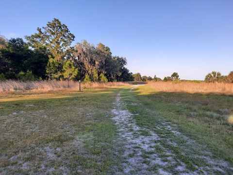
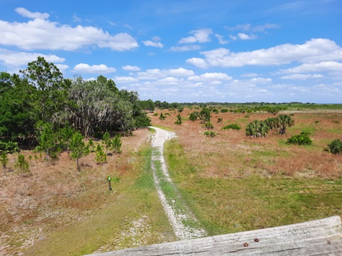
Lake Kissimmee State Park has 5 numbered and marked trails - easy to follow, watch for the blazes and the numbered markers at intersections. From what we observed, there is little hardpack trail surface in the Park. On the trail sections that go through the more forested areas, falling leaves and debris help to stabilize the sandy trail surface. We confined our off-road biking to these more forested areas. Upon first entering the Park, we were given a Park brochure & map, along with this separate trails map (pdf), which shows the numbered trail intersections. (Note: we found this trail map to be most useful by far, but we couldn't find it online, so we provide a link here.)
- Kristin Jacobs Trail (Yellow blaze), 6 miles, Bike, Hike
- Buster Island Loop (White blaze) 6.7 miles, Bike, Hike, Equestrian
- Flatwoods Pond Trail (Blue blaze) 0.25 mile, Hike only
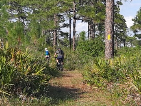
- Gobbler Ridge Trail (Green blaze) 2.80 miles, Bike, Hike
- Connector Trail (Blue blaze) 0.9 mile, Bike, Hike (connects 1 - 4)
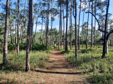
Kristin Jacobs Trail
The 6-mile Kristin Jacobs Trail (also called the North Loop Trail) makes an elongated loop through a more forested area, close to and crossing the Park Road 4 times, offering easy on-off options. Sandy sections, but includes some relatively firm, multi-use trail to ride. A 1-mile connector trail leads to the Gobbler Ridge Trail.
Buster Island Loop
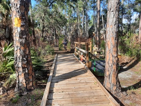
Cross the old wooden bridge (next to new bridge) and past an entry gate. Continue straight to an equestrian staging area and start of the loop. This multi-use trail (hike/bike/equestrian) circles the interior of the island. There's a primitive campground about halfway around. Very sandy at the entrance, we did not attempt biking here on this day.
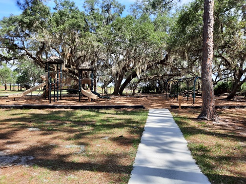
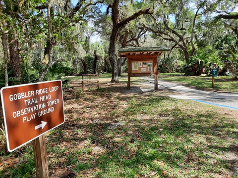
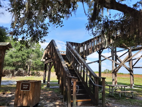
Gobbler Ridge Trail and Observation Tower
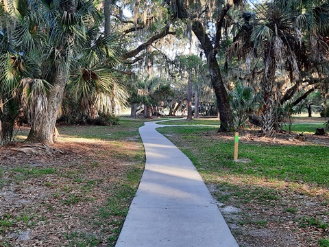
Take the paved walkway from the parking lot, past picnic area and playground, to just before the observation tower. Then it's sand and grass. About 2.8 miles round-trip, it's the only trail that actually touches any of the 3 lakes surrounding the State Park. Note: the observation tower's 3rd story is under repair, so the best views will have to wait.
Lake Kissimmee State Park - More to Do and See
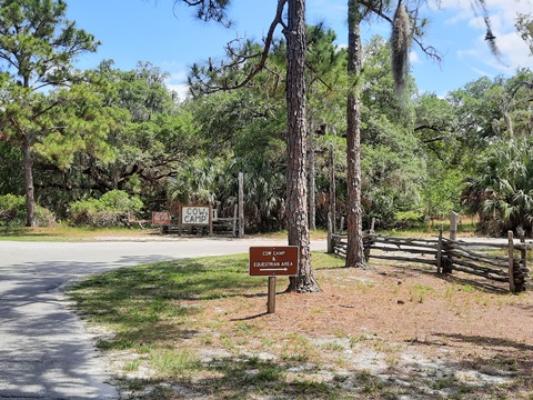
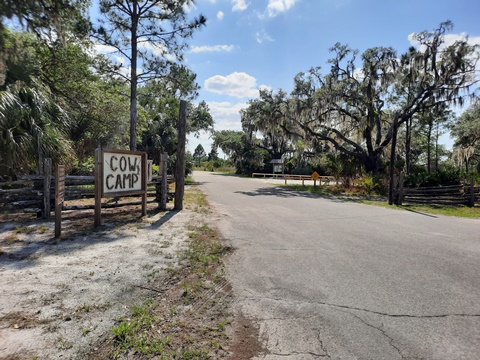
Zipprer Canal, Cow Camp
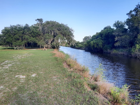
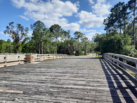
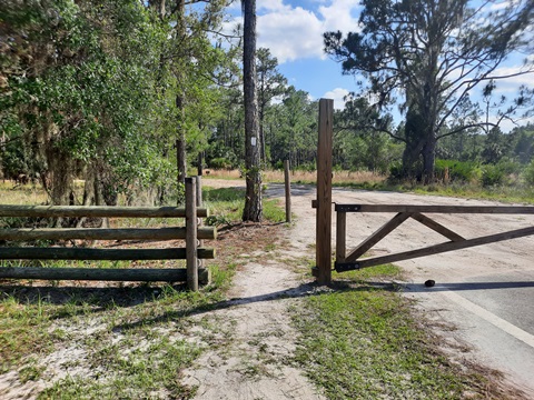
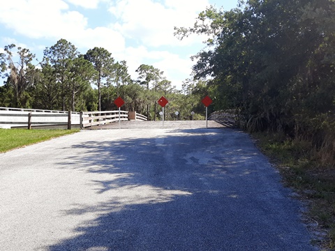
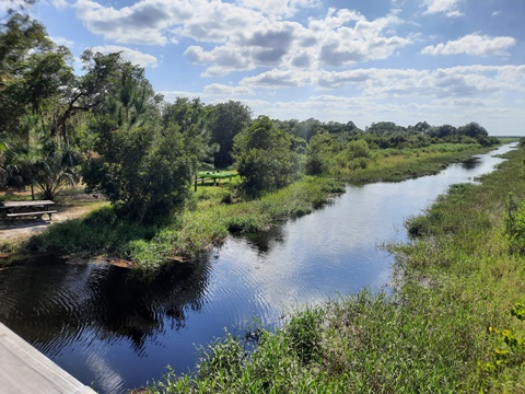
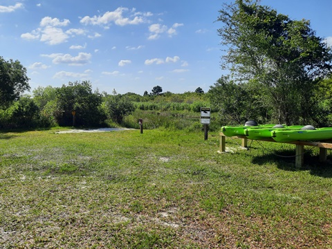
Where the paved Park Road splits, take the right turn (south) leading to the Cow Camp. A bridge crosses the Zipprer Canal (flood control canal between Lake Rosalie and Lake Kissimmee). Immediately next to the new bridge is the old wooden bridge, an interesting sight, now serving as a hiking path to the Buster Island Loop Trail. Along the canal here is a grassy kayak/canoe launch area with picnic tables. After crossing the bridge, the pavement ends. Past a gate are two options: (1) link to the Buster Island Trail (see above) or (2) visit the 1876-era Cow Camp. This is a unique feature, a living history re-enactment (open weekends only in season) providing a glimpse into Florida's history. Unfortunately, the camp was closed the day we visited. Note: The gate is closed and locked when the Cow Camp is closed, but hikers and bikers can simply walk around the gate.
More Information and Resources
Nearby Biking:
Central FL Region - more trails with a full Regional Overview map
Related Resources:
Florida State Parks - Lake Kissimmee State Park
Lake Kissimmee State Park
Brochure & Map (pdf)
Trails Map (pdf) - shows numbered trail intersections, very useful
Find Trails by FL Region or Listed A - Z

100FloridaTrails.com... 100+ Florida Multi-use Bike Trails, Best for Safe, Fun Recreation and Fitness
Other Websites:
BikeOrlando.net
PaddleFlorida.net
BikeTripper.net
Copyright © 100FloridaTrails.com. All Rights Reserved.