100 Florida Trails®
Top FL Multi-use Bike Trails
Map Links & Photos Galore
Coast-to-Coast Updates
You are here >
Home >
FL Eco-biking >
Shingle Creek Management Area
Reported: February 2022
Shingle Creek Management Area... Orlando, FL
Area Protects Headwaters of the Everglades... Eco-biking and Hiking
One of the most important watersheds in Florida is located in southwest Orange County: Shingle Creek, northernmost headwaters of The Everglades. The creek and surrounding area are protected wetlands due to their importance to Everglades restoration efforts, with the 1,750-acre Shingle Creek Management Area serving to restore, manage, protect and conserve this important resource. The area also offers visitor activities including hiking, eco-biking, mountain biking, paddling, fishing, picnicking, birdwatching and wildlife viewing. (Map link and photos below.)
Location: SW Orange County
Mileage: 1 mile along Shingle Creek, 4 miles
along powerline, 3 miles at East and West Pine Islands
Trailheads: Hunters Creek Middle School, Vista
Park (Hunters Creek)
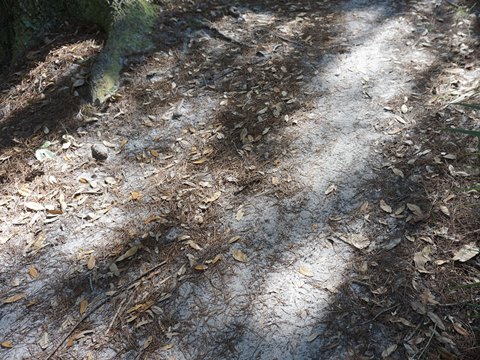
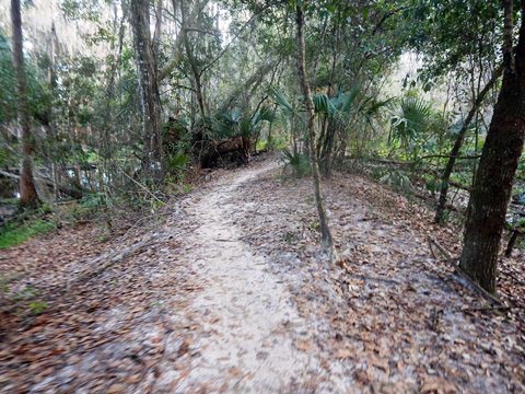
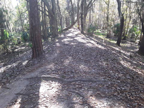
Surface: Packed dirt, gravel, sand, grass
Nearby Points of interest: Walt Disney World, SeaWorld
Bike Shops/Rentals: N/A
Page Summary:
- Eco-biking and Hiking at Shingle Creek Management Area
- Entering from Hunters Creek Middle School Trailhead
- Trailhead, Boardwalk, Kayak/Canoe Launch - Entering from Vista Park Trailhead
- Trailhead, Along the Powerlines - About Shingle Creek Management Area
- More Information and Resources
Eco-biking and Hiking at Shingle Creek Management Area... Comments and Photos
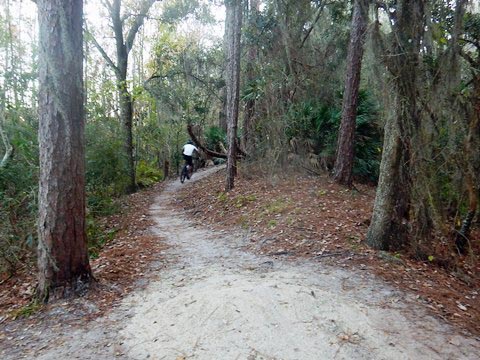
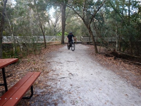
For eco-biking and hiking, Shingle Creek Management Area is accessed from two trailheads, each with a distinct personality. (1) From Hunters Creek Middle School, a trail runs along Shingle Creek, shaded and scenic, but unpaved and rough in places. The downside is this trailhead is closed during school hours. (2) From Vista Park in the Hunters Creek community, the trail runs into the Management Area along a powerline with no shade to Shingle Creek, where it continues to the Middle School. Note: A third access from the Marriott Trail at the Marriott Grande Vista resort to the north was shut down indefinitely when we visited, use the other entry points.
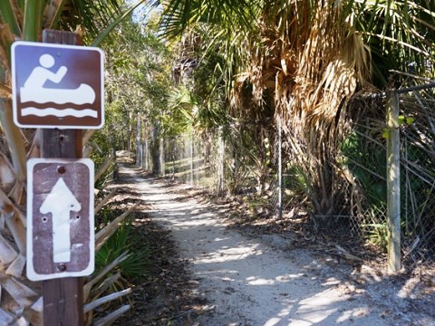
Entering from Hunters Creek Middle School Trailhead
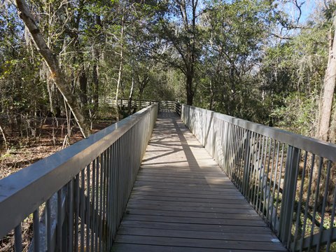
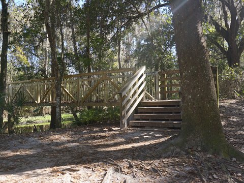
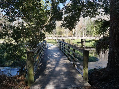
Hunters Creek Middle School Trailhead and Boardwalk
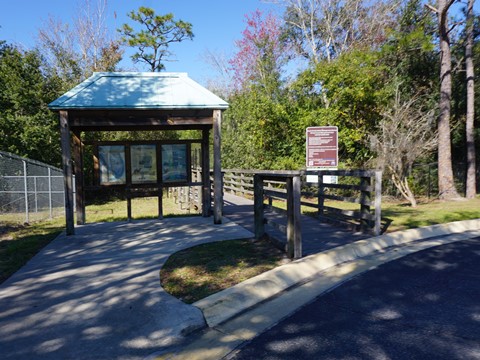
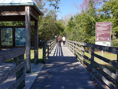
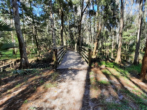
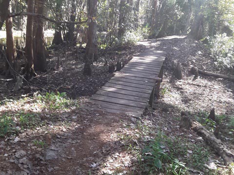
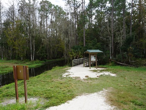
The trailhead is behind Hunters Creek Middle School (13400 Town Loop Boulevard). Limited access - only open during non-school hours, weekends and holidays. From the main entrance (end of parking lot next to school), go through a metal gate onto a boardwalk. The first set of steps to the left (south) leads to a path to the kayak/canoe launch. The boardwalk continues over Shingle Creek and ends with some steps to the right leading to the main trail. Here visitors can go either north or south on a trail paralleling the Creek. There is a second entrance towards the front of the school, which leads directly to the launch area (see below).
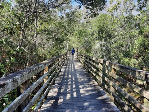
End of Boardwalk - North
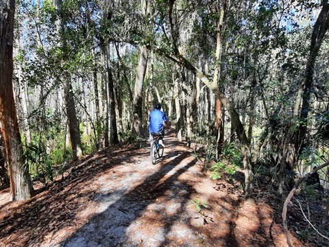
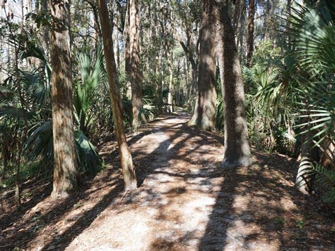
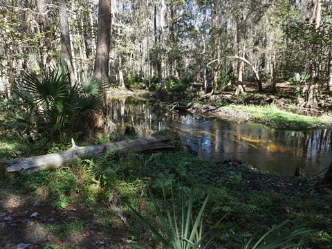
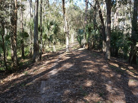
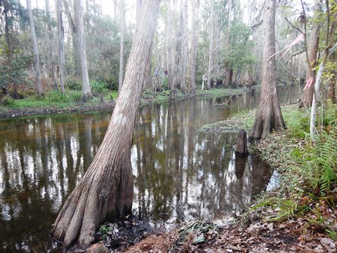
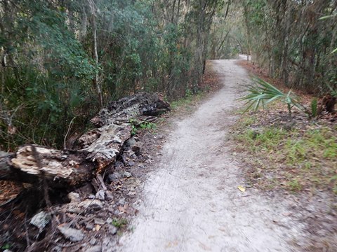
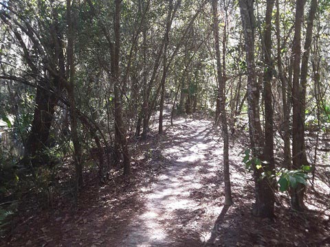
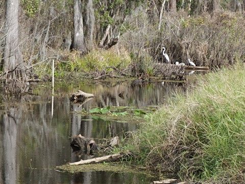
From the end of the boardwalk, continuing north (right) beside the creek leads to the trail along the powerline. This is the most scenic section, shady with creek and swamp views, and a couple of short bridges. There are some rough spots, but it's bikeable on fat tires. Note: along the creek, the trail is subject to flooding.
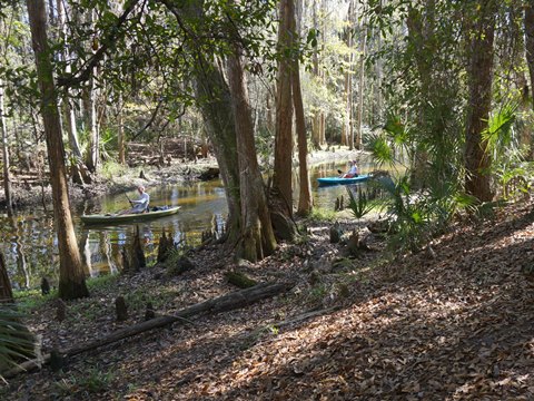
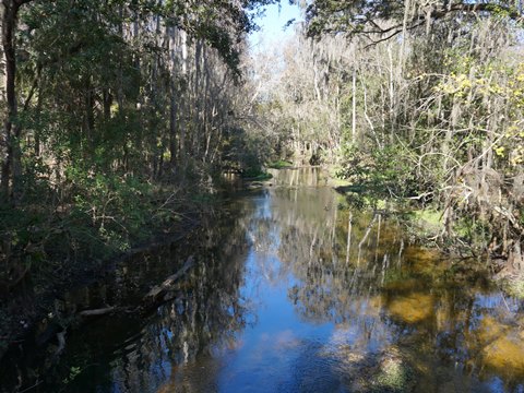
Kayak/Canoe Launch
Using a second entrance near the front of the school, it's a short walk (or carry) from the parking lot to a hand-launch on the east bank of Shingle Creek. From here, a sandy path leads north to the boardwalk and main trail across the creek.
Entering from Vista Park Trailhead (along powerline)
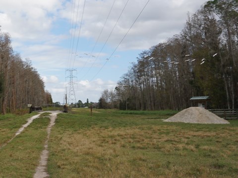
This is a moderate ride on grass and packed dirt, rideable with fat tires. No shade or facilities.
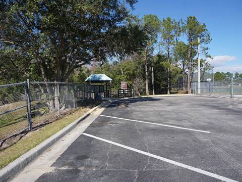
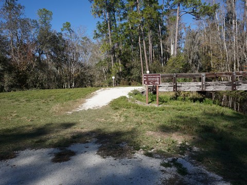
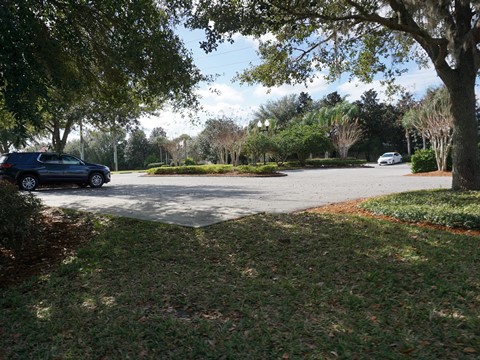
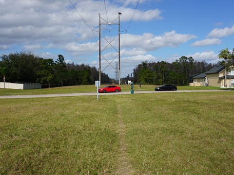
Vista Park Trailhead to Management Area
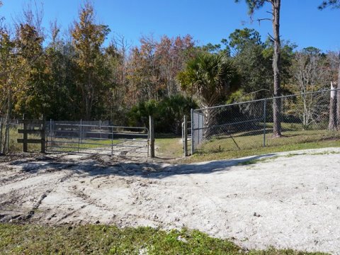
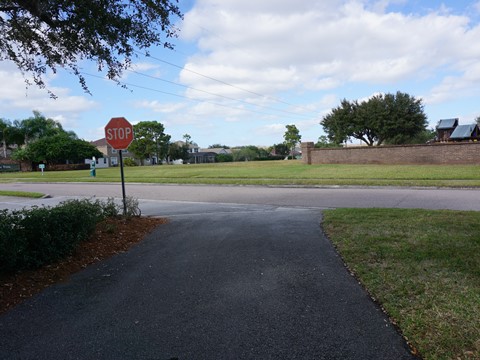
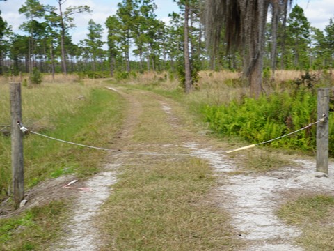
At the Vista Park trailhead (13042 Hunter's Vista Blvd.), parking is open to the public, but park facilities are resident-only. From the trailhead running south is a 1-mile paved section of Shingle Creek Trail (link below). From the trailhead going north to the Management Area, cross Hunter's Vista Blvd. and continue along the powerline, crossing Tarragona Drive to the entry to the Management Area (4/10 mile). Note: we've seen cars parked along Tarragona Dr. at the road crossing vs. parking at Vista Park.
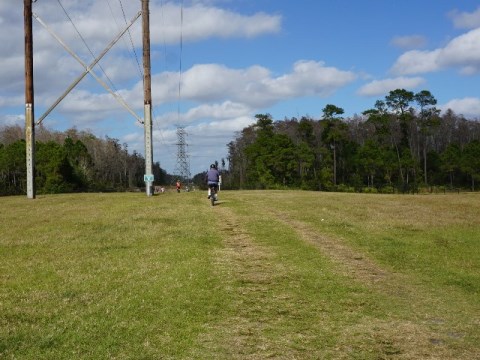
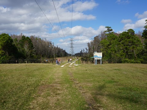
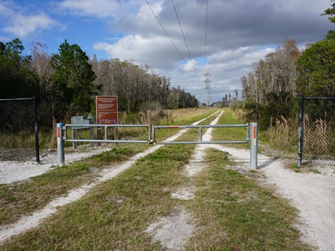
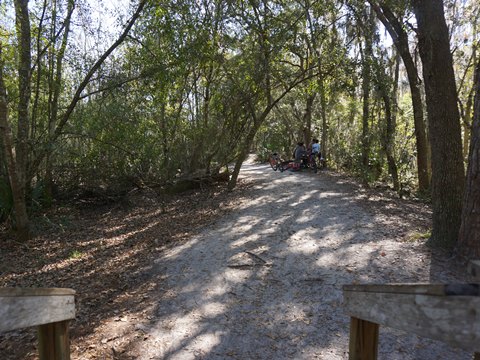
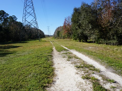
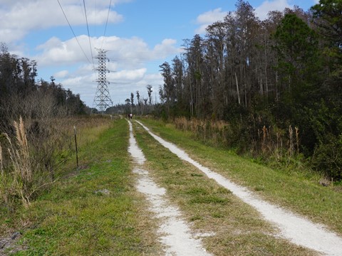
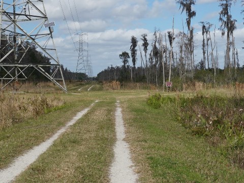
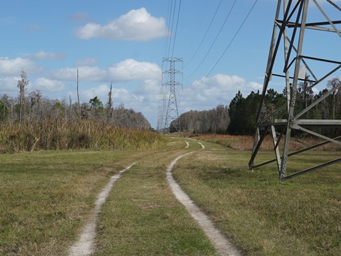
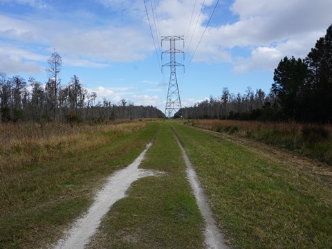
Along the Powerlines
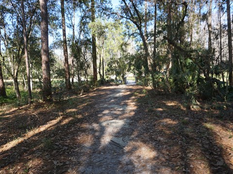
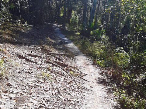
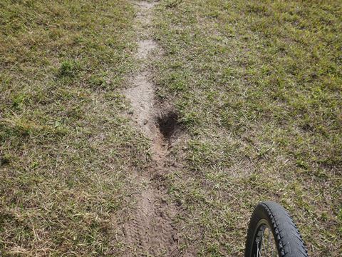
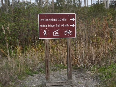
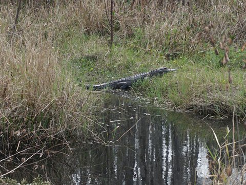
Once through the gate into the Management Area, there's an intersection in 1/10 mile. Go straight (north) along a powerline the Pine Island West Loop Trail and Marriott Trail (when open). Go right (east) along another powerline to continue to Shingle Creek and Hunters Creek Middle School Trailhead - this is the more popular route. The trail runs along a canal where we saw many birds and an alligator. Note: much of the ride here is in a deep rut, so it's wise to ride with eyes to the ground. Thus, we frequently stopped to enjoy the wildlife. In 3/10 mile, there's a turn-off (north) to the Pine Island East Loop Trail (very uneven) and picnic area. Continue straight for another 7/10 mile to Shingle Creek. There's a bridge over the creek, but this area is restricted - so go right across a boardwalk into the shade to continue to Hunters Creek Middle School.
About Shingle Creek Management Area
Named in the late 19th century after the cypress trees (used to make shingles) that lined the banks, Shingle Creek flows into Lake Tohopekaliga (Lake Toho), continues down the Kissimmee Chain of Lakes to Lake Okeechobee and then The Everglades. The Shingle Creek Management Area has been classified as a "Regional Biodiversity Hotspot" with 54 species of wildlife and 11 listed plant species. The variety of wildlife include white-tailed deer, alligators, wild turkey, and wading birds. Habitat includes hardwood and cypress swamp, pine flatwoods, oak hammocks, and wet prairies. About 60 percent of the Management Area is wetlands, making it critically important for flood control, water quality and supply, and wildlife habitat. Agriculture, logging, channelization, wastewater, housing and urbanization have impacted the area, today it's being managed to restore and maintain the land to its natural state.
More Information and Resources
Nearby Biking:
Shingle
Creek Trail
Central FL Region - More
trails plus Regional Overview map
Nearby Paddling:
Related Resources:
South FL Water Management District - Shingle Creek Management Area
Find Trails by FL Region or Listed A - Z

100FloridaTrails.com... 100+ Florida Multi-use Bike Trails, Best for Safe, Fun Recreation and Fitness
Other Websites:
BikeOrlando.net
PaddleFlorida.net
BikeTripper.net
Copyright © 100FloridaTrails.com. All Rights Reserved.