100 Florida Trails®
Top FL Multi-use Bike Trails
Map Links & Photos Galore
Coast-to-Coast Updates
You are here >
Home >
FL Eco-biking >
Dixie Mainline Trail
Latest update: December 2020
Dixie Mainline Trail...
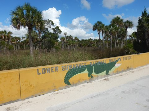
In the Lower Suwanee National Wildlife Refuge (NWR)
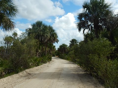
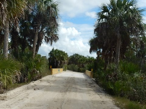
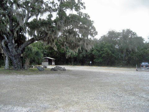
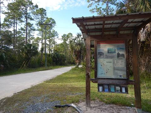
Dixie Mainline Trail runs about 9 miles in Florida's Big Bend area, near the coastline between Horseshoe Beach and Suwannee. Not exactly a bike trail, but a bike route on an old light logging railbed - open to cars, bikes, and pedestrians, with some Refuge hiking trails leading from the roadway. Auto traffic is light with slow speed limits, so suitable for biking if you want to view mostly natural, untouched habitat up close. Pick up an interpretative guide at the kiosks at the entrances (or download below). (Map link and photos below.)
Location: Dixie County (Suwannee)
End Points: Horseshoe Beach (SE 357 Hwy) to Suwannee
(SE 349 Hwy)
Mileage: 9 miles
Surface: Limestone
Nearby points of interest: Suwannee River, Horseshoe Beach,
Shired Island
Support and Advocacy:
Friends
of the Lower Suwannee and Cedar Keys National Wildlife Refuges
Page Summary:
- Eco-biking on Dixie Mainline Trail
- Dixie Mainline - North Section
- Shired Island - Dixie Mainline - South Section
- Salt Creek - More Information and Resources
Eco-biking on Dixie Mainline Trail... Comments and Photos
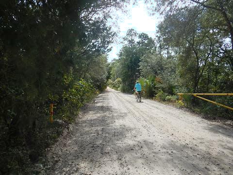
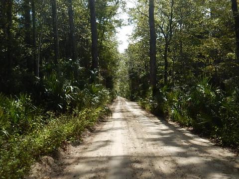
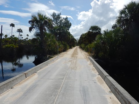
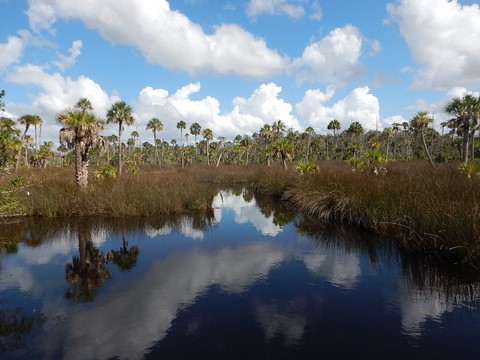
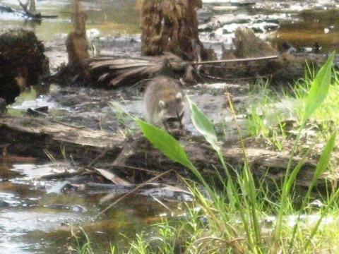
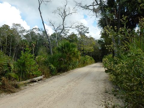
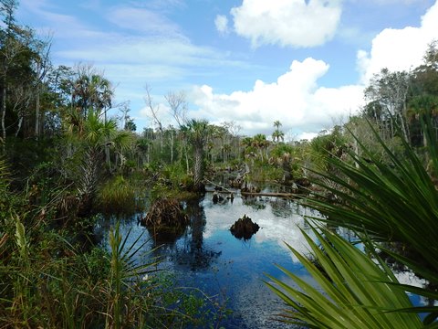
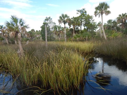
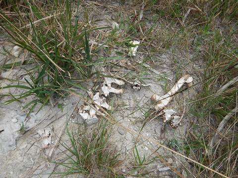
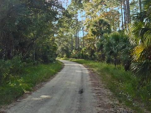
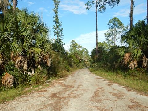
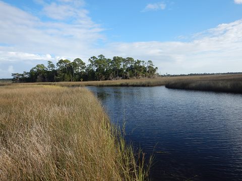
The limestone roadway is rideable if a bit rough with rocks and pebbles and a few potholes. It can be flooded and impassable on occasion. Speed limit is 15 mph, many roll slower. Some of the best views are from the bridges over the tidal creeks - cypress swamps, pine forest, hardwood hammock, marsh islands and tidal creeks. The diverse habitat includes a variety of plants and wildlife - alligators, turtles, herons, egrets, ibis, owls, and small mammals. October- November is hunting season, check hours (usually over in the afternoon). We don't recommend the summer due to insects and voracious flies.
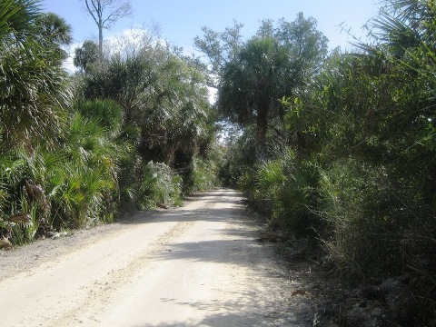
Here we visit Dixie Mainline Trail from North to South
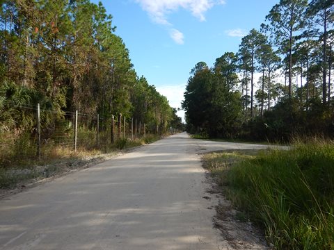
Dixie Mainline - North Section
Dixie Mainline from SE 357 Hwy to Sanders Creek
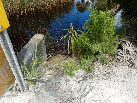
At Shired Creek Bridge and Johnson Creek Bridge, it's possible to hand launch a kayak or canoe along the side of the road - but it's not a smooth or easy launch on the rocky embankments.
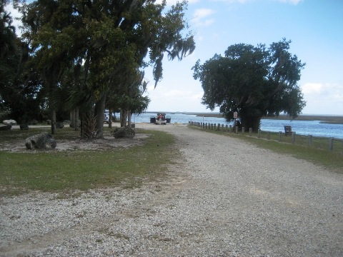
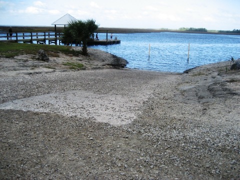
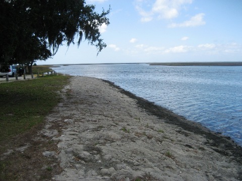
Shired Island
One of many campsites for kayakers along the Big Bend Saltwater Paddling Trail, Shired Island is a nearby point of interest, with facilities. From the intersection of Dixie Mainline, north entrance, take CR 357 southwest about 3.5 miles towards the Gulf of Mexico (a picturesque drive itself). The road ends on Shired Island, which offers camping, boat launch, small fishing pier, short hiking trail, and the only restroom for miles.
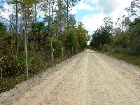
- South Section
Sanders Creek to SE 349 Hwy
Near the southern end of the Mainline, a high fence runs along the road with "no trespassing" signs, not sure of the owner but clearly not welcoming!
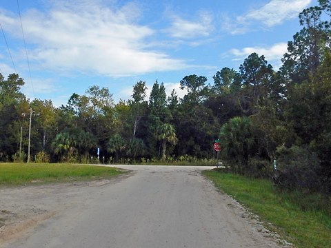
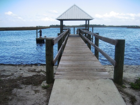
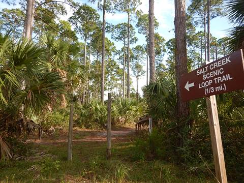
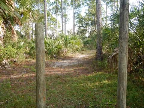
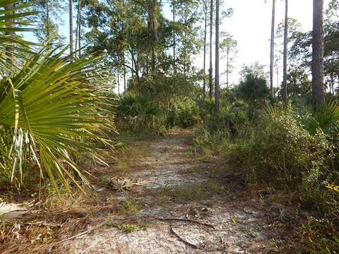
Salt Creek
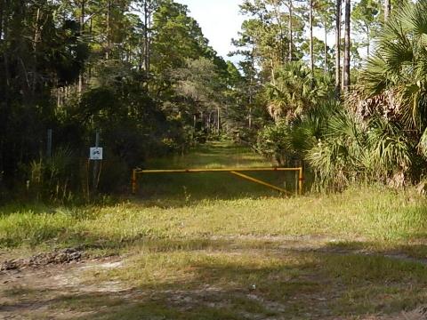
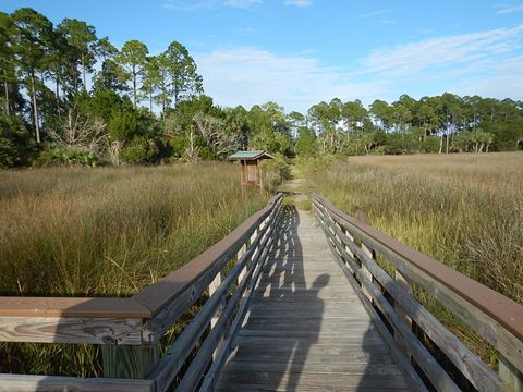
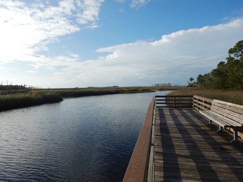
The road branching off to Salt Creek is near the southern end of the Dixie Mainline. Mostly hard packed with some sandy spots. At the end of the road, about 1.25 mile, is parking, a 1/3 mile nature trail, and an observation deck/fishing pier (go past the yellow gate).
More Information and Resources
Nearby Biking:
Lower Suwannee NWR (Overview)
Biking at Cedar Key
Nature Coast State
Trail
North FL Region - More
trails plus Regional Overview map
Nearby Paddling:
Big Bend Saltwater Paddling Trail
Related Resources:
Friends of the Lower Suwannee &
Cedar Keys National Wildlife Refuges - Dixie Mainline Trail Guide
- Download the brochure
Find Trails by FL Region or Listed A - Z

100FloridaTrails.com... 100+ Florida Multi-use Bike Trails, Best for Safe, Fun Recreation and Fitness
Other Websites:
BikeOrlando.net
PaddleFlorida.net
BikeTripper.net
Copyright © 100FloridaTrails.com. All Rights Reserved.