100 Florida Trails®
Top FL Multi-use Bike Trails
Map Links & Photos Galore
Coast-to-Coast Updates
You are here >
Home >
FL Eco-biking >
Lake Apopka Loop Trail
Latest update: February 2026
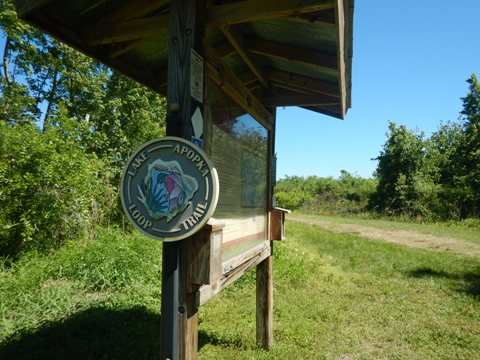
Lake Apopka Loop Trail... Florida
Popular Eco-biking Trail with Water Views and Wildlife
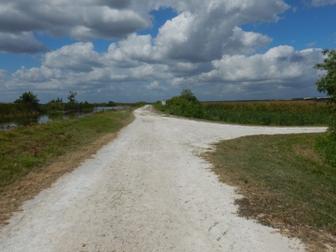
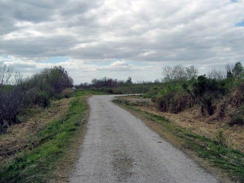
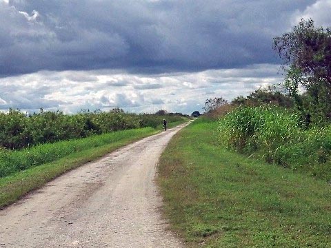
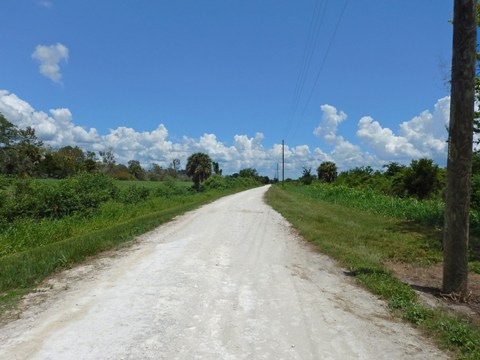
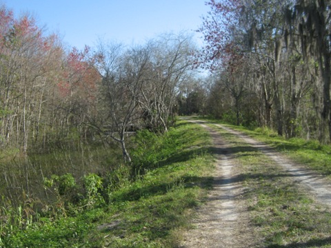
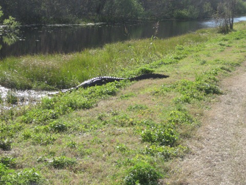
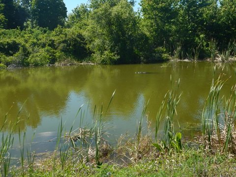
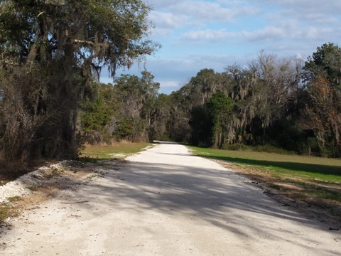
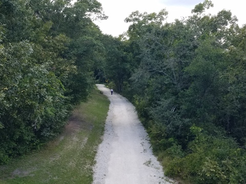
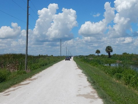
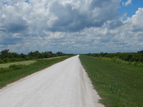
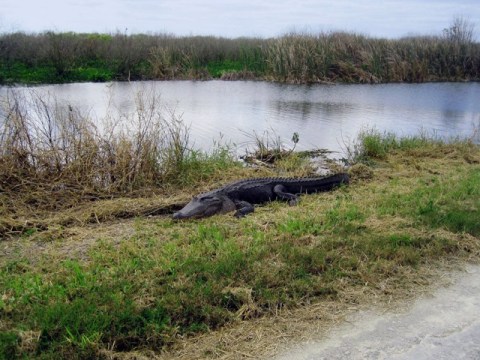
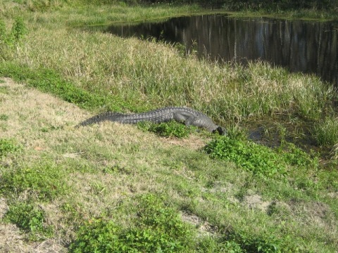
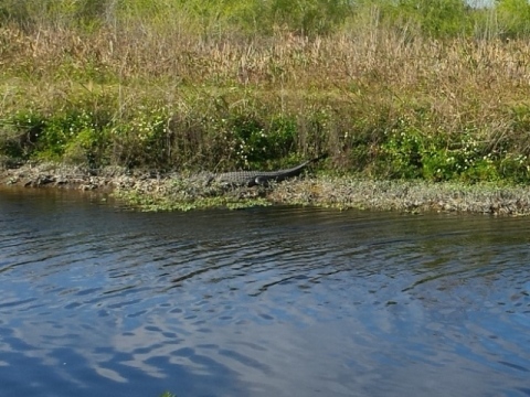
The Lake Apopka Loop Trail ("LA Loop") runs along the Lake Apopka North Shore in Orange and Lake Counties (northwest of Orlando). The area lies on former farmland now under restoration, with the trail running on old farm roads and levees. Popular with bikers and hikers, equestrians are allowed in some sections. With little to no shade, this is best as a cool weather ride. Bring water, sunscreen, and insect repellent. The trail is paved for a half mile from the Magnolia Park Trailhead, but the rest is mostly hard-packed limestone and gravel, with some sandy spots and potholes - while it can be rough it is rideable - bikes with fat tires and shocks or mountain bikes are recommended. (Hint: we found that riding at the edge of the roadway was smoother.) The area is known for its birds and wildlife, with more alligators - mostly very large! - than you can count. No entry fee. (Map link and photos below.)
- The trail now connects to the West Orange Trail and South Lake Trail, as part of the Apopka Lake Trail Loop circling Lake Apopka.
- Note: portions of the Lake Apopka Loop Trail may be closed at times. Before visiting, check for status.
Mileage: 17.2 miles (more available on loops
and spurs)
Surface: Hard-packed limestone. gravel and
grass; paved 1/2 mile
only, at Magnolia Park
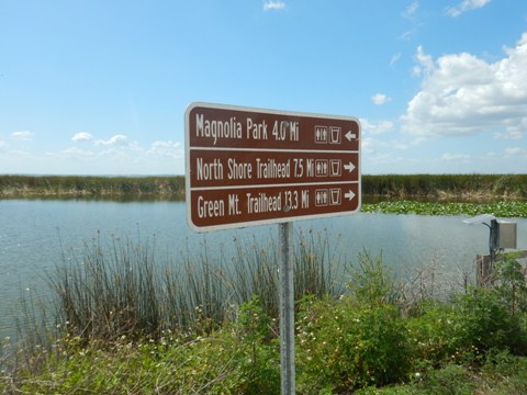
Trailheads: Magnolia Park (2929 S. Binion Road, Apopka), North Shore Trailhead
(24600 CR 448A, Mt. Dora), Clay Island Trailhead (22526 Carolyn Lane, Astatula),
Green Mountain Scenic Overlook (20700 County Road 455, Montverde). (See map)
Bike Shops/Rentals:
Spin City Cycles (Apopka)
Support and Advocacy:
Page Summary:
- Eco-biking on the Lake Apopka Loop Trail
- Magnolia Park Trailhead to Historic Pump House
- Historic Pump House to North Shore Trailhead
- McDonald Canal Boat Ramp - North Shore Trailhead to Clay Island Trailhead
- Clay Island Loop - Clay Island to Green Mountain Scenic Outlook
- Wildlife Drive
- Wildlife
- Lake Apopka Restoration
- More Information and Resources
Eco-biking on the Lake Apopka Loop Trail... Comments and Photos
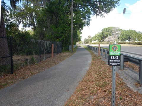
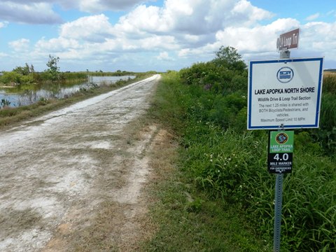
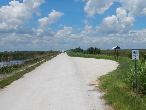
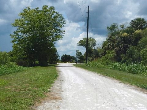
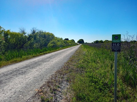
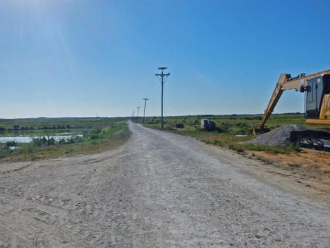
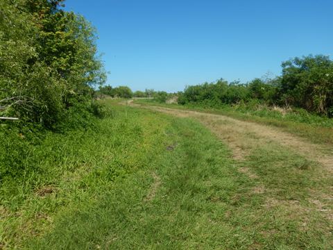
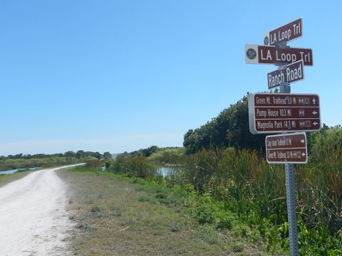
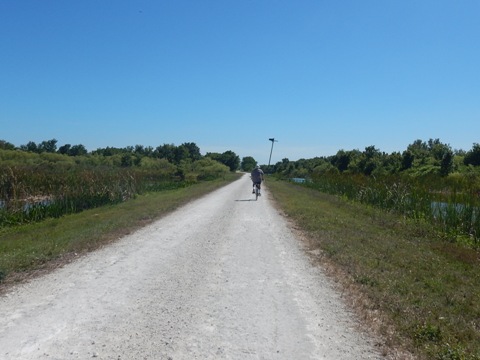
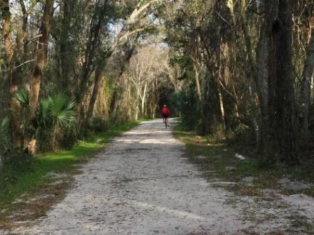
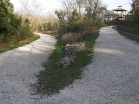
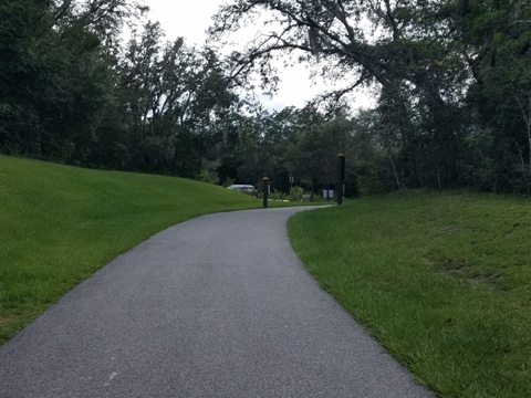
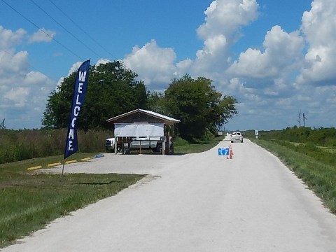
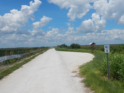
The LA Loop has four trailheads, linking to the Hancock Rd. Trail (to South Lake Trail) to the west, and to the Lake Apopka Connector Trail (to West Orange Trail) on the east. The marked trail is 17.2 miles, but mileage can be increased and some smaller loops created on connecting roads and levees. Directional signs point the way, and mile markers with emergency information are posted every half mile. The Lake Apopka North Shore guide map available at trailheads and kiosks along the trail is extremely helpful in choosing your route. With restoration work ongoing, you may occasionally encounter construction equipment or trucks driven by district personnel. The only facilities are restrooms at Magnolia Park, the North Shore Trailhead (at the adjoining McDonald Canal Boat Ramp), and Green Mountain Scenic Overlook trailhead; port-a-potties are located at the Pump House and along Wildlife Drive. Watch the weather, there is little shelter and long distances between points.
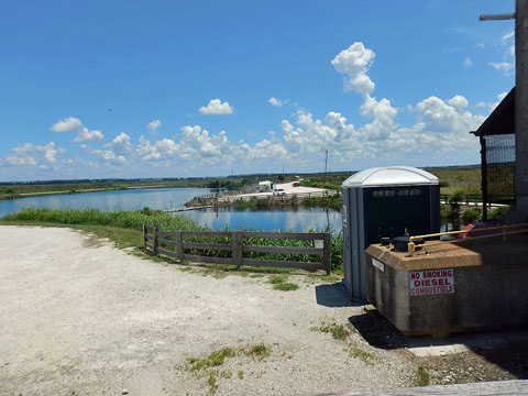
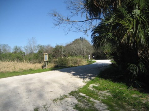
Magnolia Park Trailhead to Historic Pump House (4 miles)
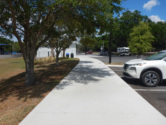
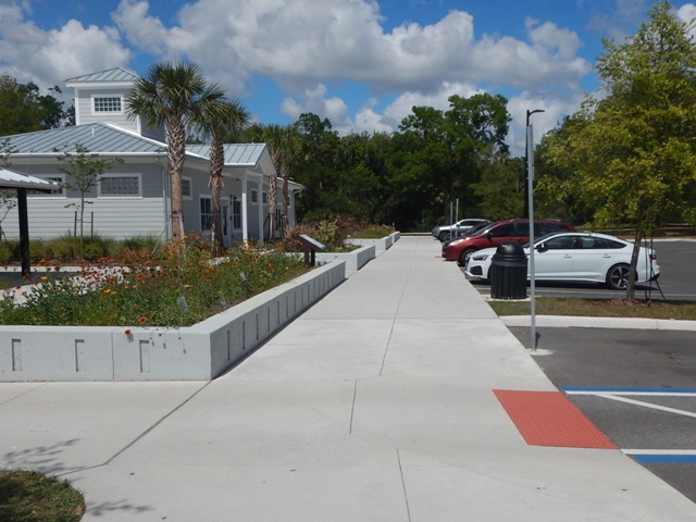
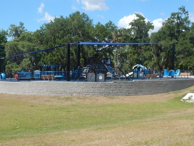
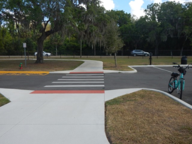
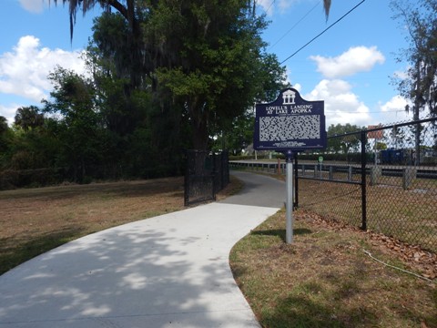
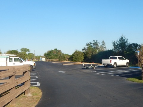
Magnolia Park
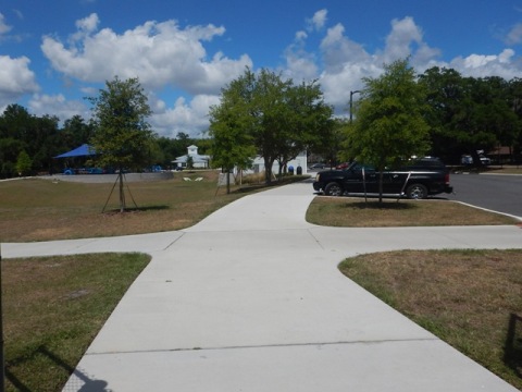
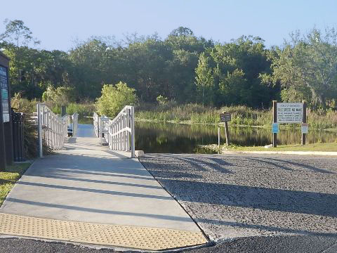
Magnolia Park spans both sides of Binion Road. Lake Apopka Loop Trail access is on the west (lake) side with parking, restrooms, water, picnicking, playground, and boat ramp; on the east side are camping and picnicking. The Eco Education Center on site has educational displays and exhibits and offers programs on Florida plants, wildlife and conservation. Trails run around the park, connecting to facilities. The Lake Apopka Connector Trail here links to the West Orange Trail, completing the loop around Lake Apopka.
History: This is the site of Lovell's Landing at Lake Apopka. Established in 1872, it served as a hub for freight service to the surrounding area. Waterway delivery declined as more transportation options became available, roads and a park were built here in the 1920's.
West Side
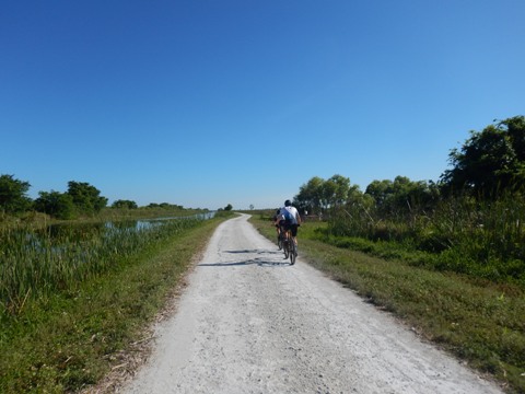
Magnolia Park to Pump House
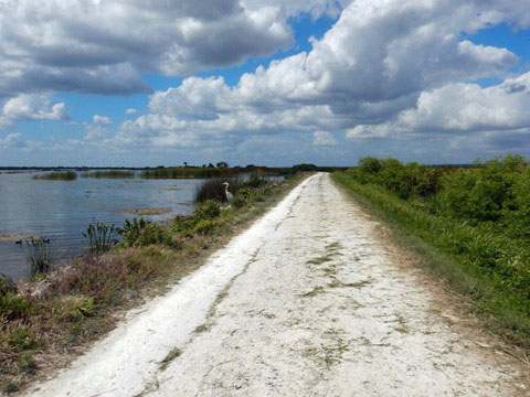
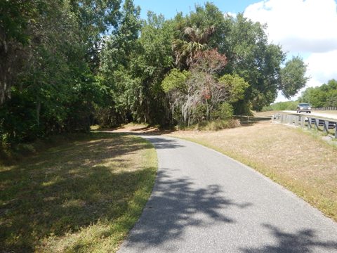
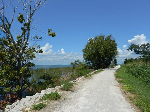
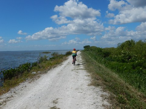
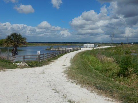
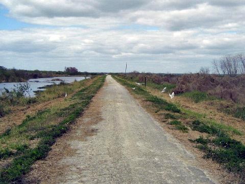
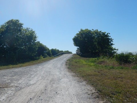
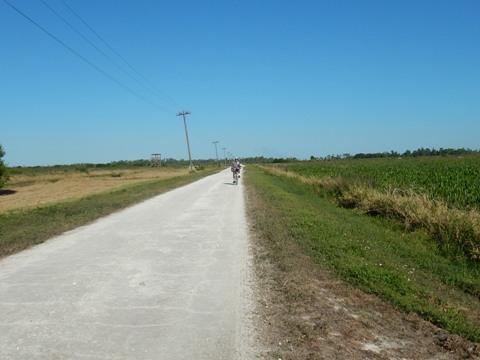
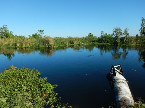
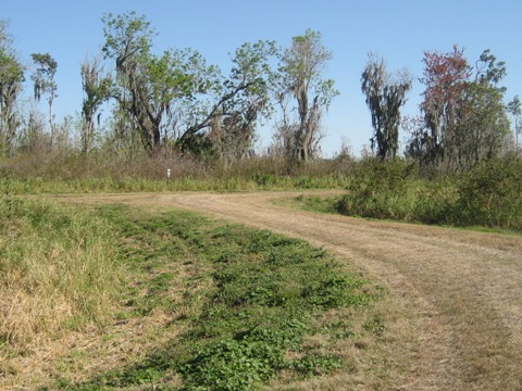
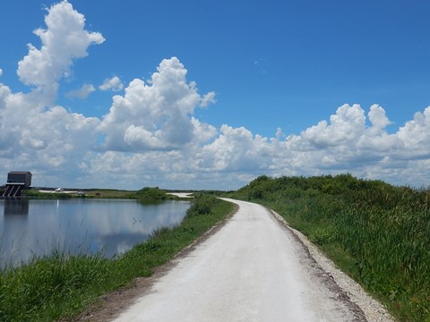
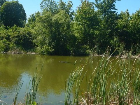
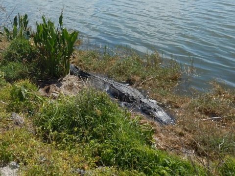
Leaving Magnolia Park, the first half mile of trail along Binion Rd. is paved, after that is an old limestone road (once used for farming) that can be bumpy. This is the most scenic section, running lakeside with views of the lake and lots of birds and alligators.

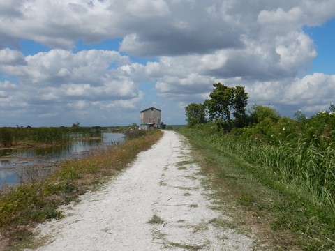
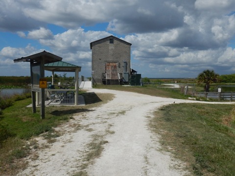
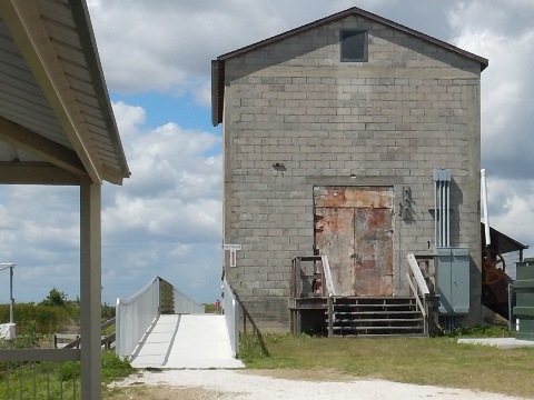
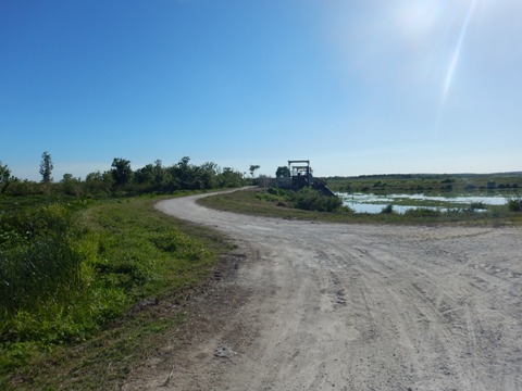
Historic Pump House Trailhead
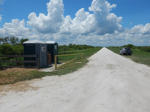
At the Historic Pump House are parking and porta-pottie. (Note: By car, this is only reachable on Friday-Sunday when Wildlife Drive is open.)
History: The pump house was once used to drain the land to create more farmland.

Historic Pump House to North Shore Trailhead (7.5 miles)
Pump House to Canal Road
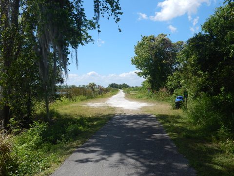
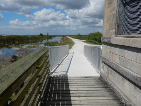
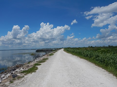
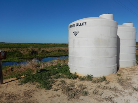
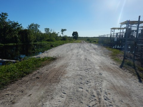
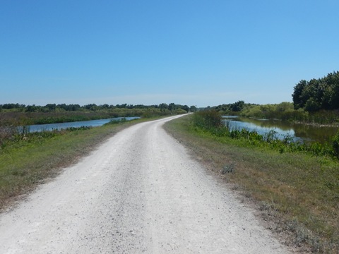
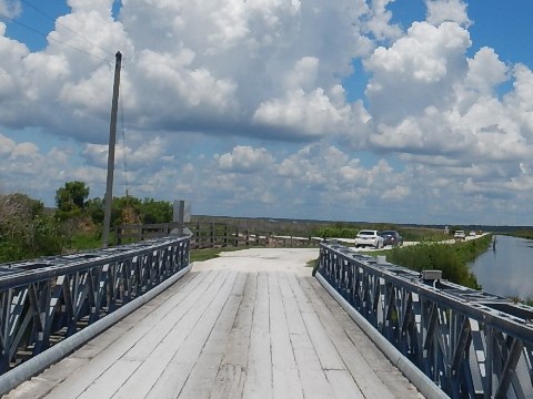
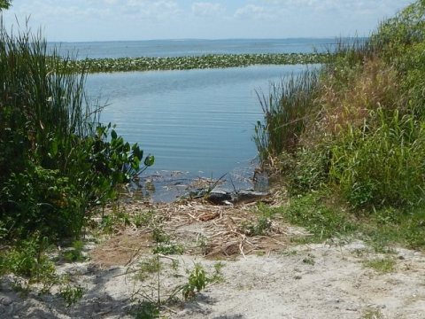
West of the pump house, you have another few miles of enjoyable lake views, before you enter the filtering area with shallow ponds and bulrushes. The first 1.25 miles are shared with cars along the Lake Spur of Wildlife Drive (Friday, Saturday, Sunday). Then the trail diverges from the roadway and continues lakeside. A canal runs to the lake, and at Canal Road the trail makes a short detour to a bridge crossing it.
Canal Road to North Shore Trailhead
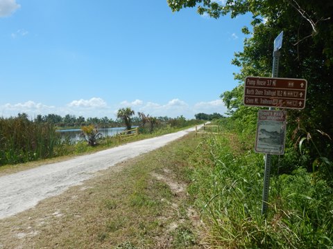
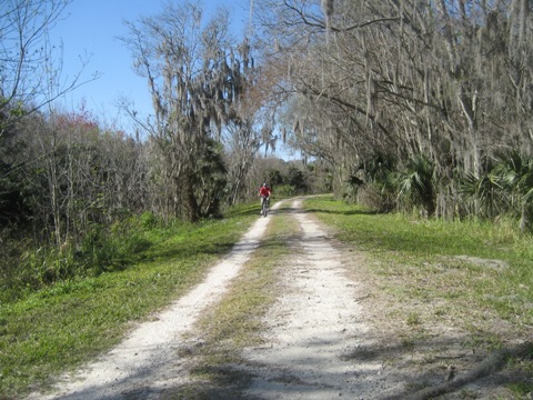
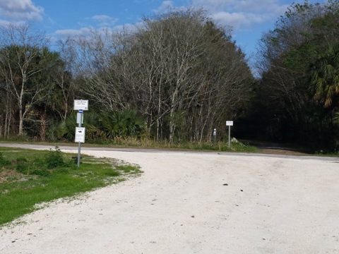
From here on, the nature of the ride changes as your field of view is more obstructed. Turning away from the lake (about 4 miles), the trail continues into Lake County. At Marsh Rabbit Road (Duda Kiosk), turn left to continue on the loop, or go straight on a spur one mile to the North Shore Trailhead.
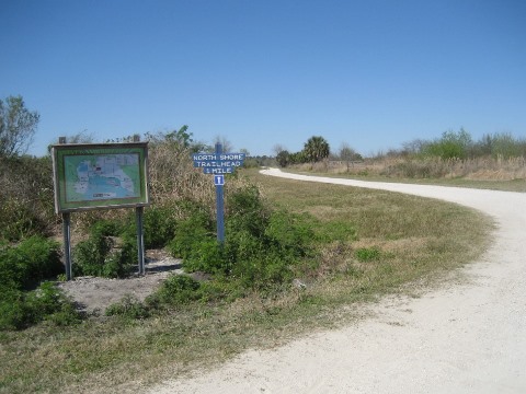
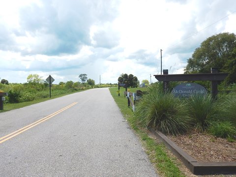
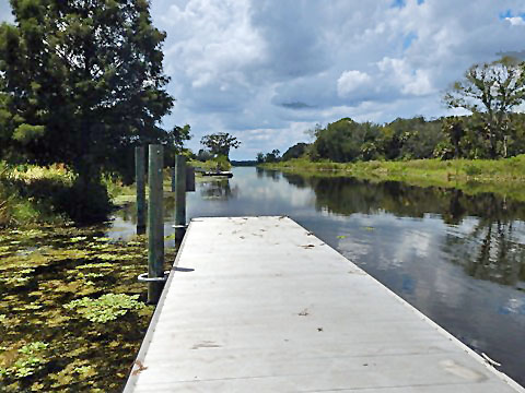
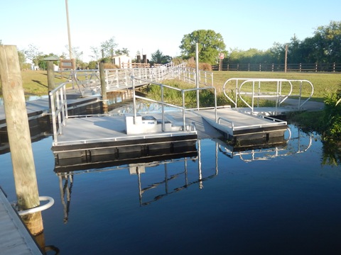
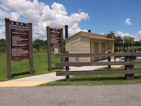
North Shore Trailhead / McDonald Canal Boat Ramp
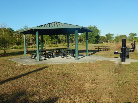
North Shore Trailhead has parking. Other facilities are available at the adjoining McDonald Canal Boat Ramp, with parking, restrooms, water station, picnic, and boat ramp.

North Shore Trailhead to Clay Island Trailhead (5 miles)
North Shore Trailhead to Apopka-Beauclaire Canal
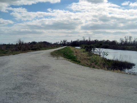
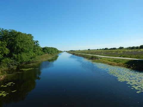
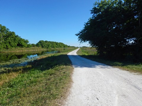
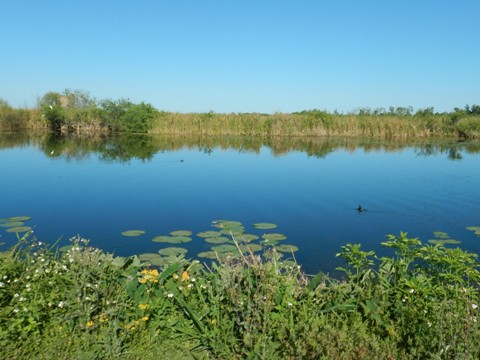
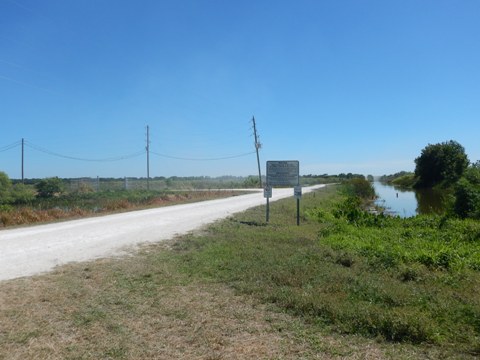
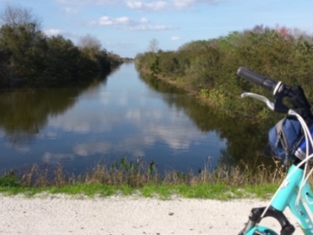
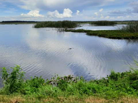
From the North Shore Trailhead backtrack to the Duda Kiosk at Marsh Rabbit Road and turn west through marsh, about 3/4 mile to the Apopka-Beauclair Canal. Cross the bridge (up one of the few "hills" on this trail) and enjoy the view, then continue south on the west side of the canal. We found this a scenic section with a lot of wildlife, with a couple sandy spots. At the end of the canal, go west to continue on the LA Loop.
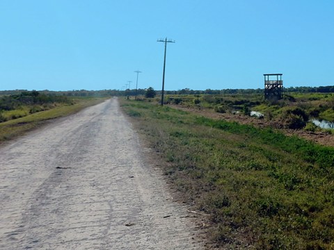
Apopka-Beauclaire Canal to Clay Island Trailhead
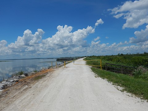
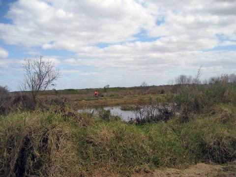
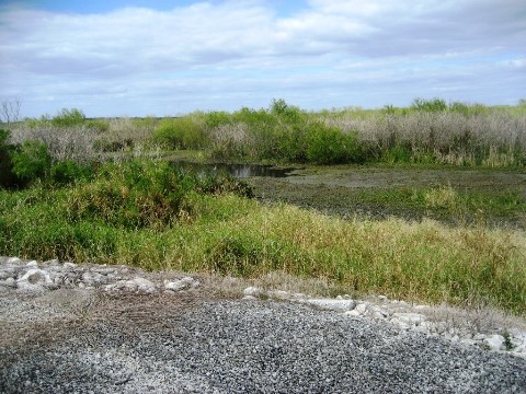
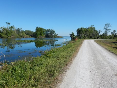
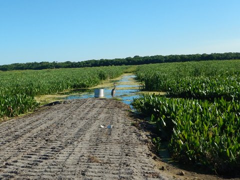
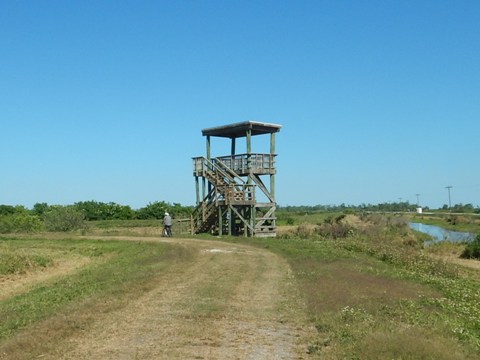
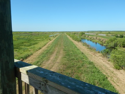
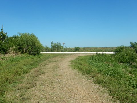
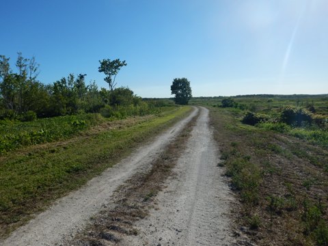
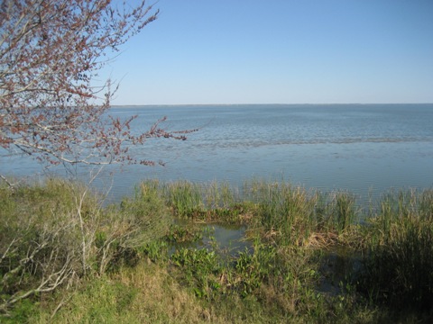
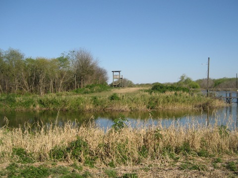
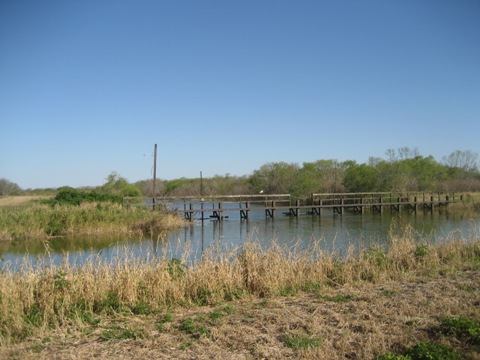
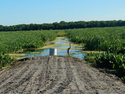
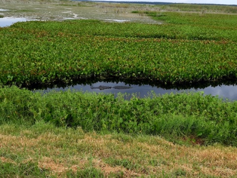
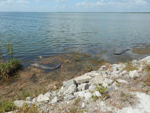
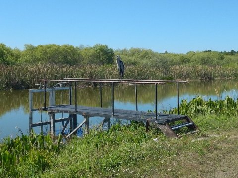
A road branches to the south, past three pumps - this is part of the Clay Island Loop "white blaze" trail, we report more on this below. Continuing straight, the LA Loop runs about 1.5 miles to Ranch Road and the Clay Island Trailhead. This section runs through the Marsh Flow-Way, a constructed wetland system designed to filter lake water. The ditch crossings were popular with wildlife - there were birds or gators at almost every one. About half way (mile 13.5), an observation tower on the right gives views of the system - the white blaze trail continues to the north from the tower.
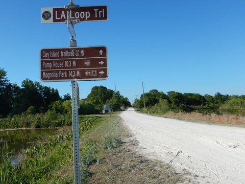
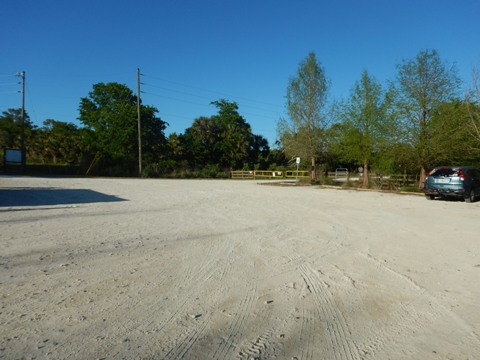
Clay Island Trailhead
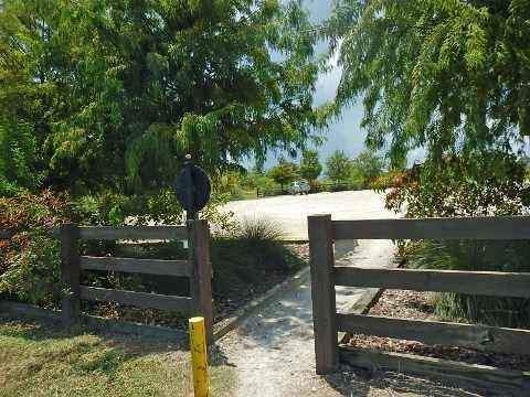
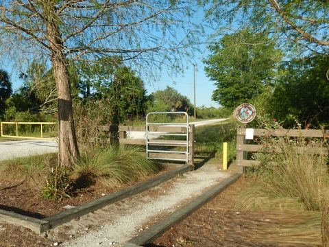
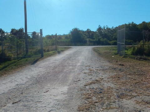
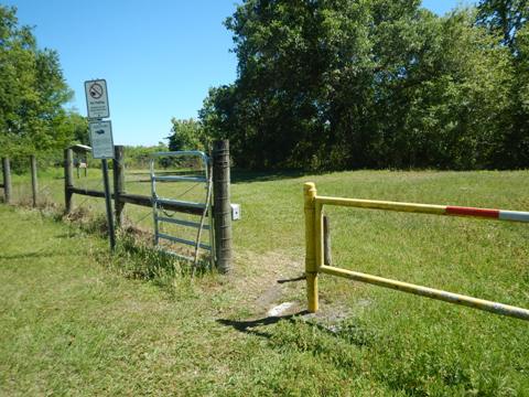
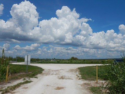
Clay Island Trailhead is reached via a grassy path off Ranch Road, about 500 feet. This can get overgrown and pushing your bike through easier. A kiosk provides information, pass through the gate to the trailhead with parking only. This is also popular with equestrians.
Clay Island Loop - White Blaze (6 - 7.2 miles)
The Clay Island Loop, or white blaze trail - used by cyclists, hikers and equestrians - has two loops, 6 miles to the south of Clay Island Trailhead and 1.2 miles to the north. Note: The northern loop is more grassy, popular with equestrians.
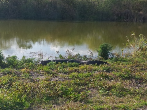
We visited the longer south loop, starting from Clay Island Trailhead and heading east on LA Loop to the juncture with the Apopka-Beauclaire Canal - turn south at the pump station. The grass and gravel trail starts past the pumps. This follows the lake shore with two more observation towers. There are grassy areas, but we were able to push through on fat-wheel bikes. Some shady sections, many alligators and birds. The trail then re-joins the LA Loop at the turn-off to Green Mountain Trailhead - continue straight onto Ranch Road, back to the Clay Island Trailhead.
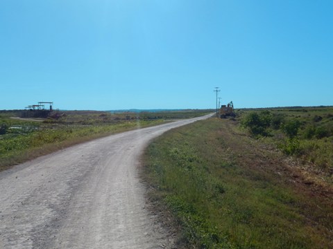
Clay Island Trailhead to Green Mountain Scenic Outlook (3 miles)
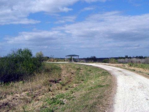
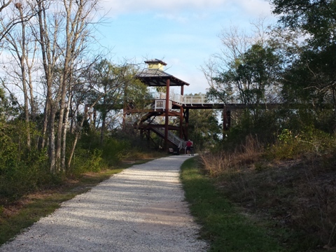
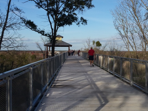
From the Clay Island Trailhead, go south on Ranch Road. The first mile follows a canal with many alligators, then the LA Loop turns right and crosses the canal - go straight to the Green Mountain Scenic Overlook, or left onto the Clay Island Loop white blaze trail (above). Much of the roadway is wide and hard packed. After crossing the canal there are some pleasant shaded sections and a slight grade begins. A loose gravel path - including "S" curves! (we walked it) - leads up to Observation Tower.
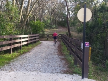
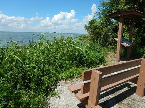
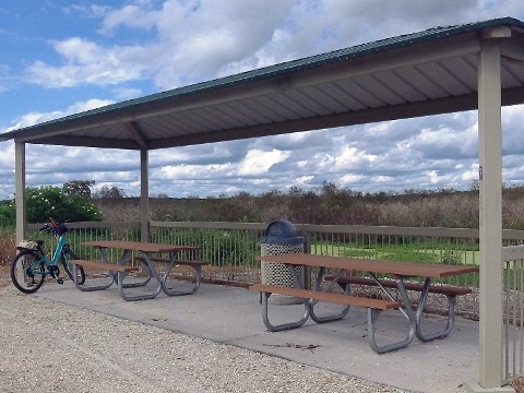
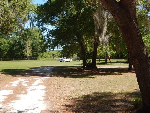
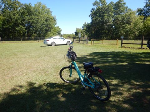
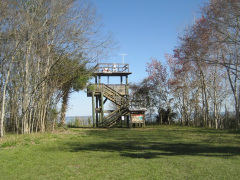
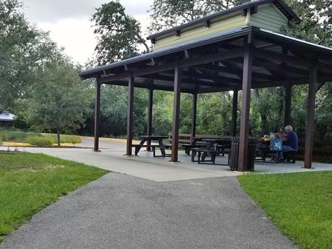
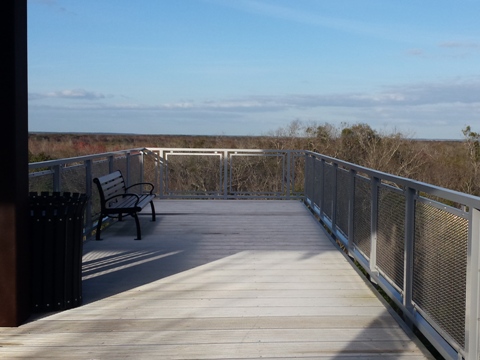
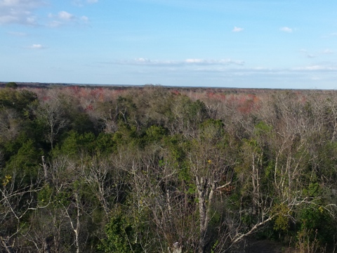
Green Mountain Scenic Overlook and Trailhead
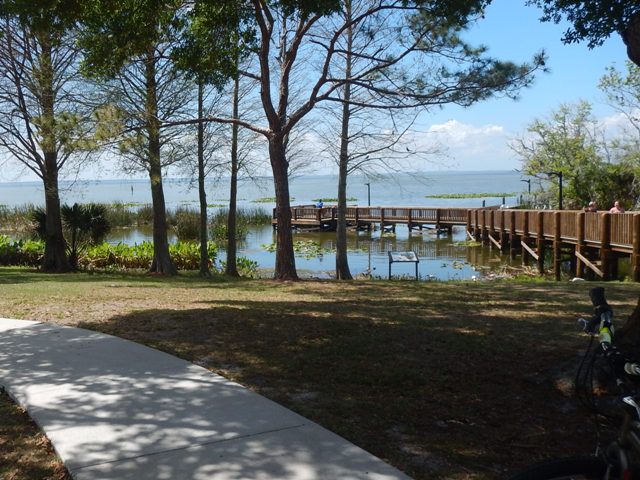
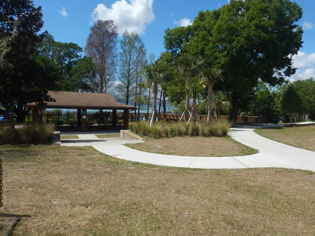
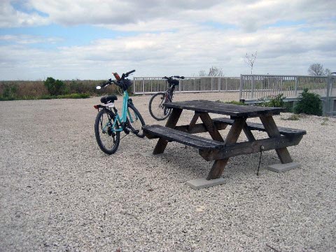
At the tower, you have the option to climb up the stairs to the tower or continue on the gravel path to the Green Mountain Trailhead, where the path is paved. The trailhead has parking, restrooms, drinking fountain, bicycle pump, bike racks, benches, pavilion, and educational displays. A 130-foot elevated boardwalk leads to the Observation Tower, which provides a great view of the surrounding area. The Hancock Rd. Trail from here connects to the South Lake Trail, to complete the loop around Lake Apopka.
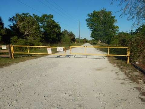
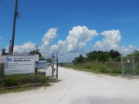
Wildlife Drive
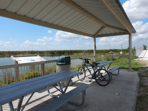
The 11-mile Wildlife Drive is open on Friday, Saturday and Sunday and on Federal holidays but closed the remainder of the week while restoration work proceeds. The entrance to the drive is at Lust Road in Apopka, and exits at Jones Avenue. This is a one-way drive, a 1.25 mile stretch (the "Lake Spur") past the Pump House Trailhead is shared with bikes. Parking and porta-potties are available at the Pump House, an informational kiosk and porta-potties are at the intersection of North Spur and West Spur (Laughlin Rd. and McDonald Canal Rd.).
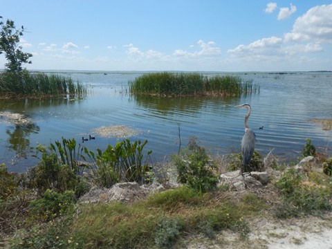
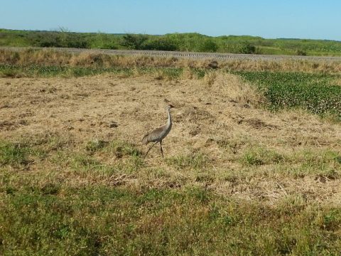
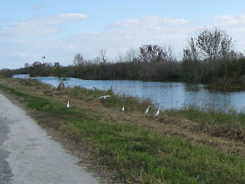
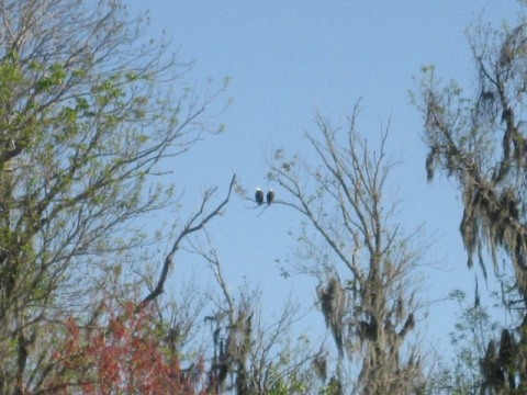
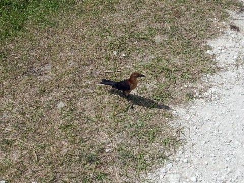
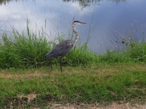
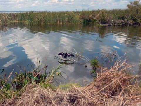
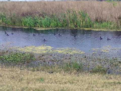
Wildlife
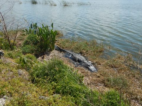
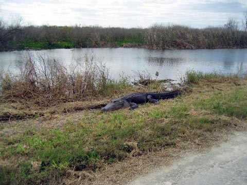
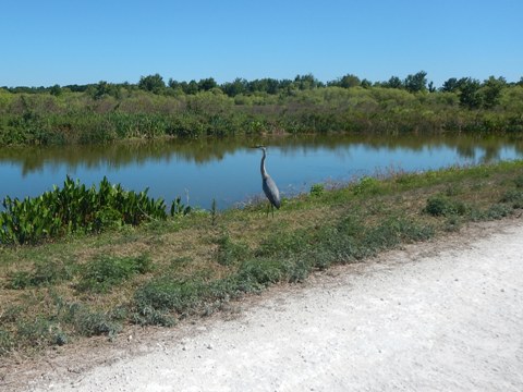
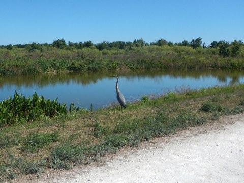
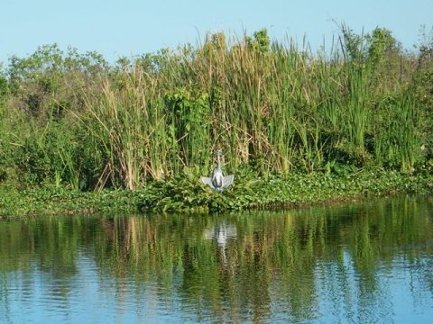
This is a must-visit for birdwatchers and nature lovers. Wildlife include alligators (again, mostly very large), snakes, turtles, bobcat, otters, raccoons and rabbits. More than 365 species of birds have been observed here. Since 1998, Lake Apopka North Shore has held the record for the highest species total for a one-day inland count (174) made at the Audubon Society's annual Christmas Bird Count, held at locations around the country each year since 1901.
Gator and heron
Lake Apopka Restoration
The fourth largest lake in Florida and headwaters of the Harris Chain of Lakes, Lake Apopka was once a fishing paradise but pollution from muck farming, citrus plants and sewage caused it to deteriorate. The former agricultural land that now comprises the Lake Apopka North Shore was acquired by the State in 1996. A project to restore the wetlands as part of the lake cleanup is ongoing, conducted by the St. Johns River Water Management District. The Lake Apopka Loop Trail was suggested by Friends of Lake Apopka as a means to bring people close to appreciate the lake and support its restoration. Covering 20,000 acres, the Lake Apopka North Shore is now a designated nature preserve.
More Information and Resources
Nearby Biking:
Lake Apopka Trail
Loop:
- West Orange Trail
- Lake Apopka Connector Trail
- South Lake Trail
- Hancock Rd.
Trail
Wekiva Trail
Wekiwa Springs State Park
(eco-biking)
Central FL Region
- More trails plus Regional Overview map
Nearby Paddling:
Related Resources:
Orange County Parks - Lake Apopka Loop Trail
St. Johns River Water Management District - Lake Apopka North Shore
St. Johns River Water Management District - Lake Apopka Wildlife Drive
Find Trails by FL Region or Listed A - Z

100FloridaTrails.com... 100+ Florida Multi-use Bike Trails, Best for Safe, Fun Recreation and Fitness
Other Websites:
BikeOrlando.net
PaddleFlorida.net
BikeTripper.net
Copyright © 100FloridaTrails.com. All Rights Reserved.