100 Florida Trails®
Top FL Multi-use Bike Trails
Map Links & Photos Galore
Coast-to-Coast Updates
You are here >
Home >
Everglades Eco-biking >
Loop Road Scenic Drive
Latest update: January 2025
Loop Road Scenic Drive... Big Cypress National Preserve
Eco-biking on a Historic Road, Loaded with Wildlife
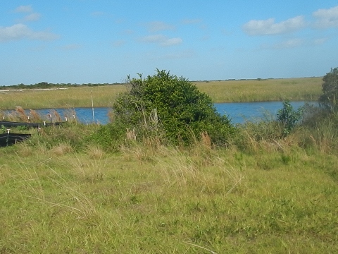
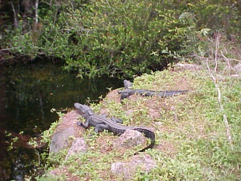
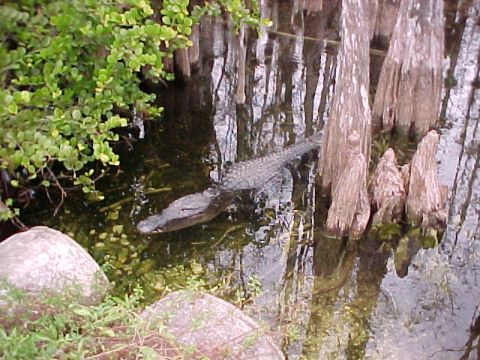
Loop Road (CR 94) is a 24-mile, two-lane road that begins just off the Tamiami Trail (US Hwy 41) about 4 miles west of the Shark Valley entrance to Everglades National Park. From here the road goes west, paralleling US 41 through the Big Cypress National Preserve, before turning to the north and rejoining US 41 at the site of the former Monroe Station, located about 4.5 miles west of the Big Cypress Oasis Visitor Center. This is a top eco-route as the scenery is unmatched! Watch for birds in the brush and perhaps otters cavorting in the ponds - and of course alligators galore! (Map link and photos below.)
Overview Map... Loop Road Scenic Drive
Location: Big Cypress National Preserve; Collier,
Monroe and Miami-Dade Counties
Mileage: 24 miles
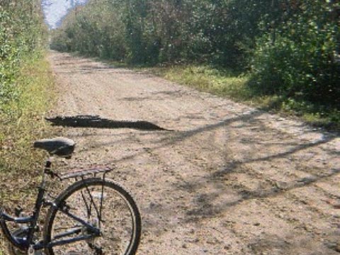
Surface: 8 miles paved; remainder dirt, gravel
Nearby Points of Interest: Clyde Butcher Big Cypress
Gallery, Miccosukee Indian Village, Ochopee Post Office
Bike Shops/Rentals: N/A
Page Summary:
- Biking at Loop Road Scenic Drive
- 40 Mile Bend to Loop Road Education Center
- Campgrounds, Pinecrest, Loop Road Education Center - Loop Road Education Center to Gator Creek Trailhead
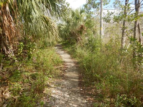
- Florida National Scenic Trail, Culverts, Sweetwater Strand - Gator Hook Trailhead to Road End
- Gator Hook Trail and Trailhead, Monroe South Off-road Vehicle Trailhead - Wildlife
- Some History
- More Information and Resources
Eco-biking at Loop Road Scenic Drive... Comments and Photos
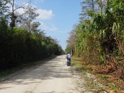
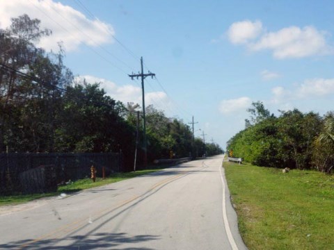
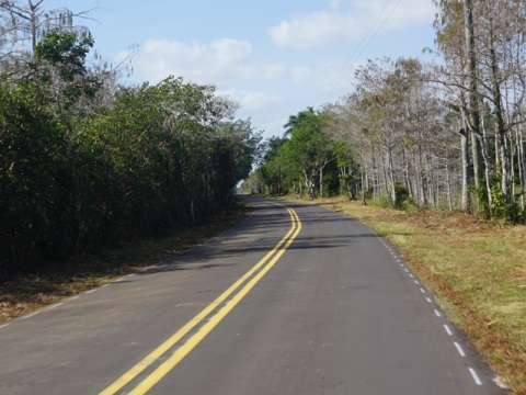
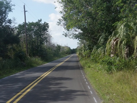
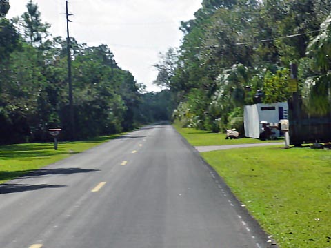
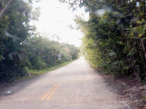
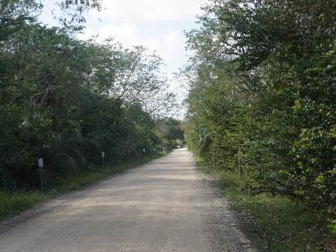
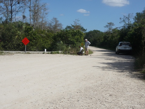
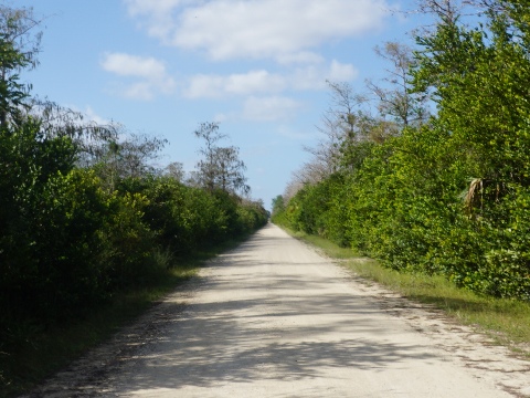
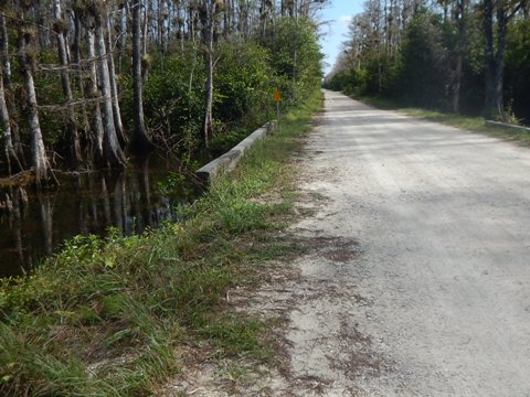
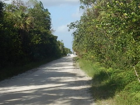
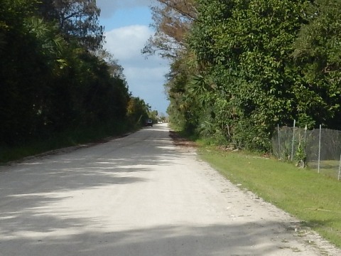
Loop Road begins and ends along US Hwy 41, there are no other access points. On the east side, Loop Road is accessed just off Hwy. 41 at a sharp bend in the highway (called 40 Mile Bend because it's 40 miles from Miami), and on the west side, at the former location of Monroe Station, for years the main service station and eatery between Miami and Naples. From the eastern end, Loop Road is paved for the first 8 miles, and for a very short distance at the western end. The remainder is unpaved and hardpack, but it can be bumpy in spots. It's a mostly an easy bike ride (fat tires recommended), but the road is shared with slow-moving motor vehicles. When conditions are dry, passing cars can kick up dust along the unpaved sections. Thus, bikers should consider riding in the direction where the wind will blow the dust away from your side of the road. Most people drive the road - generally 1.5 to 2 hours, with frequent stops at culverts to take in the views that will typically include plentiful wildlife. Often short hikes and bike rides are done from a stopping point. The road runs mostly through cypress swamp, with some Sawgrass prairie and pineland. Portions may be flooded in the summer, November to May is the best time to visit. Restrooms are available near the western end at Gator Hook Trailhead and the Monroe Station Off-road Vehicle Trailhead, otherwise no other facilities.
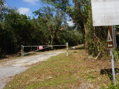
40 Mile Bend to Loop Road Education Center - 8 miles
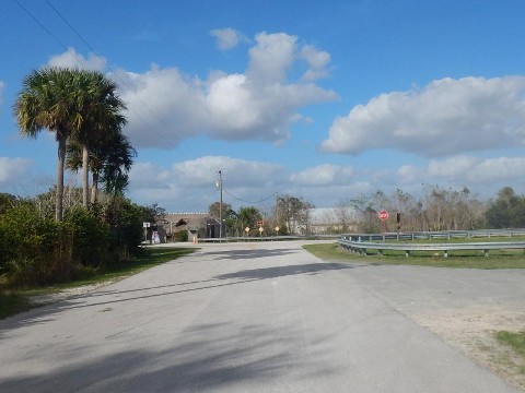
The road starts at the hunter check station just off US 41 "40 Mile Bend." The paved road passes a number of private homes of members of the Miccosukee Tribe - be respectful of their privacy. Continuing on the road as it becomes more remote are:
- Two campgrounds (Pinecrest and Mitchell's Landing).
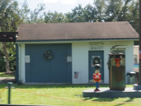
- A few homes and Pinecrest Gas Station, about 6 miles from start, remnants of the ghost town of Pinecrest. The small logging town had about 400 residents in the 1930's. By-passed by the Tamiami Trail, the town dwindled and the land was eventually acquired by the State as part of development of Big Cypress National Preserve (1974). Visitors are asked to respect the private property of those who still call Pinecrest home.
- Another homestead along the road, marked by a fence with assorted memorabilia. It's the home and studio of Lucky Cole, an Everglades photographer known for his portraits of nude women. The gates may be open on weekends, when Lucky will regale visitors with stories and serve beer and hot dogs.
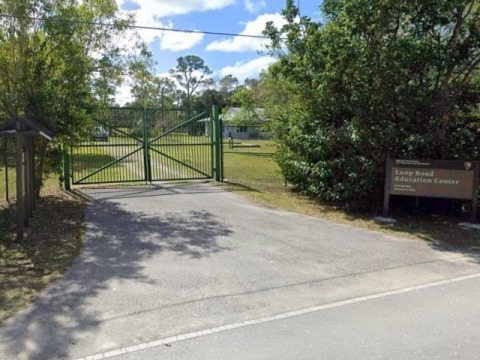
- The Loop Road Education Center, at about mile 8, offering programs to 5th and 6th graders. The paved road ends just past here.
- Tree Snail Hammock Trail is across from the Education Center. The short (0.3 mile) nature trail is named for the endangered Florida tree snail, which can be seen here.
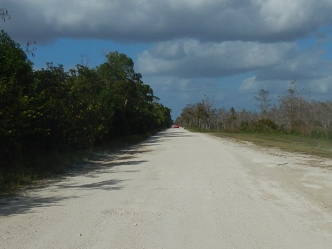
Loop Road Education Center to Gator Creek Trailhead - 14 miles
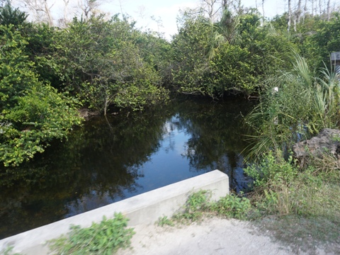
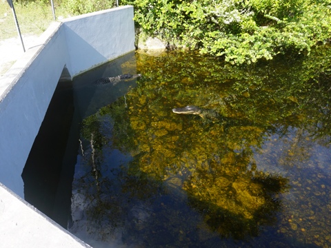
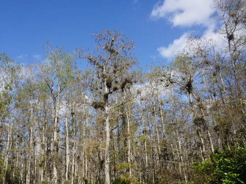
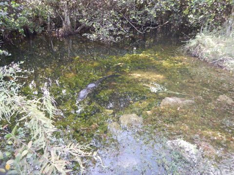
Past the Loop Road Education Center, the pavement ends and the road continues unpaved hardpack until the pavement resumes near the western end at Tamiami Trail. This is a very remote area and can flood. The best wildlife viewing is generally at the culverts going under the roadway. In this section:
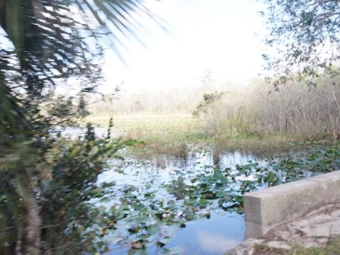
- Many culverts. They serve to allow a more natural flow of water. Culvert 30, about 0.5 mile past the Florida Trail, is deeper than others, it stays more flooded and is great for wildlife viewing.
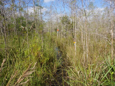
- The original start of the Florida National Scenic Trail at about mile 14. Today, the Florida National Scenic Trail officially begins at the Oasis Visitor Center along US 41. The trail between these two points is about 6.5 miles - be prepared for much wading, especially during rainy season.
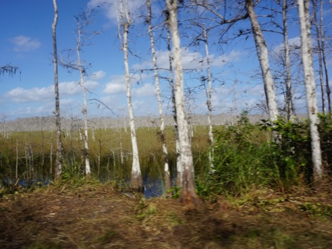
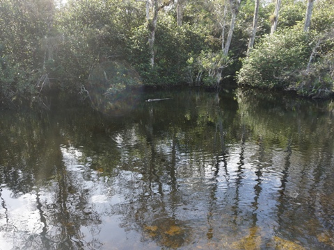
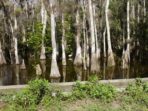
- Sweetwater Strand at about mile 19, defined by large cypress and one of the most scenic and photographed sections along Loop Road, with abundant wildlife.
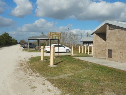
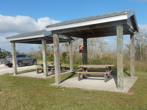
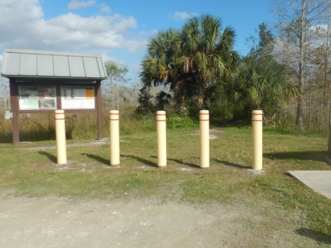
Gator Hook Trailhead to Road End - 2 miles
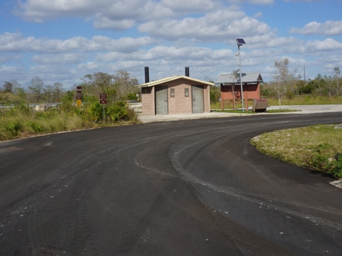
- The Gator Hook Trailhead, located about 2 miles from the Loop's western road end, has a restroom and picnic tables. Gator Hook Trail is named for Gator Hook Lodge (1958-1977), a rowdy bar and dance club located in Pinecrest which was the social center of Loop Road, frequented by locals for evening entertainment. One of the regulars was fiddler Ervin T. Rouse who wrote Orange Blossom Special, later made popular by Johnny Cash.
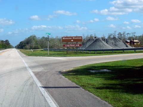
- The road exits back onto US 41, the Tamiami Trail. Here, the Monroe Station Off-road Vehicle Trailhead has parking and a restroom. An off-road vehicle course starts here. This is the site of the original Monroe Station. Dating from the 1920's, it was the largest of 6 outposts constructed along the original Tamiami Trail, offering gas, food, and boarding to motorists. It was shut down due to heavy damage from storms over the years, and the old landmark building eventually burned down in 2016.
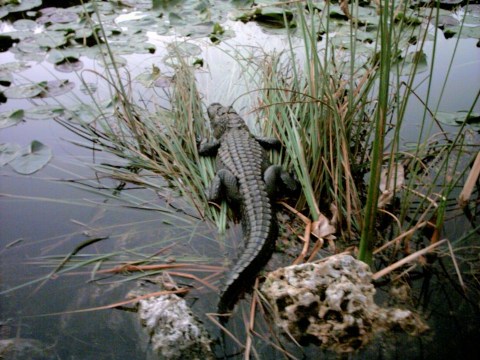
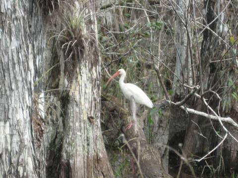
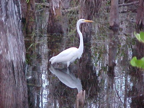
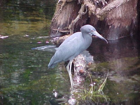
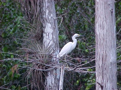
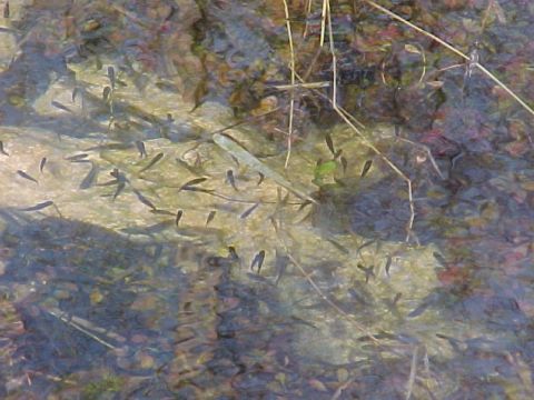
Wildlife
Wildlife along Loop Road include alligators, many assorted birds, otters, deer, bears, snakes, turtles, and occasionally a Florida panther.
Some History
Construction of Loop Road was started in 1921, envisioned as an east-west highway through the Everglades, with the town of Pinecrest as its hub. Eventually, however, the Tamiami Trail was built along a route to the north, opening in 1928. With Loop Road left behind by the new road, the developers went bankrupt and sold the property to the Federal government in 1937. See full history here .
Loop Road Trivia: Rumors have circulated that Al Capone had a hunting lodge at Pinecrest in the 1920's (some versions say it was a moonshine operation, bordello and gambling den). No actual records exist.
More Information and Resources
Nearby Biking:
Everglades Area
Eco-biking
- Inside the National Park
- Historic Roads
- Canal/Levee trails
Paved biking at Everglades
National Park
South FL Overview -
all 3 South Florida Regions, with Regional Overview map
Nearby Paddling:
Related Resources:
National Park Service-Big Cypress - Loop Road
National Park Service-Big Cypress - Loop Road Scenic Drive
National Park Service - Big Cypress National Preserve
Find Trails by FL Region or Listed A - Z

100FloridaTrails.com... 100+ Florida Multi-use Bike Trails, Best for Safe, Fun Recreation and Fitness
Other Websites:
BikeOrlando.net
PaddleFlorida.net
BikeTripper.net
Copyright © 100FloridaTrails.com. All Rights Reserved.