100 Florida Trails®
Top FL Multi-use Bike Trails
Map Links & Photos Galore
Coast-to-Coast Updates
You are here > Home >
Trails >
West Florida >
Tampa Riverwalk
Reported: May 2021
Tampa Riverwalk... Florida
Tour the Historic Tampa Waterfront by Bike... 2.6 Mile Multi-use Path
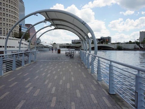
Enjoyed by locals and visitors alike for biking and walking, the Tampa Riverwalk runs 2.6 miles along the Hillsborough River from the North Blvd. Bridge (north) to Channelside Drive (south). The Riverwalk passes four riverfront parks, historical markers, museums, restaurants, a sports area, hotels, and more. Public art enhances the experience. At night, enjoy the Tampa Lights. The Riverwalk is a model for redeveloping an aging downtown waterfront by making it more bike and pedestrian friendly. (Map link and photos below.)
Location: Hillsborough County
End Points: Along the Hillsborough River, North Blvd.
Bridge to Channelside Drive
Mileage: 2.6 miles, more biking via connecting multi-use pathways
Surface: Asphalt
Trailheads/Parking:
Garages and Lots
Nearby points of interest: Florida Aquarium, Tampa
Bay History Center, Tampa Museum of Art, Glazer Children's Museum,
Straz Center for the Performing Arts, Amalie Arena, and more.
(See map)
Bike Shops / Rentals:
City Bike
Tampa (rentals,
sales, service)
Coast Bike Share (rentals)
Tampa by Bike (rentals, tours)
Support and Advocacy:
Friends of the
Riverwalk
Bike/Walk Tampa
Page Summary:
- Biking along the Tampa Riverwalk
- Riverwalk South... Hixon Riverside Park to Channelside Drive
- Riverwalk North... Hixon Waterfront Park to North Blvd. Bridge - Downtown Tampa Multi-use Connectors
- Selmon Greenway
- River Trail at University of Tampa - Protected Bike Lanes
- Cass St., E. Jackson St. - More Information and Resources
Biking Along the Tampa Riverwalk... Comments and Photos
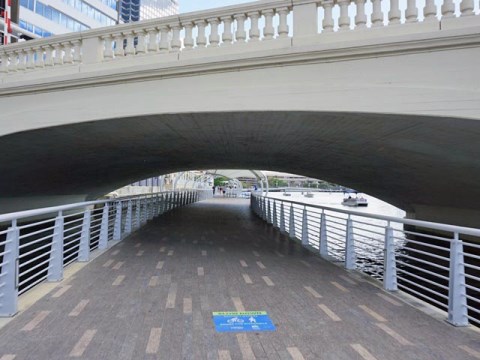
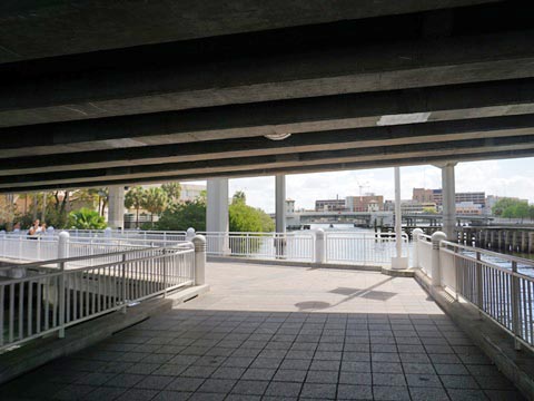
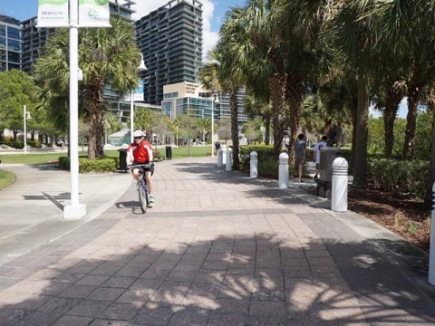
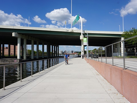
Bike rentals are available (to include water bikes). We parked at a garage near Curtis Hixon Waterfront Park (Riverwalk mid-point) and biked south to Channelside Drive, then north to the North Blvd Bridge, a casual 5.2-mile round-trip. Underpasses at major roads and bridges are a big plus. Tampa and Hillsborough County have ambitious plans for expanding their biking and greenways trails. Future extensions of the Riverwalk are planned at both the north and south ends, as well as for more protected bike lanes and multi-use connectors to other nearby bike trails. Bravo Tampa!
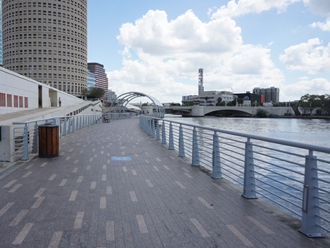
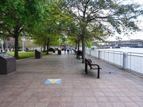
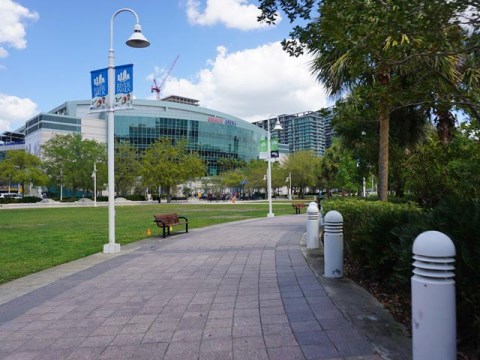
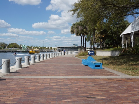
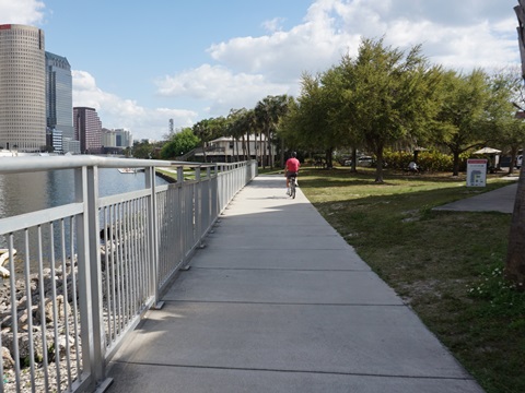
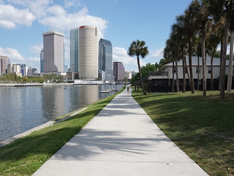
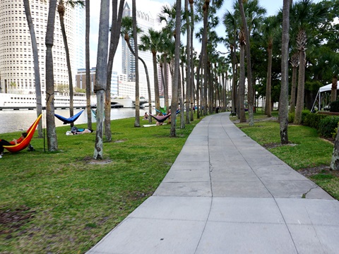
Riverwalk South... Hixon Riverside Park to Channelside Drive
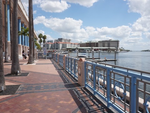
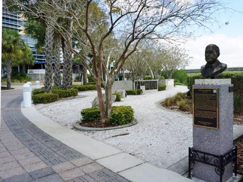
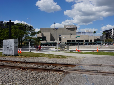
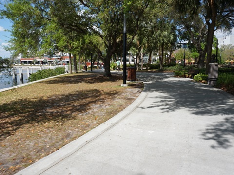
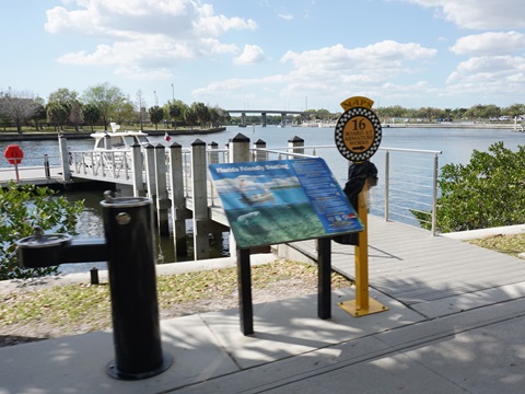
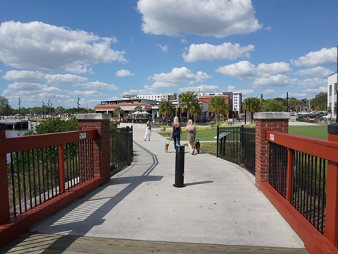
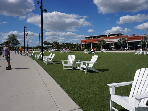
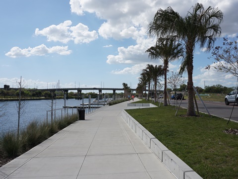
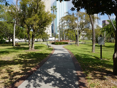
Curtis Hixon Waterfront Park (MM 1.3, midpoint of the Riverwalk) is Tampa's largest park, hosting many festivals and events. To the south is Kennedy Blvd. Plaza, 4 blocks over water with the best views and featuring signature "sail" shade structures. Continuing on the Riverwalk are several more parks, restaurants, hotels, museums and more. The Historic Monuments Trail runs along this section, a series of bronze and marble busts and monuments tell of the people and events that shaped the area's history. Past the Convention Center are marina, water taxi, water bikes and ferry. The Riverwalk then turns along Garrison Channel, connecting to Upper Tampa Bay. At the History Center is Heroes Park (MM 0.2) honoring Veterans and first responders. From the end (currently) of the Tampa Riverwalk, it's only 0.2 mile east along Channelside Drive to the Florida Aquarium, the Maritime Victory Warship and Museum, and Tampa's cruise terminals.

Located along South Section of Riverwalk:
Curtis Hixon
Waterfront Park - 8 acres
Kennedy Blvd. Plaza - 1.8 miles connecting parks
Florida Museum of
Photographic Arts
MacDill Park - 3/4 acre park
USF Park on the Riverside - Linear
park
City of
Tampa Convention Center
The
Sail Plaza and Big Ray's Fish Camp
- 360 degree waterfront restaurant
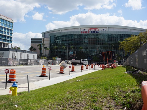
Amalie Arena
- Home of Tampa Bay Lightning (hockey)
Cotanchobee Fort Brooke Park
- 4.5 acres
Heroes Plaza - Memorial park
Tampa Bay History Center
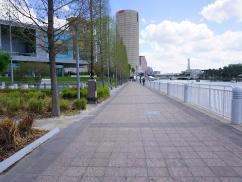
Riverwalk North... Hixon Waterfront Park to North Blvd. Bridge
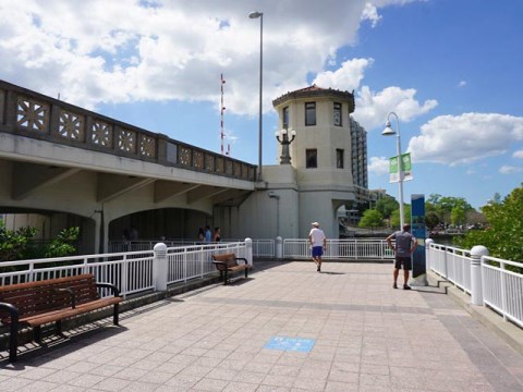
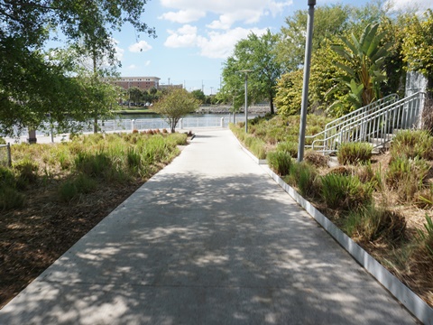
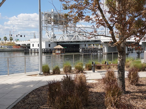
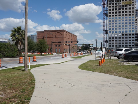
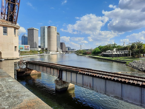
At the north end of Curtis Hixon Waterfront Park are the Tampa Museum of Art and Glazer Children's Museum. The Riverwalk detours here, go up the ramp toward the museums, and across the railroad track - to the left are the Cass Street Bridge and Old Steel Railroad Bridge leading to the University of Tampa (below). The Riverwalk then passes the Straz Center for the Performing Arts (MM 1.6), and runs under the Laurel Street Bridge (1927). Past I-275 is a pleasant section to Ulele Water Works Park (MM 2.4), named for an Indian Princess. Ulele Spring flowing into the Hillsborough River has been restored, having been shut off for almost a century. The Ulele Restaurant in the 1903 Tampa Heights Water Works building is a popular stop. Tampa Armature Works (1910) was formerly the storage and maintenance facility for Tampa Electric’s (TECO) streetcars, now redeveloped into an entertainment venue.
Located along North Section of Riverwalk:
Tampa Museum of Art
Glazer Children's Museum
Straz Performing Arts Center
Ulele Water
Works Park -
with splash pad
Tampa
Armature Works
- events venue
Downtown Tampa Multi-use Connectors
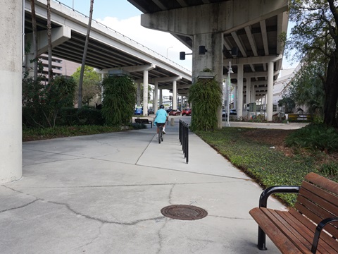
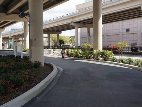
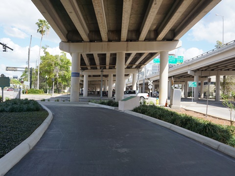
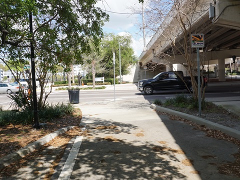
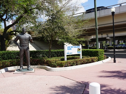
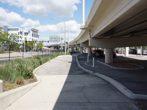
Selmon Greenway - 1.7 miles
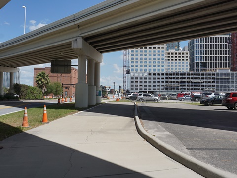
The Lee Roy Selmon Greenway takes advantage of the space under the Selmon Expressway to create an east-west crosstown multi-use path through Tampa's Channel District. Starting at the Brorein Street Underpass where it meets the Riverwalk, the 15-foot wide Greenway runs to N. 19th Street weaving back-and-forth under and along the Expressway. We proceeded to Jefferson St. and returned from this point. The biggest negative is the many road crossings - great for commuting, but not a recreational trail. Some sections were confusing and we had to retrace our steps, but new signage is being added. The path is also being enhanced with more greenery including "pocket parks," lighting, benches, bike racks, and art. An extension to Ybor City is planned.
The Greenway is named for Lee Roy Selmon, a Tampa Bay Buccaneers legend and NFL Hall-of-Famer. More about the Selmon Greenway
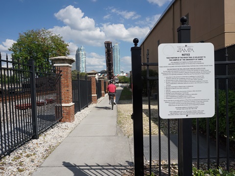
River Trail at University of Tampa
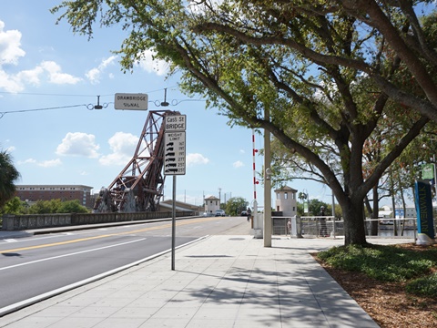
The University of Tampa is located across the river from the Riverwalk. To reach the University, best to cross on the protected bike lane over the Cass Street Bridge. The bridge is a 1926 structure, rehabilitated in 2007. The Old Steel Railroad Bridge (1915) runs parallel, the CSX line to the port is still in use but the drawbridge is left open when not in use. The whole university is bikeable; we rode the portion of the River Trail adjacent to the campus. On campus, we also visited the Henry Plant Museum and Henry Plant Park. Return via the Cass Street Bridge, or cross back to the Riverwalk at the Kennedy Avenue Bridge.
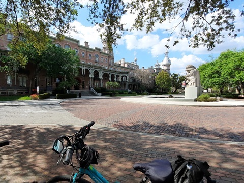
Some History: In the late 1800's, Henry B. Plant was instrumental in opening up Tampa Bay and isolated SW Florida via rail and steamship service. In 1891, his ornate Moorish- and Victorian-designed Tampa Bay Hotel and resort opened along the rail line. After the hotel closed in 1931, the City acquired the property for use by Tampa Junior College, which became the University of Tampa. The old hotel, now called Plant Hall, serves as the main administration building and houses the Henry Plant Museum. The surrounding Henry Plant Park was part of the resort, and is notable as Tampa's first park and Botanical Garden.
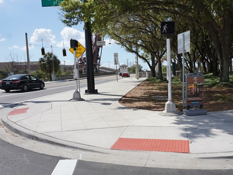
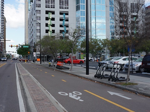
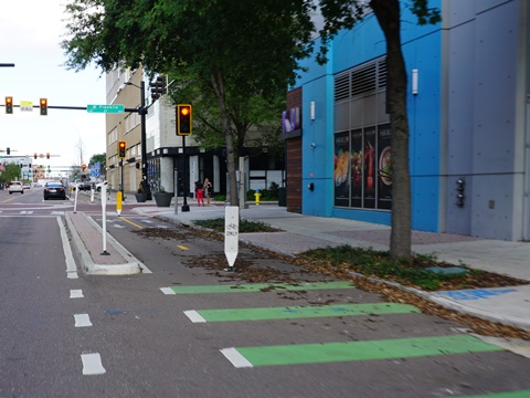
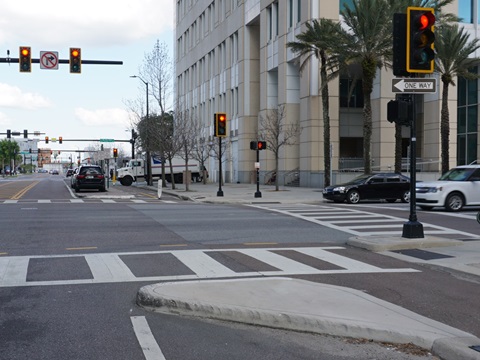
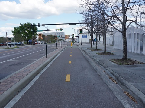
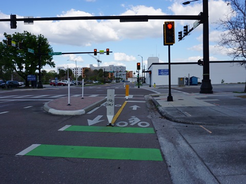
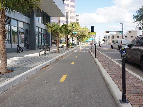
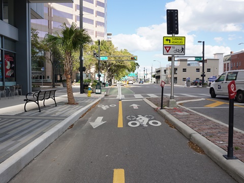
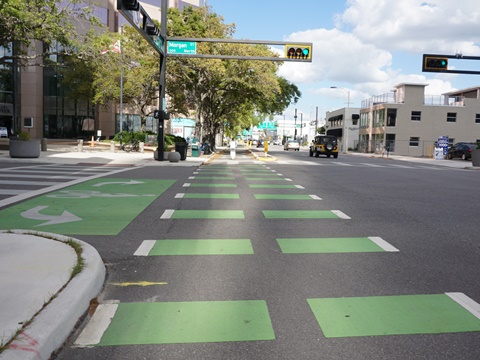
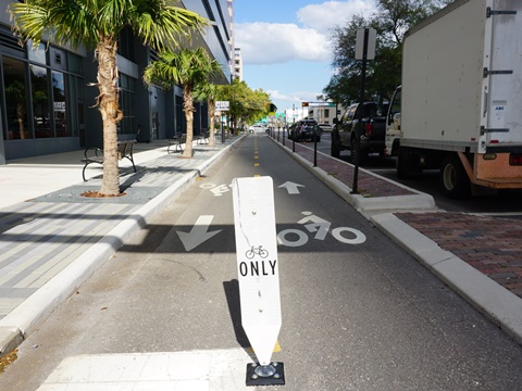
Protected Bike Lanes
To enhance cycling safety, protected bike lanes and improved crosswalks are being installed in the Tampa Downtown Core. Here are some examples of existing lanes we viewed - there are others including sections of Cleveland, Brorein and Platt St, and more are planned. Crossroads can be very busy, bike traffic lights have been installed at the crossings.
Along Cass St.
The protected bike lane along Cass Street runs about 0.75 mile from the Cass Street bridge to Nebraska Avenue, and will eventually be extended to Ybor City.
Other safety enhancements include (1) widening the sidewalks to 9-feet on both sides as part of a Brorein Street Bridge upgrade project, creating a connector to Bayshore Blvd. and the Bayshore Linear Park Greenway, and (2) adding a protected bike lane on the bridge to Harbor Island.
More Information and Resources
Nearby Biking:
Bayshore Linear
Park Trail (aka Bayshore Greenway)
Courtney Campbell Trail
West FL Region - More trails
plus Regional Overview map
Related Resources:
City of Tampa -
Tampa Riverwalk
Friends of the Riverwalk - Virtual Photo Tour
City of Tampa - Greenways & Trails
Find Trails by FL Region or Listed A - Z

100FloridaTrails.com... 100+ Florida Multi-use Bike Trails, Best for Safe, Fun Recreation and Fitness
Other Websites:
BikeOrlando.net
PaddleFlorida.net
BikeTripper.net
Copyright © 100FloridaTrails.com. All Rights Reserved.